Paria Canyon Vermilion Cliffs Wilderness
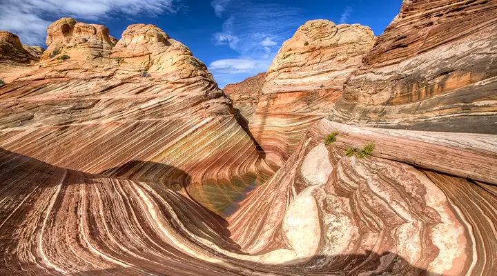
The Wave, a rock formation at North Coyote Buttes
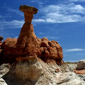
Paria Canyon mushrooms
Paria Canyon-Vermilion Cliffs Wilderness is a 112,500-acre section of Vermilion Cliffs National Monument. The wilderness area wraps around the greater area of the uplifted Paria Plateau. Contained within the wilderness is the main escarpment of the Vermilion Cliffs, the whole of Paria Canyon and Buckskin Gulch, and the North and South Coyote Buttes areas. The Paria Canyon/Buckskin Gulch and Coyote Buttes areas would see excessive human traffic if the Bureau of Land Management didn't institute (and strictly enforce) a 20 person per day limit on campers in the canyons and visitors to both sections of the Coyote Buttes.
Coyote Buttes North and South are areas of beautiful, other-worldly wind-and-water eroded sandstone rock forms. Part of the magic in the formations is in the multi-colored layers of stone, part of it is in the fantastic shapes themselves. Regulations in the area are pretty strict: day use permits are required, no camping or campfires are allowed, no more than 6 people in a group in the same area on the same day, no more than 10 people in the same area on the same day, display half the permit on your windshield and the other half on the outside of your backpack. If you encounter BLM personnel en route you may be asked to present a government-issued ID for permit verification (permits are not transferable). And only after you have successfully gotten a permit will you be given a map and directions to get to the Coyote Buttes North area. At times you might be able to get a permit the day before your hike at the Paria Contact Station. The Wire Pass Trailhead is the main trailhead for getting to Coyote Buttes North.
In the South Coyote Buttes area
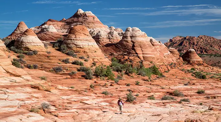
In the South Coyote Buttes area
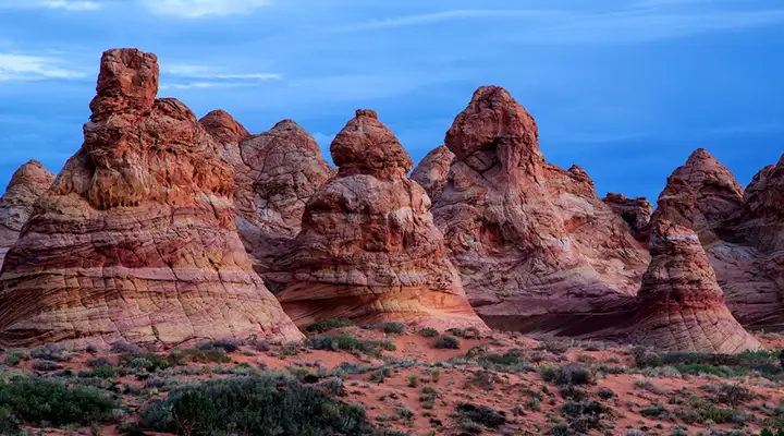
More knobs in the South Coyote Buttes area
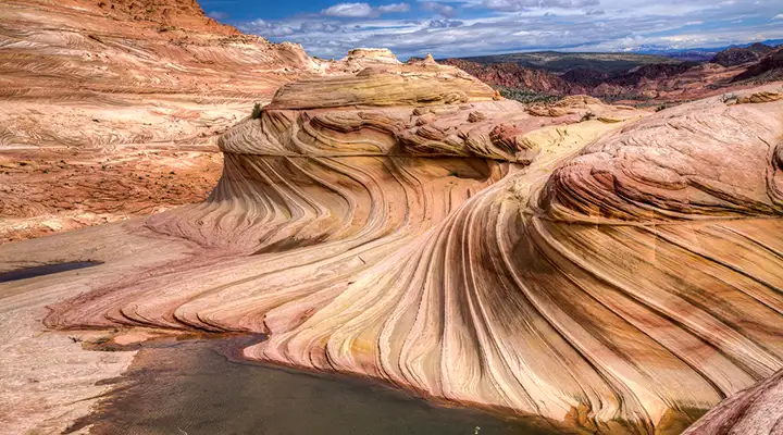
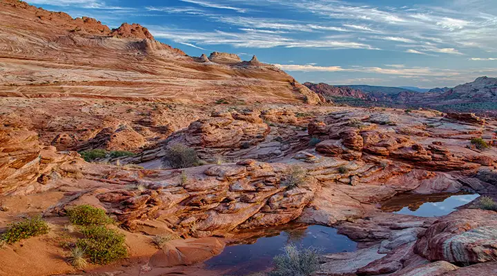
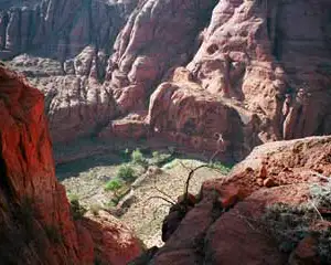
In the North Coyote Buttes area
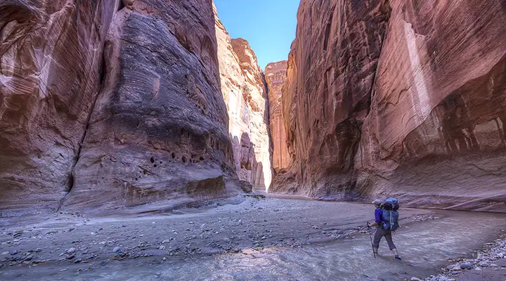
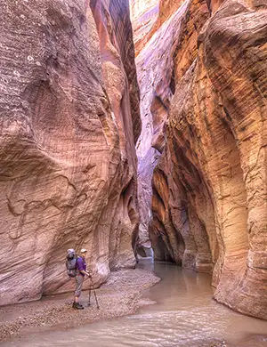
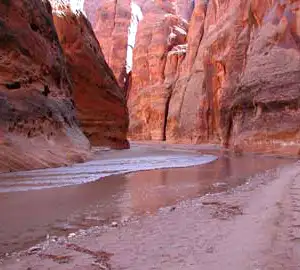
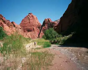
Crossing Paria Creek when it's flowing
The main trailhead for Paria Canyon is at the White House Campground. Paria Canyon itself is considered one of the world's premier slot canyon backpacking destinations. You'll find sandstone arches with huge red rock amphitheaters and hanging gardens of ferns and orchids on your journey through the canyon. The canyon is narrow, the rock faces vertical and very high, the possibility of drowning in a flash flood reasonably good. Groups are limited to 10 people each and only 20 overnight campers per day are allowed to enter the canyon. Most folks take four-to-five days to complete the hike down the canyon to where it empties into the Colorado River near Lees Ferry.
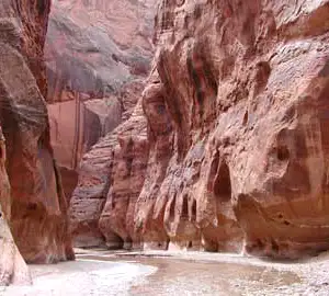
Some folks prefer the much more difficult hike down Buckskin Gulch to Paria Canyon. Buckskin Gulch is narrower (down to three-feet-wide in spots), deeper and more strenuous when you reach the outlet into Paria Canyon you have to scramble down a 30-foot rockfall to get out. From there you can choose to go left and take the seven mile hike back to White House Campground or go right and continue down Paria Canyon to Lees Ferry. Either way, it's a journey through a landscape from another world. The Buckskin Gulch Trailhead is the main access point to the upper part of Buckskin Gulch.
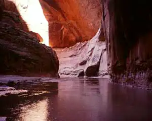
In the photo to the right, notice the log wedged between the rocks in Buckskin Gulch: that log was put there during a flash flood. This is an area where you want to have a good weather forecast in hand before you start down that first mile of trail. And during your hike you'll want to have very comfortable shoes on, shoes that you don't mind getting wet.
The photos below are courtesy of the Bureau of Land Management and I offer them to give you some sense of the scale of the place. In the lower right photo from Buckskin Gulch, note the two people to the lower right...
In a wider area of Paria Canyon,
still deep down in the red rock
Paria Canyon gets more narrow
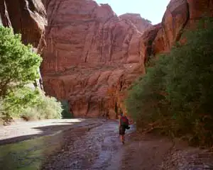
Trees in some areas of Paria Canyon
The bottom of the canyon
sees little direct sunlight
Sometimes Paria Canyon opens up
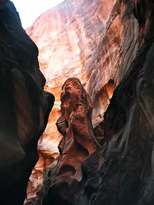
At the end of the slot canyon
Rock formations in Buckskin Gulch
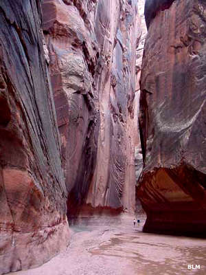
Two people deep in Buckskin Gulch
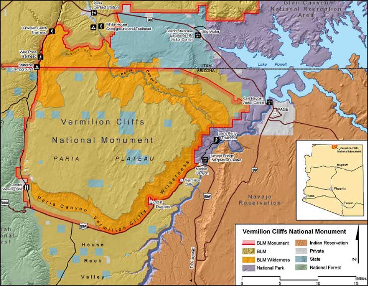
Photo of the Paria mushrooms courtesy of Alan Schmierer, CCA-by-SA 2.0 License
Other photos and map courtesy of the Bureau of Land Management
Related Pages
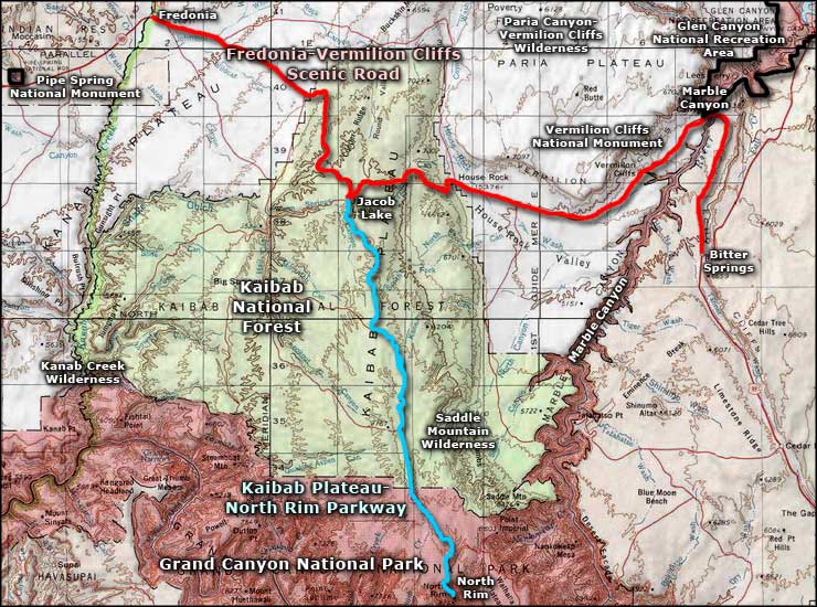
Fredonia-Vermilion Cliffs Scenic Road
Glen Canyon National Recreation Area
Grand Canyon National Park
Glen Canyon National Recreation Area
Grand Canyon National Park
Map courtesy of National Geographic Topo!