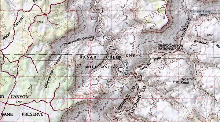
Kanab Creek Wilderness
Kanab Creek Wilderness
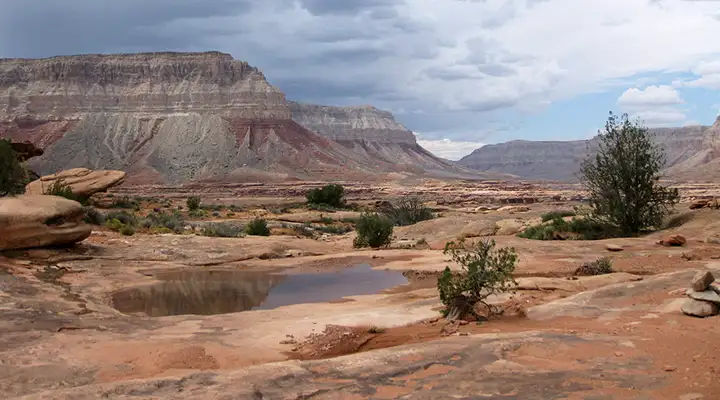
Kanab Creek Wilderness is a 75,300-acre property on the southwestern edge of Kaibab Plateau that straddles the line between Kaibab National Forest and Bureau of Land Management property to the west. Kanab Creek is the largest tributary canyon system that feeds into the north side of the Grand Canyon. Kanab Creek itself begins about 50 miles to the north and in its southward flow, has cut deeply into the rock of the Kanab and Kaibab Plateaus. At its deepest, the canyon floor is about 4,000 feet below the rim.
Archaeological evidence found in the canyon says it was regularly inhabited up to about 1100 CE, then abandoned as the great drought that dispersed the Fremont, Ancient Puebloans and Sinagua took hold in this drier area earlier than in other places. There are many fine examples of rock art to be found adorning the rock faces in this wilderness.
While sagebrush is the dominant vegetation in the area, some parts of the upper reaches have small stands of Utah juniper and pinion pine. Wetter areas in the canyon bottoms offer riparian zones with cottonwood, desert almond, single-leaf ash and western rosebud. Slowly, the imported (exotic) salt cedar is invading those wet areas and taking over.
In the higher elevations you might come across chukar partridge and wintering mule deer. You might also find coyote, fox, bobcat, squirrel, rabbit and smaller rodents. There are also several species of reptiles in the area, the only poisonous one being the rattlesnake.
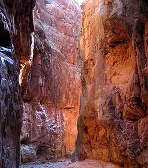
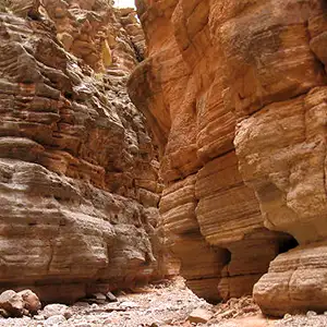
This area is very rugged and rocky (very rocky). There are slot canyons in places and access to the western edge of the property is very hard. There is a 4WD road to Sowats Point that gives access to three reasonably good trails that access the wilderness. Due to the general topography, bushwhacking in a lot of the area is extremely hard and somewhat dangerous. The photos on this page were taken from along a couple of those trails leading into Kanab Creek Wilderness from Sowats Point.
On any given day chances are good that you might have this whole property to yourself. Fall is the best time to come as summer is exceedingly hot with frequent heavy rains in July, August and early September, winter brings snowfall that makes the area unreachable and spring will often have serious waterflows from uphill snowmelt. Kanab Creek flows year round. Many of the canyons that dump into Kanab Creek Canyon are slot canyons and can be exceedingly dangerous in times of flash flood. Most folks will take five to six days to make the trip from Sowats Point down to the Colorado River and back. You'll want shoes that are very comfortable and that you don't mind getting wet.
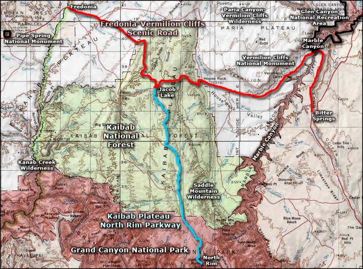
The western side of the property can be accessed via Arizona Road 389 to the Mount Trumbull Road to Hacks Canyon Road (BLM 1023), which demands high clearance 4WD. The eastern part of Kanab Creek Wilderness is accessible from US Highway 89A via Forest Service Roads 22, 423, 201 and 233. Before you go anywhere out here you might want to procure a copy of the Arizona Strip BLM map that offers great detail in regards to wilderness areas and access roads.
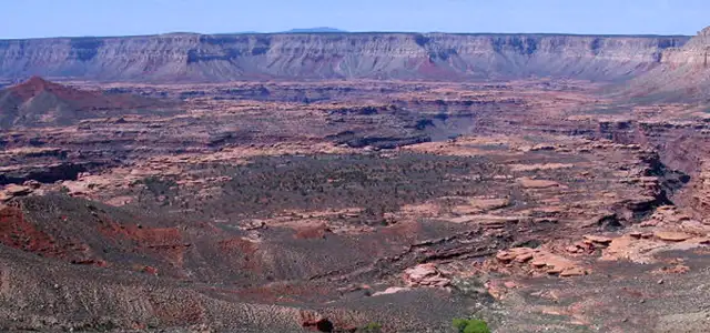
Kanab Creek Canyon from above

Down on the floor of Kanab Creek Canyon
Photos are courtesy of the Bureau of Land Management and US Forest Service
Map courtesy of National Geographic Topo!
Related Pages
Fredonia-Vermilion Cliffs Scenic Road
Glen Canyon National Recreation Area
Grand Canyon National Park
Glen Canyon National Recreation Area
Grand Canyon National Park
Map courtesy of National Geographic Topo!