Snake River Headwaters
The Snake River near its source

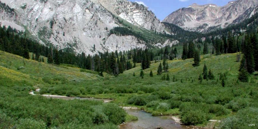
Shoal Creek
The Snake River Headwaters is unique in that it encompasses a connected watershed rather than just one river or a set of isolated rivers spread across a region. The streams and rivers of the Snake River Headwaters flow across lands administered by the U.S. Forest Service, National Park Service and US Fish and Wildlife Service, as well as a small portion of state and private lands. The Snake River Headwaters designation includes 13 rivers and 25 separate river segments totaling 414 miles, with 315 miles within Bridger-Teton National Forest. These rivers flow through an iconic landscape of stunning canyons, open meadows, broad vistas, striking mountains, glacial lakes and sage flats. This combination of landscapes provides spectacular undeveloped settings that create a distinctive sense of place and offer world-class recreational opportunities within the largest intact aboriginal ecosystem in the 48 contiguous states.

The Designated Reach of the Snake River Headwaters National Wild and Scenic Rivers area:
- Bailey Creek from the divide with the Little Greys River north to its confluence with the Snake River.
- Blackrock Creek from its source to the Bridger-Teton National Forest boundary.
- The Buffalo Fork of the Snake River consisting of: the North Fork, Soda Fork, and the South Fork, upstream from Turpin Meadows; and the Buffalo Fork from Turpin Meadows to its confluence with the Snake River.
- Crystal Creek from its source to its confluence with the Gros Ventre River.
- Granite Creek from its source to the end of Granite Creek Road and from Granite Hot Springs to the point one mile upstream from its confluence with the Hoback River.
- The Gros Ventre River from its source to the upstream boundary of Grand Teton National Park, excluding the section along Lower Slide Lake, and the segment flowing across the southern boundary of Grand Teton National Park to the Highlands Drive Loop Bridge.
- The Hoback River from the point 10 miles upstream from its confluence with the Snake River to its confluence with the Snake River.
- The Lewis River from Shoshone Lake to Lewis Lake and from the outlet of Lewis Lake to its confluence with the Snake River.
- Pacific Creek from its source to its confluence with the Snake River.
- Shoal Creek from its source to the point eight miles downstream from its source.
- The Snake River from its source to Jackson Lake, from one mile downstream of Jackson Lake Dam to one mile downstream of the Teton Park Road Bridge at Moose, Wyoming, and from the mouth of the Hoback River to the point one mile upstream from the Highway 89 Bridge at Alpine Junction.
- Willow Creek from the point 16.2 miles upstream from its confluence with the Hoback River to its confluence with the Hoback River.
- Wolf Creek from its source to its confluence with the Snake River.
In the end, the watershed streams were divided into the following classifications (and mileages): Wild — 236.9 miles; Scenic — 141.5 miles; Recreational — 33.8 miles; Total — 412.2 miles. Keep in mind that the included acreage extends beyond each stream bank to at least 1/4 mile above the highest water level, and in some cases even further: the objective is to preserve and protect the stream and its water quality.

The Snake River

Map of the Snake River Headwaters region
Photos and map courtesy of the US Forest Service