Washington - The Evergreen State

The only American state named after a president, Washington is a land of contrasts. There's a lot of mountain in the state, some of it high and dry, some of it high and very wet (much of the Olympic Peninsula is a veritable rainforest). East of the Cascade Mountains there are also some large, wide-open, high-latitude deserts and the incredible scenery of the Columbia River Gorge. Mount Baker set the world record for snowfall in a single season in 1999: 1,140 inches. Then there's the Hanford Reservation (a couple hundred miles south of Mount Baker) which averages between 6 and 7 inches of precipitation per year.
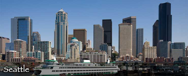
Nearly 60% of the human population of Washington lives in the Seattle Metropolitan Area.
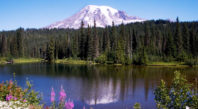
Mt. Rainier reflected in Reflection Lake
Fast Facts about Washington
Capital: Olympia
Largest City: Seattle
Became a State: November 11, 1889 : 42nd
Largest City: Seattle
Became a State: November 11, 1889 : 42nd
Area: 71,342 square miles : 18th
Highest Point: Mount Rainier : 14,411'
Lowest Point: Pacific Ocean : 0'
Highest Point: Mount Rainier : 14,411'
Lowest Point: Pacific Ocean : 0'
Washington Population Demographics: 2020
Total Population
7,705,267
Males
3,880,988
Females
3,824,279
Population by Age
Under 18
1,698,169
18 & over
6,007,098
20-24
480,431
25-34
1,172,723
35-49
1,533,852
50-64
1,432,202
65 & over
1,209,398
Population by Ethnicity
Hispanic or Latino
1,058,613
Non Hispanic or Latino
6,646,654
Population by Race
White
6,012,669
African-American
339,979
Asian
748,773
Native American
150,647
Hawaiian or Pacific Islander
61,280
Two or more
391,919
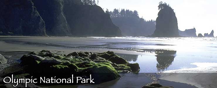
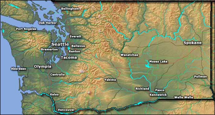
Photo of Mount Rainier courtesy of Wikipedia userid Kelvin Kay, CCA-by-SA 3.0 License
Photo of the floating bridges courtesy of Wikipedia userd Tradnor, CCA-by-SA 3.0 License
Photo of the Seattle Skyline courtesy of Wikipedia userid Jamies
Map courtesy of Cartesia MapArt US Terrain