Mountain Lakes Wilderness
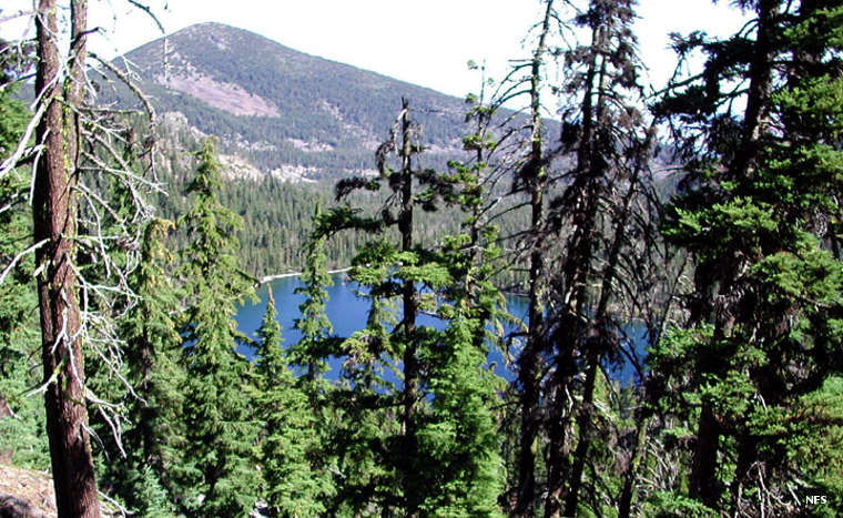
Forest and lake inside the rim of the caldera
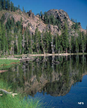
Mountain Lakes Wilderness is a 23,071-acre property that preserves and protects the remains of an ancient caldera in the Cascade Range. At one time there was a composite volcanic cone here, built up of several overlapping shield volcanoes and cinder cone vents. The magma chamber blew out and the caldera collapsed before the ice ages began. Over time the snow and ice inside the caldera built up, became a glacier and pushed out through the northern wall of the crater, spilling down the slopes and beginning the erosion that has shaped the old volcano into what we see today. Of the caldera wall there are only eight high points left in the landscape. And where Crater Lake to the north filled in as one large lake, the bottom of this caldera supports multiple lakes.
When the Federal government was setting aside Primitive Areas in 1930, Mountain Lakes was one of the first three set aside in the Northwest. Mountain Lakes Wilderness is the only wilderness in the system that is laid out along the survey lines of a single township, resulting in a square wilderness boundary.
To get there:
- From Klamath Falls go west on US 66 11 miles toward Keno. Just before crossing the Klamath River turn and go north on Clover Creek Road. Go about 15 miles to FSR 3852. The Clover Creek Trailhead is at the end of FSR 3852.
- From Klamath Falls go north on Highway 140 for about 34 miles. Turn south onto FSR 3660 and go about 1.5 miles to the Mountain Lakes Trailhead. Parking at the trailhead is limited.
- From Klamath Falls go north on Highway 140 for about 22 miles. Then turn and go south on FSR 3637 for about 1.7 miles. At the junction with FSR 3664 turn left and go another 2 miles to the Varney Creek Trailhead.
All these trails connect with the 8.2-mile Mountain Lakes Loop Trail in the interior of the wilderness.
Upper photo courtesy of Dwight Johnson, US Forest Service
Upper left photo courtesy of Steve Boutcher, US Forest Service