Kalmiopsis Wilderness
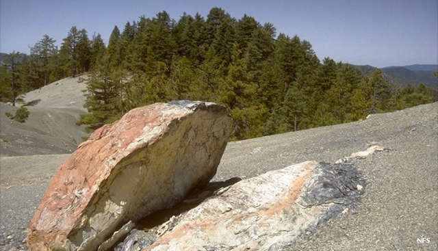
On top of a serpentine ridge in Kalmiopsis Wilderness
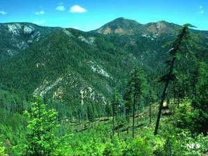
Kalmiopsis Wilderness is a 180,095-acre property in the Klamath Range of southern Oregon. Elevations in the wilderness range from a low around 500 feet and a high of 5,098 feet atop Pearsoll Peak. The landscape is very rugged with deep canyons, sharp rock ridges, steep hillsides and swift rushing streams.
Kalmiopsis is most known for the diversity of wildlife and vegetation found there. The name itself comes from the Kalmiopsis leachiana, a plant found there in 1930. The plant is a relic from before the ice ages and is found nowhere else on Earth. The explosion in plant diversity is a result of plants adapting to the soil: a mix of serpentinite and peridotite, rocks which are rich in poisonous heavy metals such as iron, magnesium, nickel and chromium. That goes hand-in-hand with a diversity of habitats created through processes of geologic faulting, uplifting and folding, erosive/depositional forces (weathar, glaciers, river silt) and fire. The 2002 Biscuit Fire burned 100% of the wilderness and scientists are having a field day observing the recovery.
The Wild segments of the North Fork Smith, Chetco and Illinois Rivers flow through Kalmiopsis Wilderness. The water flows clear and the fish habitat is excellent. There are only two lakes in the wilderness: Vulcan Lake near the western boundary and Babyfoot Lake on the eastern boundary. The lakes see the most human traffic now as the fire burned all the trail signs in the area and the deadfall has almost obliterated the rest. Today, the understory is recovering well but there are still dead snags falling... There were about 160 miles of trails in the wilderness and they were well known for their steepness and narrow rocky tread. Some of the lesser damaged trails reopened in 2015.
Kalmiopsis Wilderness is part of Rogue River-Siskiyou National Forest.
Photos courtesy of the US Forest Service