The Neogene Period
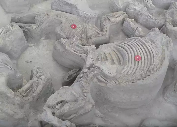
#1 is a Teleoceras major, #2 a 3-toed horse: Cormohipparion occidentale from the Ashfall Fossil Beds in Nebraska, Miocene Epoch
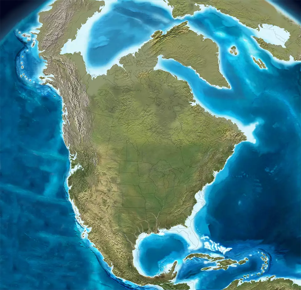
North America, 15 million years ago
Click or tap to see a larger version
The Neogene Period began with the ending of the Paleogene Period about 23 million years ago and ended about 2.58 million years ago when the Earth passed into today's Quaternary Period. The beginning of the Quaternary Period was marked by the onset of new glaciation, globally.
The Basin and Range Orogeny began about 30 million years ago and ended about 15 million years ago. The extensive folding and faulting caused extensive basaltic magmatism in the Basin and Range Province and on the south, west and east margins of the Colorado Plateau.
Greenland stopped pulling away from North America and ocean-floor spreading stopped in the Labrador Sea. From that point on, all spreading has occurred along the Mid-Atlantic Ridge. The passive margin along the Atlantic and Gulf coasts continued as the Caribbean plate expanded well into the Atlantic with the Antilles arc migrating eastward.
Epochs of the Neogene
- Miocene - 23 to 5 million years ago
- Pliocene - 5 million years ago to present
North America collided with South America and the Isthmus of Panama formed along the western side of the Caribbean plate. The Gulf of Mexico saw large deltaic and coastal plain deposition systems develop with extensive slumping and landslides along the northwest margin.
The Colorado Plateau, first pushed up about 65 million years ago, remained high and relatively undissected until the last 5 to 7 million years. The opening of the Gulf of California about 5 million years ago allowed the integration of the Colorado River system through complex stream capture. That's what facilitated the cutting of the Grand Canyon and erosion of the Colorado Plateau and western Rocky Mountains that we see today.
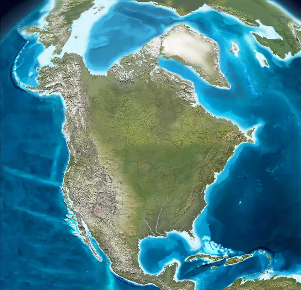
North America, 3 million years ago
Click or tap to see a larger version
The Neogene saw the expansion of the transform Pacific margin throughout the period. Subduction continued north and south of today's transform margin. The northward movement of the Wrangellia Terranes continued, too.
Complex transfer (plate capture) of parts of the western North American plate onto the Pacific Plate happened as the San Andreas Fault and earlier similar faults generated right lateral transform motions. The end of the Neogene led to 100,000 years of Pleistocene glaciation that greatly affected sea level and erosional and depositional patterns across the North American plate.

5 million years of erosion on the Colorado Plateau

Earth, 20 million years ago
Upper photo is in the public domain
North America maps © Ron Blakey, NAU Geology, Colorado Plateau Geosystems
Lower photo is courtesy of TheArmchairExplorer, CCA-by-SA 4.0 License
Bottom map courtesy of Ron Blakey, NAU Geology, CCA-by-SA 4.0 License
North America maps © Ron Blakey, NAU Geology, Colorado Plateau Geosystems
Lower photo is courtesy of TheArmchairExplorer, CCA-by-SA 4.0 License
Bottom map courtesy of Ron Blakey, NAU Geology, CCA-by-SA 4.0 License