Bandelier National Monument
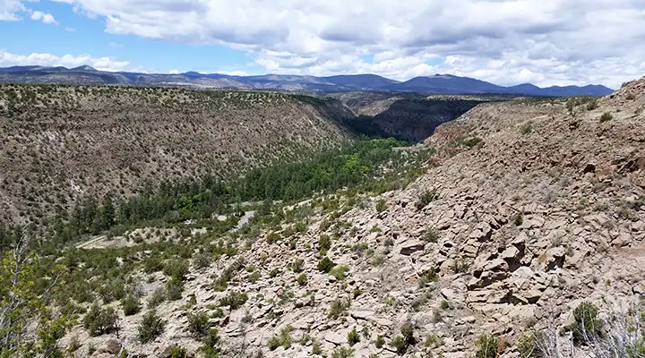
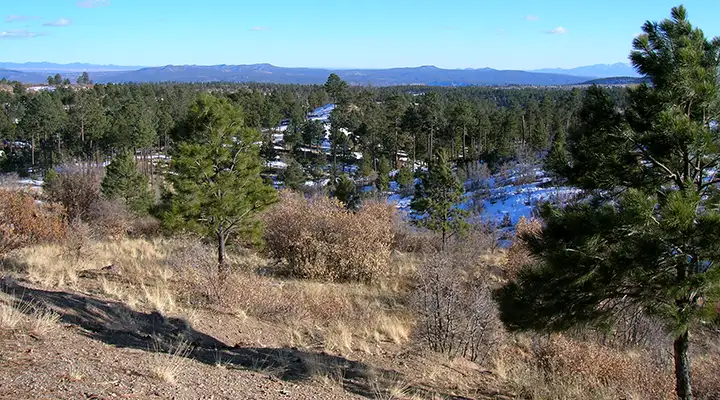
A view of Frijoles Canyon, the main section of Bandelier National Monument

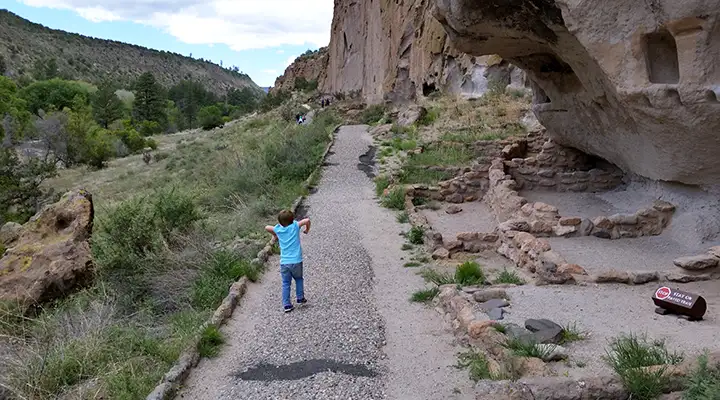
The walkway in the Talus Houses area
Best known for mesas, sheer-walled canyons and the Ancestral Pueblo dwellings found among them, Bandelier National Monument also includes over 23,000 acres of designated Wilderness. The property was named for Adolph Bandelier, a 19th-century self-taught anthropologist who spent significant time among the ruins. Men from Cochiti Pueblo guided him to their ancestral homes in Frijole Canyon in 1880. Archaeological surveys since have found more than 3,000 sites inside the boundaries of the national monument. They weren't all occupied at the same time but the population slowly grew, the culture got more sophisticated, the trade routes grew more established and the people began gathering in ever larger collectives. By the mid-1200's structures of 40-and-more rooms began to appear. Tyuonyi eventually grew to more than 600 rooms in the heart of Frijoles Canyon.
In the early 1900's Dr. Edgar Lee Hewett directed several excavations in Frijoles Canyon. He realized the need to protect and preserve the area and was instrumental in getting Bandelier National Monument established in 1916.
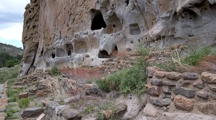
Beginning in the 1200's, the areas that are now included in Bandelier National Monument became an increasingly popular refuge for Anasazi, Chacoans and northern San Juan people fleeing the drought devastating their homelands. Located in the high, forested lands of the Pajarito Plateau, Bandelier was an oasis to them. Between about 1200 CE and 1500 CE they built pueblos up the faces of the volcanic rock cliffs and, in other areas, in the open along the stream beds. By the time the Spaniards arrived in the mid 1500's, this area had been abandoned and the folks had moved on to the Rio Grande Pueblos where we find their descendants today. The people of Cochiti, Santo Domingo, San Felipe and Zuni trace some part of their lineage back to Frijoles Canyon. The people of San Ildefonso and Santa Clara trace their lineage to the Tsankawi area (Tsankawi is an undeveloped, non-contiguous piece of Bandelier National Monument located about 11 miles to the north of Frijoles Canyon). For all these pueblos, this is sacred land.
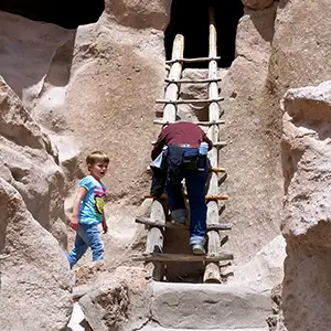
Climbing a ladder into a cliff dwelling
For most visitors, the first activity at Bandelier National Monument is walking the Main Loop Trail, which starts at the Visitor Center and leads through excavated archaeological sites. Other trails vary from short and easy to long and strenuous, inviting day hikes, backpacking, birdwatching, and just general enjoyment of the beautiful surroundings. No pets or bicycles are permitted on any of the trails.
Regularly scheduled guided walks, evening programs and interpretive talks are offered in the summer months. Self-guided trails are available year round. Batwalks are also offered during the summer. These are evening, ranger-led walks to the bat cave at Long House, to watch the beautiful nightly flight of the colony of Mexican freetail bats.
One hundred years of fire suppression led to the forest fires of 1977, 1996, 2000 and 2011 that together burned more than 60% of the park. In many areas, the only large tree cover left is in the bottom of the canyons. Bandelier is unusual in that there are 70 miles of hiking trails in the park but only three miles of actual road. The roads lead either to the visitor center or into the Juniper Campground. The trails lead into the backcountry past many of the more prominent ruins in Frijoles Canyon and along other canyons in the park. To the east and west is Santa Fe National Forest. to the north is Los Alamos National Laboratory, to the northwest is Valles Caldera National Preserve.
The Tsankawi area is bounded by San Ildefonso Pueblo to the east and south and by Los Alamos National Lab to the north and west. Tsankawi is essentially undeveloped and has never been excavated. There is a parking area along the side of NM Route 4 at the trailhead. The trail is a loop about 1.5 miles long and it leads past many cliff dwellings, a large unexcavated village and a lot of petroglyphs.
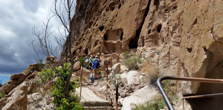
The walkway in the Talus Houses area
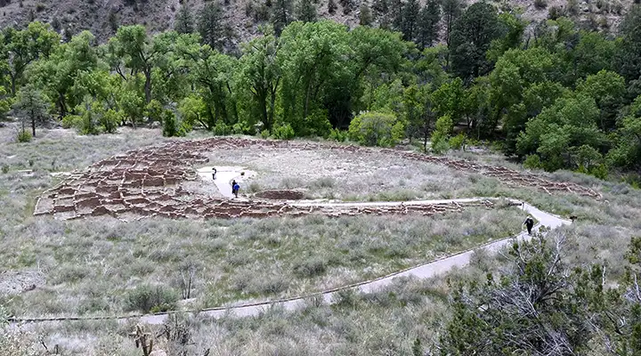
The foundations of Tyuonyi
In the Long House area
More of the Long House
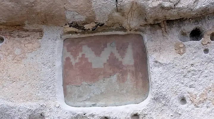
A bit of preserved rock art
Bandelier Wilderness
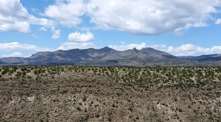
Bandelier Wilderness, the mountains in the distance are part of Dome Wilderness
Bandelier National Monument preserves and protects several settlements built by the Ancestral Pueblo peoples between the ninth and thirteenth centuries. Some 23,270 acres beyond the prehistoric settlements were designated as the Bandelier Wilderness by Congress in 1976. This area is full of deep river gorges and dry canyons carving into the volcanic tuff of the Pajarito Plateau.
The 70+ miles of hiking trails lead through the challenging terrain of lush canyons and sweeping mesa tops past isolated prehistoric ruins. There's something for everyone here. One 3-mile trail takes you to the deep gorges of Alamo Canyon. A 5-mile trail leads to the ancient ruins at Yapashi. A 20-mile loop takes you past the Painted Cave and the Stone Lions Shrine. Three different trails lead you across the Bandelier Wilderness boundary and into the Dome Wilderness to the west. Another 8-mile trail leads into the densely Ponderosa-forested region of Upper Frijoles Canyon.
Water is not hard to find here, but you still may want to bring your own in the summer time. And while back country camping is allowed, campfires and pets are not allowed in the Bandelier Wilderness.
Update 2019: More than 60% of Bandelier National Monument and Wilderness was burned off in the forest fires of the last few years. Recovery is going to take some serious time... but neither Tsankawi nor the bottom of Frijoles Canyon were burnt, yet. I guess there's always next year, eh?
Another area in the Bandelier Wilderness
Photos courtesy of TheArmchairExplorer, CCA-by-SA 3.0 License
Related Pages
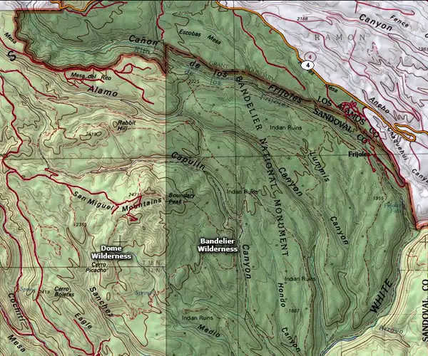
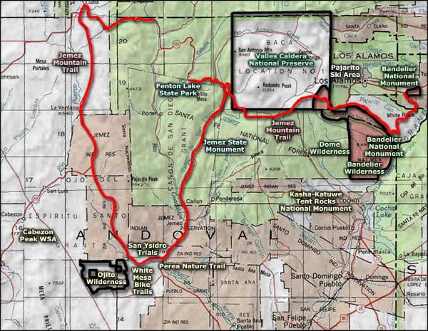
Map courtesy of National Geographic Topo!