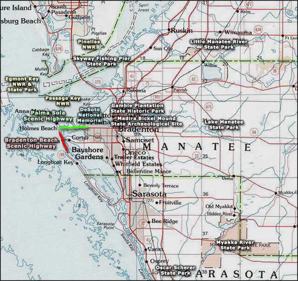
Palma Sola Scenic Highway

An aerial view of the Palma Sola Scenic Highway causeway
The Palma Sola Scenic Highway is a 4-mile route that connects West Bradenton with Holmes Beach (at the intersection with State Road 789, which becomes the Bradenton Beach Scenic Highway a short way to the south).
"Palma Sola" means "Solitary Palm," and the solitary palm referred to is an old palm standing near the beach at Holmes Beach on Anna Maria Island. Sailors have searched the horizon for that palm on Anna Maria Island for many years, using it to guide themselves into Anna Maria Sound and Palma Sola Bay. The entire scenic byway is on State Road 64, also known as Western Manatee Avenue. The eastern terminus of the scenic byway is at the intersection with 7th Street W, which goes north to the De Soto National Memorial. Most of Manatee Avenue is four or six lanes wide but when you come to the scenic byway section, it reduces to two lanes and the trees close in.
The views along most of this road are excellent: there aren't a lot of trees in the way once you're crossing the bay on the causeway and for part of the distance, the water is lapping at both sides of the road. The mainland and island parts of the corridor have a very "park-like" feel, landscaped with mature native vegetation and offering enhanced picnic areas, restrooms and many other beach-type amenities. I drove the route on a beautiful Sunday in April, temperatures in the low 80's and the sun just shining down out an azure sky. The road was busy (but not bumper-to-bumper), the parking areas almost filled. There were folks flying kites, sleeping on the grass, swimming, fishing, sunning, watching the boats and jet skis go by and just enjoying a beautiful day in a beautiful place. Nowhere along the route do I remember seeing a sign declaring this to be the Palma Sola Scenic Highway.
When we were clearly across the bridge and on Anna Maria Island, I went straight ahead through the stop light and came next to Manatee Public Beach. That looked pretty crowded so I went right for maybe a mile and found a small side street in Holmes Beach that wasn't parked up and parked. The beautiful white sand beach wasn't one hundred yards away...
This is an area of Florida that was first settled thousands of years ago. Some of those ancient peoples left shell mounds behind: huge piles of oyster shells and refuse, built up over many years of use. The first tribe we have a name for were the Manasotas, but they were followed by several other cultural groups before the first Spaniards arrived with Hernando de Soto in 1539. Since that time, the area has filled with Spanish, English and American settlers until today, it's a cultural melting pot.
I've driven this route twice, mainly to check out the beaches along the way. I did once come across a woman training horses in the water once. That was interesting to watch, but this is Florida: too many so-so beaches, too many people, and far too much attitude, everywhere.

Training horses in the bay

Right next to the roadway

The Palma Sola Causeway east of the bridge

The bay just east of the bridge

The Palma Sola Bridge to Anna Maria Island

The view north from just north of Manatee County Public Beach

The view south near Manatee County Public Beach on Anna Maria Island
Upper photo courtesy of the Florida Department of Transportation
Other photos courtesy of TheArmchairExplorer CCA-by-SA 3.0 License
Other photos courtesy of TheArmchairExplorer CCA-by-SA 3.0 License
Related Pages
Area map courtesy of National Geographic Topo!