Osceola National Forest
Osceola National Forest
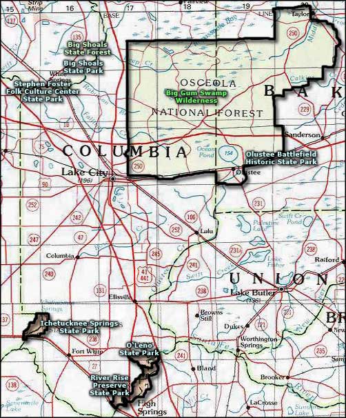
Located in central northern Florida between Lake City and Jacksonville, Osceola National Forest straddles Interstate 10. On the northeast side of the Forest you'll find Pinhook Swamp, an arm of swamp that connects the Forest with the huge (and famous) Okefenokee Swamp of south Georgia.
The Forest was designated by Presidential Proclamation on July 10, 1931. Back in those days, the place had been clear-cut and almost completely burned off. The first thing the Forest Service needed to do was get some reforestation happening... Apparently they were successful because heavy logging returned in the 1950's and 1960's. It was in the 1960's that the Forest Service mission was expanded from timber production to include managing for wildlife, grazing range, water resource conservation and recreation.
There are numerous sites scattered through the Forest from historic logging times. The Civil War battlefield at Olustee (site of the largest Civil War engagement in Florida) is also within the Forest.
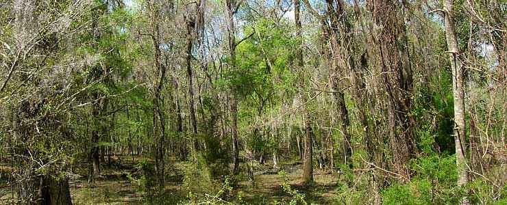
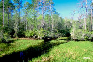
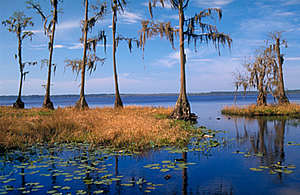
Osceola National Forest is classed as a "flatwoods" forest as it contains a patchwork of cypress and bay swamps separated by low pine ridges. The Forest sports an extensive system of horse-back riding and hiking trails available, including a 23-mile segment of the Florida Trail. Other hiking trails available on the Forest include the Mt. Carrie Trail, Trampled Track Trail and the Olustee Battlefield Trail. The two primary equestrian trails run near scenic bay areas through open pine forest. The Forest also offers many roads that are usable by unlicensed vehicles (such as OHV's and dirt bikes), but keep all your vehicles on the already established roads (ie: don't go mudding or trying to blaze new trails). Certain areas are off-limits to motorized vehicles in order to protect biological communities. One of these protected areas is the Osceola Research Natural Area, a designated National Natural Landmark since December, 1974. Another protected area is the Big Gum Swamp Wilderness.
Osceola National Forest has a district ranger office in Olustee, and a separate Depot Information Center in Olustee, too. The Depot Information Center is open Monday through Friday, 9 to 12 and 12:30 to 4:30.
Forest Facilities
| Site Name | Amenities |
|---|---|
| Big Hunt Camp | |
| Cobb Hunt Camp | |
| East Tower Hunt Camp | |
| Fanny Bay Trail | |
| Hog Pen Landing | |
| Mt. Carrie | |
| Ocean Pond | |
| Olustee Battlefield | |
| Olustee Beach | |
| Sandhill Hunt Camp | |
| Seventeenmile Hunt Camp | |
| The Landing | |
| West Tower | |
| Wiggins Hunt Camp |
Upper photo courtesy of TheArmchairExplorer, CCA-by-SA 3.0 License
Other photos and small icons courtesy of the US Forest Service
Other photos and small icons courtesy of the US Forest Service
Related Pages
Area map courtesy of National Geographic Topo!