Vasquez Peak Wilderness
In Vasquez Peak Wilderness
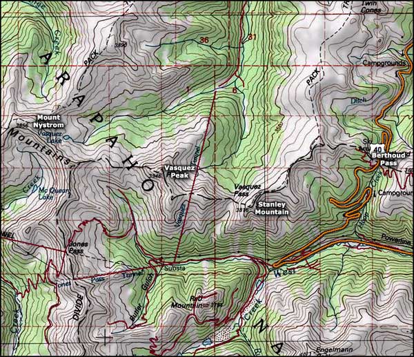
Congress established the Vasquez Peak Wilderness in 1993. It encompasses 12,986 acres of tundra, krummholz and spruce/fir forest in Arapaho-Roosevelt National Forest in Grand County, CO. Vasquez Peak is the highest point in the wilderness at 12,947'.
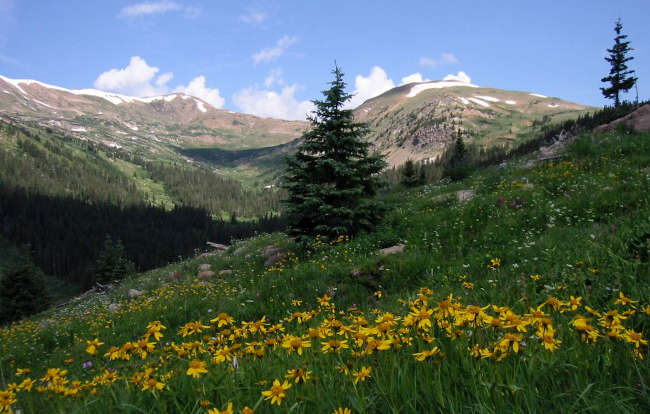
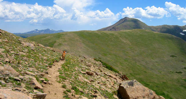
The Vasquez Peak Wilderness is bordered by Winter Park Ski Resort to the north; the Fraser Experimental Forest to the west; Berthoud Pass (US 40) road to the east; and Jones Pass and the Henderson Mine to the south. This high country wilderness sits entirely above 10,000 feet with over half of its area above timberline. There are about 17 miles of hiking trails across the alpine tundra and only one trail that climbs through the spruce/fir forest. These trails lead up to two small lakes, across six peaks above 12,500 feet in elevation and along numerous small creeks that source in the high alpine basins. About 7 miles of the Continental Divide National Scenic Trail cross the Vasquez Peak Wilderness. On the Continental Divide, Vasquez Peak is most easily reached by following the 3-mile-long Vasquez Peak Trail from Vasquez Creek.
The main drainage in the Vasquez Peak Wilderness leads north from Vasquez Peak down the drainage of Vasquez Creek. Most of the Vasquez Creek area is non-wilderness because of a water-collection system that feeds to the City of Denver.
Because so much of this Wilderness is above treeine, hiking here in the summer can be interesting: when thunderstorms kick up quickly (as they often do in the summer heat), you may get a chance to see just how good a lightning rod you might be... When there's heavy snow on the ground, avalanches are common.
The heart of Vasquez Peak Wilderness