Jennie Lakes Wilderness
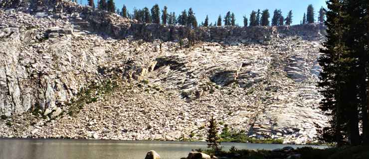
Jennie Lake
Jennie Lakes Wilderness is a 10,289-acre property about 60 miles east of Fresno in Sequoia National Forest, immediately south and west of Kings Canyon National Park and immediately north of Sequoia National Park. On the western boundary is Giant Sequoia National Monument.
Jennie Lake is the largest and highest (about 9,000 feet) of the six lakes in the wilderness area, almost against the southern boundary with Sequoia National Park. A major feature across the center of Jennie Lakes Wilderness is Boulder Creek Canyon, a north/south gash up to 1,000 feet deep. Boulder Creek is sourced at Jennie Lake. The eastern side of the wilderness is a high plateau with a slight upward tilt from the rim of Boulder Creek Canyon running southeasterly to a high ridge bordering the National Parks on the east, north and south. The western half of the property is dominated by Shell Mountain (9,594 feet). Elevations on Jennie Lakes Wilderness range from a low around 6,640 feet to the high on the summit of Mitchell Peak at 10,365 feet.
The landscape is a mix of perennial streams, seasonal ponds, a couple year-round lakes, lush meadows and coniferous forests with large and small outcroppings of granite everywhere. The primary forest cover is composed of lodgepole pine, western white pine and red fir. Black bear and mule deer are common in the area.
The are four primary trailheads (with five major trails for a total of 26 miles) leading into Jennie Lakes Wilderness. Most of those trails cross the wilderness and lead into the back country of Sequoia-Kings Canyon Wilderness. Because of that connection, the Jo Pass, Rowell Meadow and Jennie Lake trails are most heavily used. To cross that line into the National Parks requires a park pass and camping across the line requires an NPS wilderness camping permit.
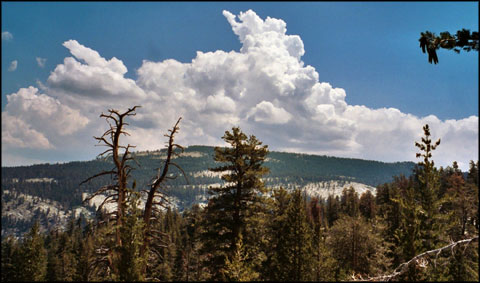
High on a trail in Jennie Lakes Wilderness
Photos courtesy of Carol Hallacy, via Wilderness.net