Vermilion Cliffs National Monument
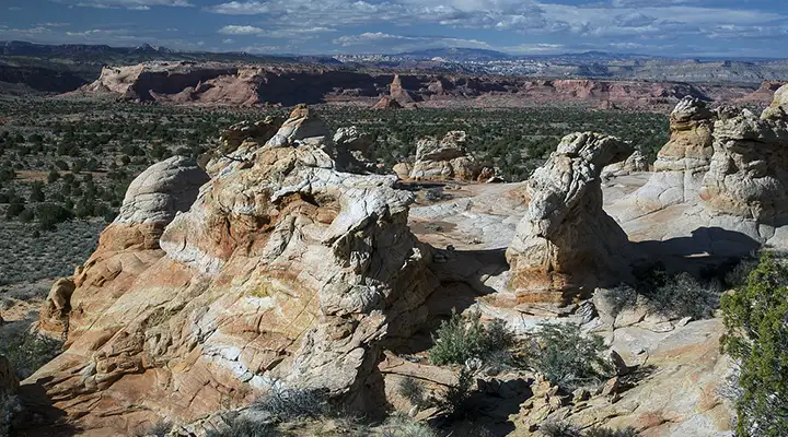
Rock formations at Vermilion Cliffs National Monument

Banded sandstone
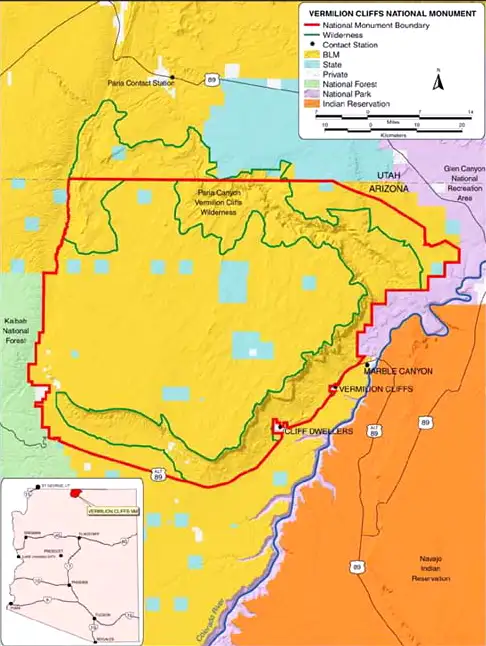
Bordered by US Highway 89 to the north and US Highway 89A to the south, Vermilion Cliffs National Monument is a 294,000-acre treasure chest of geological wonders. The Vermilion Cliffs themselves are an escarpment that rises as much as 3,000 feet to meet with the Paria Plateau. This is an area of spectacular multi-colored cliffs and elegant sandstone formations that display seven major geological formations in a layer-cake fashion. The southern edge of the plateau is cut many times by deep, narrow canyons while the upper parts of Paria Plateau sport several incredible deep slot canyons that make getting around on the property very tricky. There's also the problem of temperature extremes, deep sand and the possibility of flash floods. In rainy times, most of the unpaved access roads are impassable.
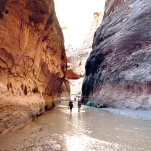
A significant portion of the National Monument is contained in the Paria Canyon-Vermilion Cliffs Wilderness. Most folks come to explore the magnificent canyons along the southern edge of the national monument or to explore Buckskin Gulch and/or Paria Canyon or to visit the Coyote Buttes area. Visiting Coyote Buttes or Paria Canyon/Buckskin Gulch requires special permits in advance (because of the great demand for access and to protect the properties from the impact of too many humans). Backpacking either Buckskin Gulch or Paria Canyon is a four-to-five day adventure that should only be undertaken by folks who are physically fit and prepared for an outstanding wilderness adventure.
The only developed campgrounds are at Stateline and White House. Neither offers any amenities. Primitive camping is allowed at least 1/4 mile from the designated campgrounds but only in previously camping-disturbed areas.
There are no universally accessible facilities on the property. The nearest sources of food and supplies are Page, Arizona and Kanab, Utah. There are three lodges located along US Highway 89A west of Navajo Bridge that also offer limited food and supplies. The nearest reliable first aid is at the National Park Service office in Lees Ferry. The nearest hospital is 125 miles away in Flagstaff.

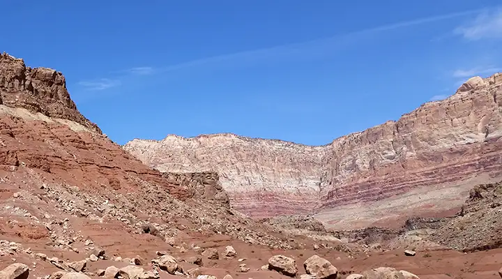
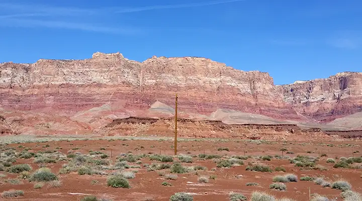
The Vermilion Cliffs
The Vermilion Cliffs near Cliff Dwellings
The Vermilion Cliffs almost ring the Paria Plateau
Vermilion Cliffs National Monument
Top and small photos and close up map courtesy of the Bureau of Land Management
Lower large photos courtesy of TheArmchairExplorer, CCA-by-SA 4.0 License
Related Pages
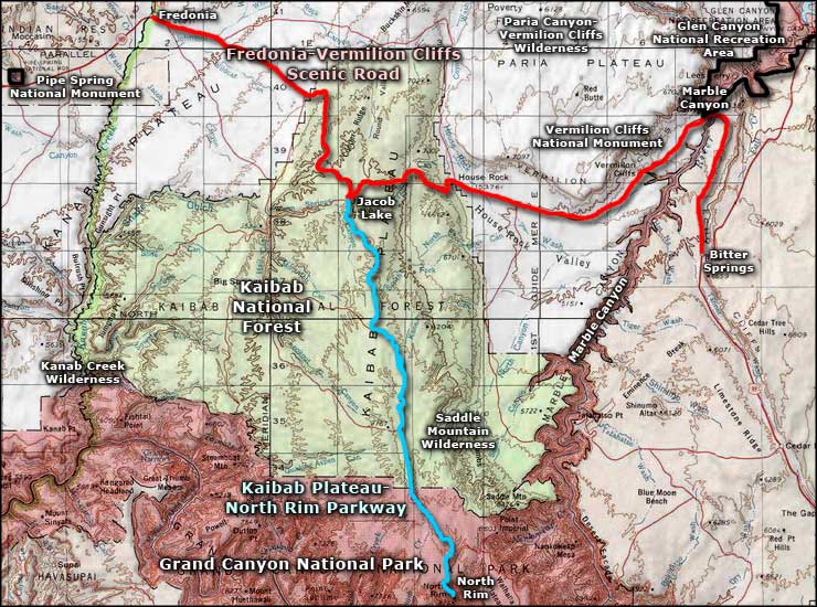
Fredonia-Vermilion Cliffs Scenic Road
Glen Canyon National Recreation Area
Grand Canyon National Park
Glen Canyon National Recreation Area
Grand Canyon National Park
Map courtesy of National Geographic Topo!