Salt River Canyon Wilderness
Salt River Canyon Wilderness
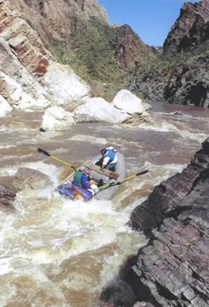
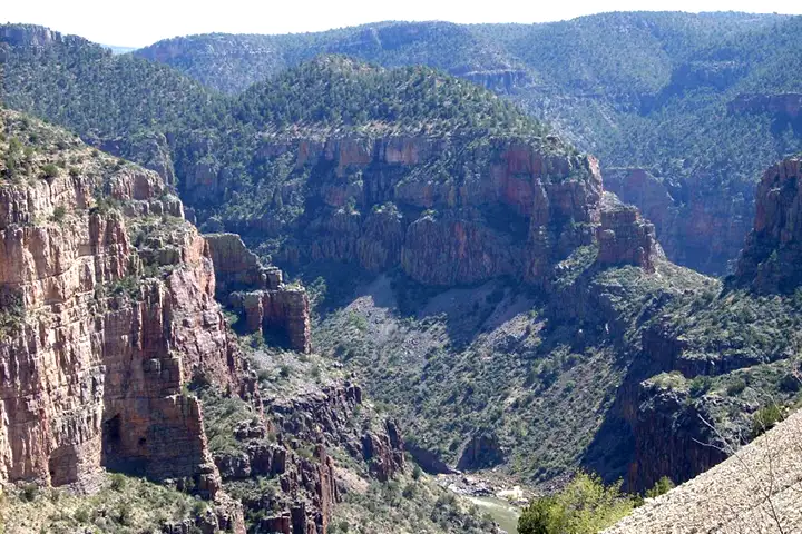
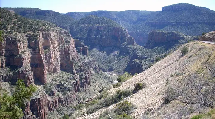
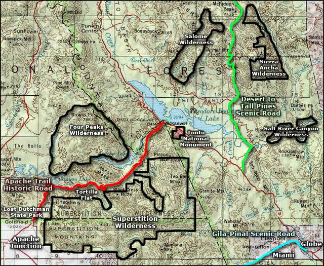
Salt River Canyon Wilderness is a hard-to-reach, extremely rugged 32,101-acre property about 20 miles downstream from the US Highway 60 crossing. There are no maintained trails in the wilderness, more than half the folks who visit the area do so during the March 1 to May 15 whitewater rafting season on the Salt. March 1 to May 15 also coincides nicely with the Federal-required visitor permit season... Reserved date/visitor permits are available only to non-commercial boaters, and you don't want to be caught on the river without one. On the other hand, the Forest Service doesn't require reservations or permits between May 16 and February 28, probably because there's usually not enough water flowing in the river to be used for rafting purposes.
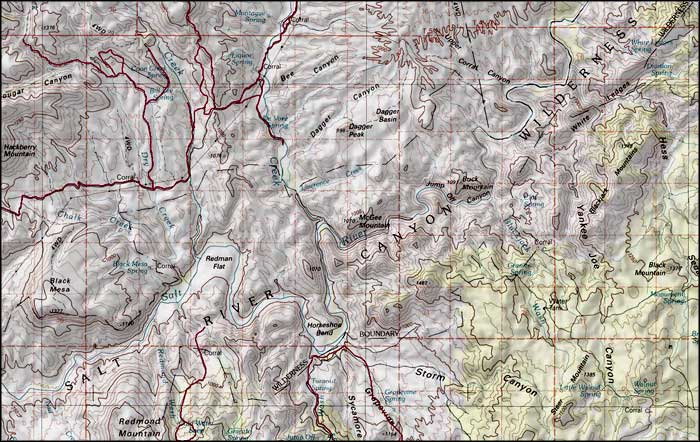
Most folks put into the river at Gleason Flats, about 20 miles downstream from the Highway 60 bridge. The pull-out area is at Highway 288, 30 miles downstream from Gleason Flats. Some folks do make the run from the Highway 60 bridge area down to Gleason Flats but there are additional complications along that part of the river: it is within the boundaries of the Fort Apache Indian Reservation and the tribe requires permits 365 days a year. Permits can be obtained at the Salt River Trading Post near the Highway 60 bridge. 10.5 miles downstream from the Highway 60 bridge is the Salt Banks area, a sensitive cultural and religious site that is completely off-limits to anyone who is not an enrolled member of the tribe. There is another similar area just upstream of the Highway 60 bridge.
Salt River Canyon Wilderness
Upper photo of Salt River Canyon courtesy of PhillipC, CCA-by-SA 3.0 License
Photo of the rafters in Salt River Canyon Wilderness courtesy of Brian Murdock, via Wilderness.net
Lower photos of Salt River Canyon courtesy of MountainMates.com
Map courtesy of National Geographic Topo!
Related Pages
Map courtesy of National Geographic Topo!