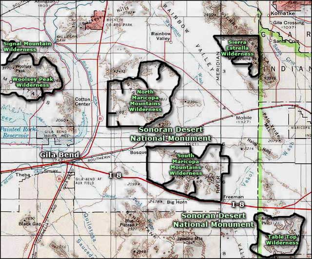
North Maricopa Mountains Wilderness
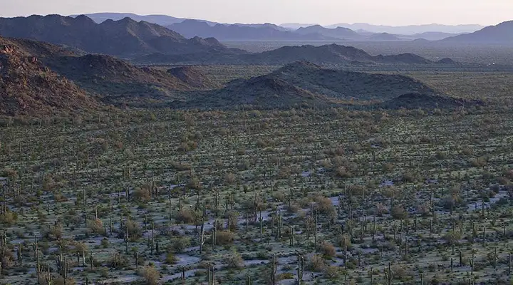
North Maricopa Mountains Wilderness from the south
Containing a 10-mile section of the northern Maricopa Mountains, North Maricopa Mountains Wilderness is a 63,200-acre property that also includes extensive areas of the surrounding desert plains. The North Maricopa Mountains are a jumble of isolated peaks and long ridges that never rise above 2,813 feet in elevation. The bajadas, washes, alluvial fans and desert floor surrounding the mountains drop to about 900 feet above sea level near Gila Bend. In between is some rugged country sporting saguaro, ocotillo, cholla, paloverde, creosote bush and other typical Sonoran Desert vegetation. For wildlife you might find coyote, desert bighorn sheep, fox, mule deer, bobcat, desert tortoise, Gambel's quail and the usual assortment of other reptiles, songbirds, insects and arachnids that make the Sonoran Desert their home.
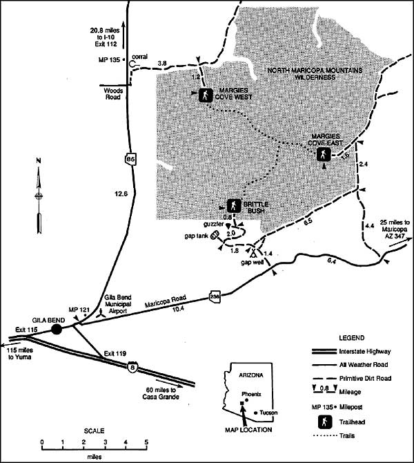
There are two primary hiking trails on the North Maricopa Mountains Wilderness. The Margie's Cove Trail crosses the wilderness east-west, the Brittlebush Trail comes in from the southern boundary and ends where it meets the Margie's Cove Trail. The trails are hardly marked and the faint traces that are there are easy to lose when crossing arroyos and sandy washes.
To get there: you'll want to be riding in a high clearance 4WD vehicle to get to the fence. From Maricopa Road (State Route 238) you'll find several dirt roads leading north to the southern wilderness boundary. You'll also find several dirt roads leading south from Rainbow Valley Road to the northern wilderness boundary. There's also a primitive dirt road running along part of the eastern wilderness boundary.
North Maricopa Mountains Wilderness was designated by Congress in 1990. In 2001, the property was included in the newly designated Sonoran Desert National Monument. The Juan Bautista de Anza National Historic Trail parallels the southern boundary of the North Maricopa Mountains Wilderness.
7.5-Minute Topo Maps: Cotton Center, Butterfield Pass, Cotton Center NW, Cotton Center SE, Mobile NW, Margies Peak

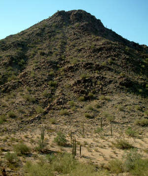
A jumble of basalt rocks
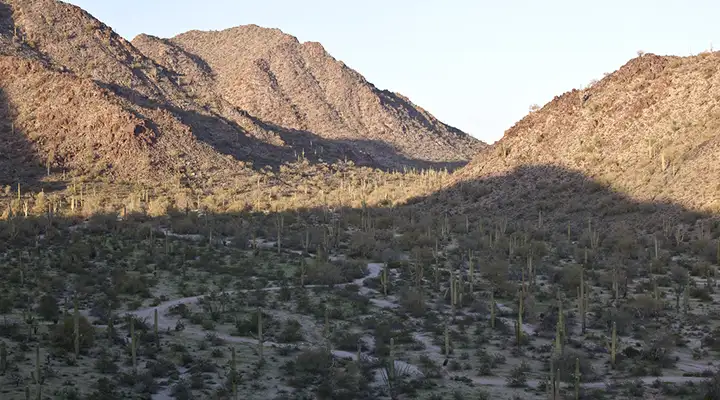
Looking down on the Margie's Cove Trail
North Maricopa Mountains Wilderness
Upper left, middle and bottom photos courtesy of R Scott Jones, CCA-NC-by-SA 3.0 License
Other photos and map courtesy of the Bureau of Land Management
Related Pages
Map courtesy of National Geographic Topo!