Fredonia-Vermilion Cliffs Scenic Road
The Vermilion Cliffs off in the distance
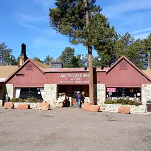
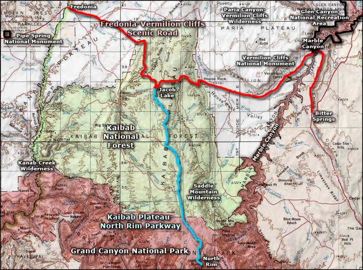
The Fredonia-Vermilion Cliffs Scenic Road is a 104-mile drive between Fredonia and Bitter Springs on US Highway 89A. This is Arizona Strip-BLM country, although part of the drive is across the Kaibab National Forest. But this is one of those roads that is featured heavily in those tourism guidebooks for Arizona. Huge multi-colored sandstone cliffs rising up, deep multi-colored canyons dropping below, vast wide-open spaces on an other-worldly landscape. I highly recommend this drive to everyone, just don't be in a hurry: get out and enjoy the scenery. There's amenities at Fredonia and a bit at Jacob Lake but not much else. If your destination is the North Rim of the Grand Canyon: you're going to drive at least half this road on the way there.
While you're gawking at the incredible landforms along this route, you might see a large, strange looking bird: it has a bald, orange head and a nine-foot wingspan. The endangered California condor was reintroduced to this area only a few years ago and has slowly established a tenuous residence. Because of the presence of condors in Grand Canyon, the National Park Service has imposed low-fly limits on aircraft in that space. About 35 of the 200-or-so living California condors hang out in this part of Arizona.
The Ancestral Puebloans lived in this area for thousands of years, ending around the time of the great drought of the late 1200's CE. Near water sources you might come across artifacts and constructions they left behind. The first Europeans to explore the area found Paiutes living in some areas in 1776. Those first Europeans were members of the Dominguez-Escalante Expedition, looking for a new route between Santa Fe, New Mexico and Monterey, California. In traveling through this area they camped at what is now the San Bartolome Historic Site, a marked site about halfway between Marble Canyon and Jacob Lake. At this point on their journey, they were headed back to Santa Fe after having been defeated in their quest by the desert in western Utah.
The first Anglo-American settlers in the area were Mormons, arriving in the 1860's. Fredonia was the first Mormon settlement and the name is supposedly a combination of the words "freedom" and "doña" (Spanish for wife). Those first settlers were often polygamists and they thought they were outside the laws against polygamy out there. At the time, there were no Mormon temples in Arizona so to sanction their marriages, they would usually travel the "Honeymoon Trail" between Fredonia and the temple at St. George, Utah. The trail was in use from 1870 to 1926, when the first graded-and-graveled road reached Fredonia.
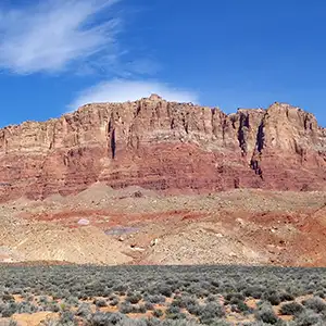
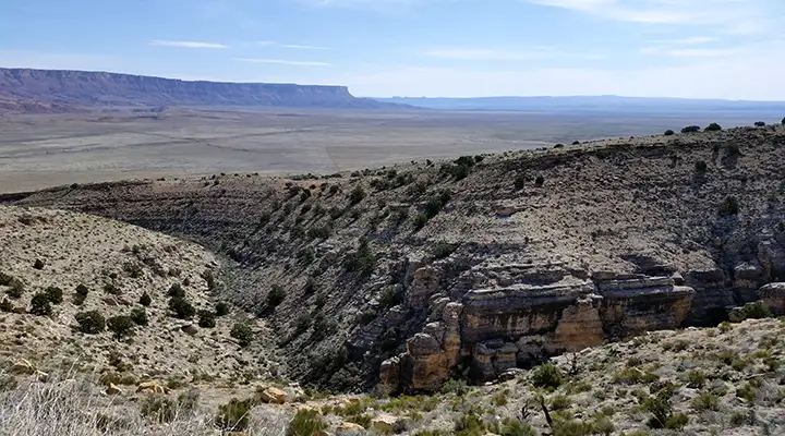
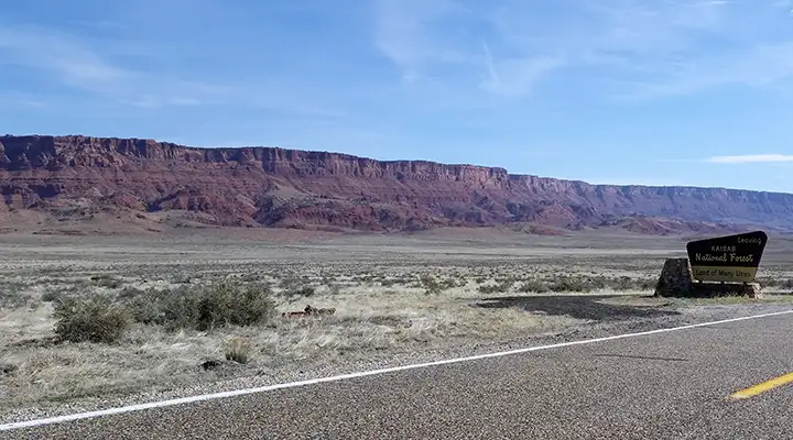
Between Marble Canyon and Jacob Lake, the road rises about 4,500 feet, from barren desert into Ponderosa pine forest. The road travels between House Rock Canyon on the south and the Vermilion Cliffs on the north. The Vermilion Cliffs in this area are part of the Vermilion Cliffs National Monument. Just behind the cliffs that you see from the road is the Paria Canyon-Vermilion Cliffs Wilderness, an area of incredible geological splendor and some very deep slot canyons. At the upper end of House Rock Canyon you'll be climbing the side of the Kaibab Plateau into the forest. To the south is the Saddle Mountain Wilderness with some excellent hiking trails and great views over Marble Canyon and the beginning of the Grand Canyon.
The forest offers an explosion of greenery and wildlife surrounded by all that red rock desert. Bison, pronghorn, mule deer, black bear, elk and the famous Kaibab squirrel (a bushy-tailed, tuft-eared black squirrel that exists only on the Kaibab Plateau) can be seen here. Jacob Lake itself is really just a sinkhole but it's at Jacob Lake where you'll have to make a choice: turn and go south to Grand Canyon National Park on the Kaibab Plateau-North Rim Parkway or continue on the 89A to Fredonia. You could also choose to continue west on Forest Service roads and make your way down to Kanab Creek Wilderness.
Before exiting the Kaibab Plateau and the forest, you'll pass by the Le Fevre Overlook offering views across the desert grasslands of the Kanab Plateau with sandstone cliffs and red-shale promontories off in the far distance. Then you'll get to drive across more wild, open country to Fredonia. About 14 miles southwest of Fredonia (on the way to Colorado City and more of the Arizona BLM Strip) is Pipe Spring National Monument.
I've driven the full length of this road at least a dozen times over the years.
Boundary of Kaibab National Forest
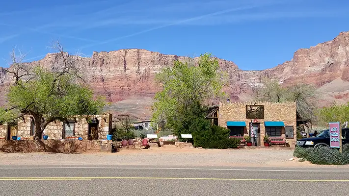
Marble Canyon, the town
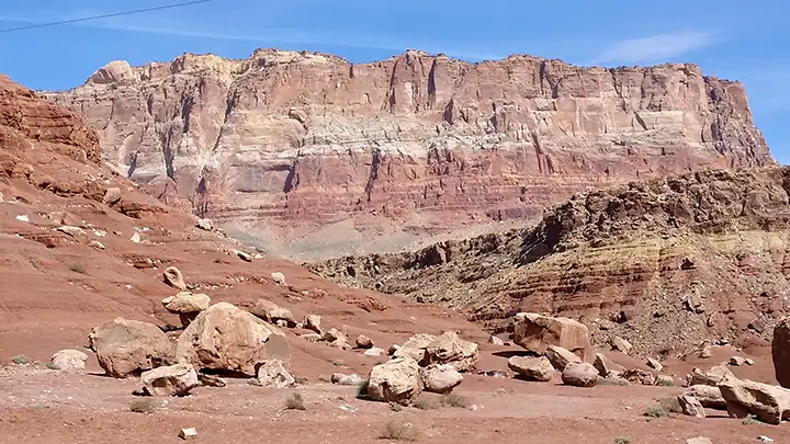
Another view along the Fredonia-Vermilion Cliffs Scenic Road
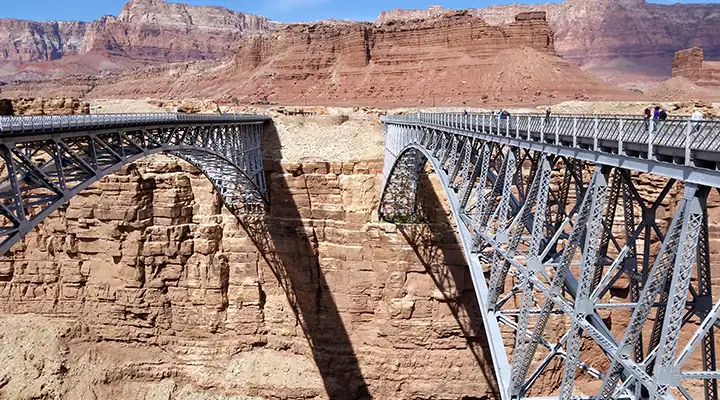
The Navajo Bridges across Marble Canyon
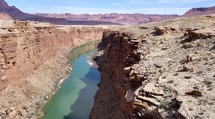
Marble Canyon from Navajo Bridge
Related Pages
Fredonia-Vermilion Cliffs Scenic Road
Glen Canyon National Recreation Area
Grand Canyon National Park
Glen Canyon National Recreation Area
Grand Canyon National Park
Map courtesy of National Geographic Topo!