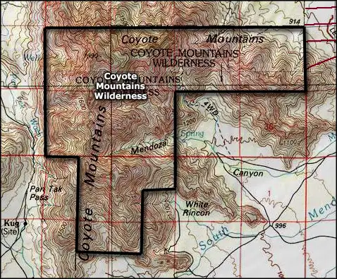
Coyote Mountains Wilderness
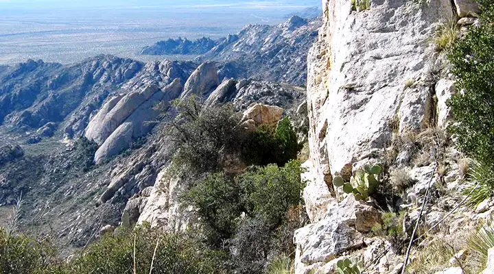
A view in Coyote Mountains Wilderness
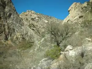
Coyote Mountains Wilderness is a 5,100-acre property in a detached mountain range adjacent to the Baboquivari Mountains in southern Arizona. Coyote Mountains Wilderness is an area of large open canyons with sheer cliff faces topped by massive rounded bluffs.
Vegetation in the Coyote Mountains is mostly of the Sonoran Desert ecosystem: giant saguaro, paloverde, oak woodlands and thick mesquite/ironwood chaparral. For large mammals you might find javelina, mountain lion and bobcat.
To get there: officially, take Arizona Highway 86 west out of Tucson toward Kitt Peak Observatory, then go eight miles south on Arizona Highway 289. Coyote Mountains Wilderness is about 4 miles east of there. However, all direct access to the wilderness is either across private land or across a section of the Tohono O'odham Indian Nation. I have heard stories of access being obtained from private landowners on the east side of the wilderness, in Altar Valley, but those rumors are unconfirmed. I've also come across mention of a winding route across public dirt roads that leads to the wilderness boundary, but that is unconfirmed, too, although that mention also recommended that no one camp at the wilderness boundary as there are a couple inhabited residences just a few feet away.
These mountains are very rugged: forget trails, forget signage, bring your compass, GPS device, a good map and lots of water... you're most likely going to be alone out there. If you get into trouble, you're probably really in trouble.
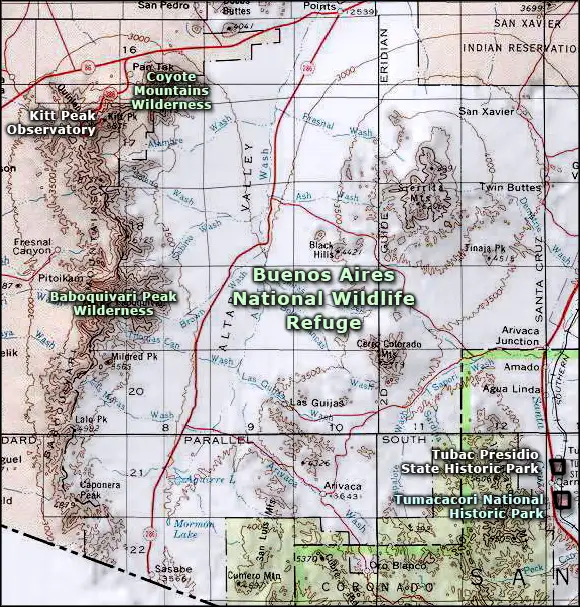
Topping the mountains across the valley to the west are the various structures and telescopes of Kitt Peak Observatory.
7.5-Minute Topo Maps: Pan Tak, San Pedro, Kitt Peak, Palo Alto Ranch
Related Pages
Map courtesy of National Geographic Topo!
Upper photo courtesy of Scott Surgent
Upper left photo courtesy of the Bureau of Land Management
Map courtesy of National Geographic Topo!