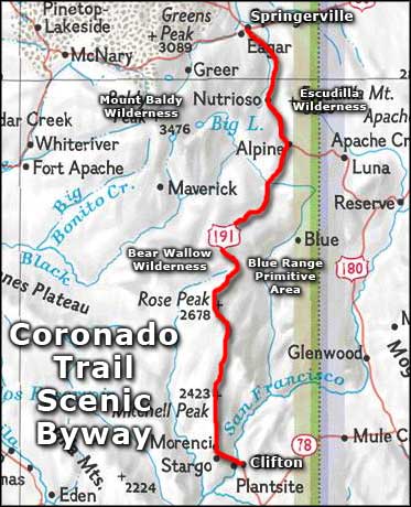
Coronado Trail Scenic Byway
Apache-Sitgreaves National Forest along the Coronado Trail Scenic Byway

The Coronado Trail Scenic Byway is a 123-mile route through the Apache-Sitgreaves National Forest in eastern Arizona. After the highway was built, it became one of the least traveled of all federal highways because, as one old cowboy remarked, "There ain't even a good horse trail." Back in those days it was also designated Route 666 ("the Devil's Highway"). Now it's designated US Highway 191. The Coronado Trail Scenic Byway earned its name by virtue of being very close to the actual route taken by Francisco Vasquez de Coronado and his men during their 1540-1542 expedition to explore the hinterlands of Spanish America in search of the Seven Cities of Cibola.
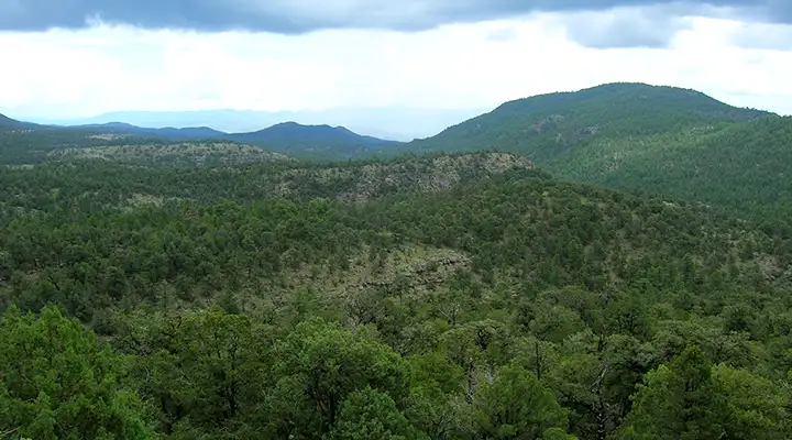
The southern end of the Coronado Trail Scenic Byway is in Clifton, a former copper mining center at the foot of the Mogollon Rim. Just out of Clifton the road starts the climb up through the canyons to the top of the Mogollon Rim. That's a journey from desert scrub into dense conifer forest, accomplished through the artifice of some 400 switchbacks. Passing Morenci be sure to stop at the Morenci Mine Overlook and take a peek down into the depths of one of the world's largest open pit copper mines. Once you get through the majority of the switchbacks, you'll come to an overlook that gives you a view across southeastern Arizona and into northern Mexico, then you move into heavy forest.
The Coronado Trail Scenic Byway passes close to the Blue Range Primitive Area and three National Wilderness Areas: Bear Wallow Wildernerness, Mount Baldy Wilderness and Escudilla Wilderness. Bear Wallow and Blue Range are based around canyons dropping down from the Colorado Plateau, Mount Baldy and Escudilla are based on volcanic remnants that rise above the plateau. All of them are close to the scenic byway, the Blue Range within easy walking distance at many points along the route.
At Hannagan Meadow you'll find a rustic two-story log lodge, convenience store and restaurant with direct access to the forest. Great views, good food, good selection of supplies and really good advice for folks wanting to go further into the back country. Within a few miles of Hannagan Meadow are many trail heads, including several leading into Bear Wallow Wilderness and more than a dozen leading into the Blue Range Primitive Area.
North of Hannagan Meadow the first signs of "civilization" you'll come to are around Alpine, site of an Army fort in the late 1800's, now the site of a burgeoning summer community. Just to the east is Luna Lake with campgrounds, picnic areas, trail heads and world-class fishing opportunities.
Just north of Alpine is Nutrioso and access to Escudilla Wilderness. Follow the signs and take the hike. Within three miles of the parking area is the summit of Arizona's third highest mountain.
North of Nutrioso is still plenty of forest but it opens up a bit and you'll find several good fishing lakes and reservoirs right beside the road. Then you'll enter Round Valley and have to make a choice between going to Eagar or going to Springerville. No big deal: they're right next to each other. But heading west out of Eagar is Arizona Highway 260, a route that travels along the edge of the Mogollon Rim and passes by Mount Baldy Wilderness and the Sunrise Park Ski Resort. Somewhere in that area, SR 260 also becomes known as the White Mountain Scenic Road.
Over the years, I have driven parts of this road several times. Stopped to camp and hike a few times. There was never much traffic in the area, except around Alpine Lake. And the road isn't plowed in the winter, the snow stays until it melts on its own.
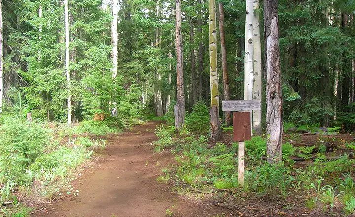
A trailhead leading into the Blue Range Primitive Area
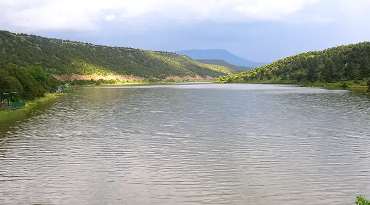
A reservoir beside the Coronado Trail Scenic Byway south of Eagar
Related Pages
Map courtesy of National Geographic Topo!