Boysen State Park
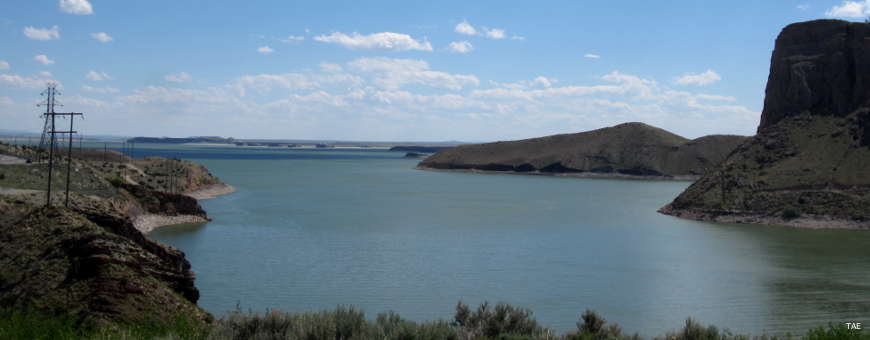
Boysen Reservoir
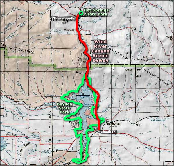
One of the larger state parks in Wyoming, Boysen State Park is oriented around Boysen Reservoir in central Wyoming, on the eastern edge of the Wind River Indian Reservation between Riverton and Thermopolis. Boysen is also at the beginning of the Wind River Canyon Scenic Byway at the south end of the Owl Creek Mountains. This is very scenic and very geologically interesting countryside.
The park offers all kinds of water recreation with day use and camping facilities spread around the lake, and a couple of camping areas below the dam along the Wind River itself:
- Lower Wind River: This campground features about 50 sites below the dam, near the tunnels that mark the site of the original Boysen Dam. This is a grassy area with shade trees and some great rock formations. Apparently, the local herd of Bighorn sheep visits often. There is a group shelter that can be reserved for special occasions and about half the campsites are also reservable.
- Upper Wind River: There are another 50 or so campsites here (10 are reservable), beside the Wind River and just below the Boysen Dam. This is another grassy area with shade trees and nice rock formations where the Bighorn sheep like to hang out.
- Brannon and Tamarisk: These campgrounds are at the northern end of the lake (the dam is at the south end). There are maybe 65 campsites between them with a boat ramp and commercial concession offering complete marina service. This is in a protected bay with a sandy beach, shade trees and picnic shelters. While most of the water systems around the lake are shut down from mid September to mid April, Brannon stays open longer.
- Tough Creek Campground: Located on a peninsula jutting into the lake, Tough Creek has a small reservable group shelter and a boat launching area. There are approximately 65 campsites, some picnic shelters and a few shade trees.
- Loop 1: This is a group of small camping areas on the west side of the reservoir with close access to the lake. South Muddy, Fremont Bay, Libby Point and Sandy Hills Loop have about 20 campsites among them with another small reservable group shelter, some picnic shelters, a few shade trees, a sandy beach and a boat launching area.
- Loop 2: Loop 2 is a bit north of Loop 1 on the west side of the reservoir and also features several small camping areas with a few shade trees, some picnic shelters, a small reservable group shelter, a sandy beach and a boat launching area. Trout Bay, Cottonwood Bay, Sand Mesa, Wilson Bay and North Muddy have about 30 campsites among them, all with close access to the lake.
Boysen State Park is located between US 20 and US 26, just west of Shoshoni on the edge of the Wind River Indian Reservation. Boysen State Park, Boysen Dam and Boysen Reservoir were named in honor of Asmus Boysen who leased some land from the Arapaho and Shoshone tribes just downstream from here in order to build the original dam and reservoir back in 1908.
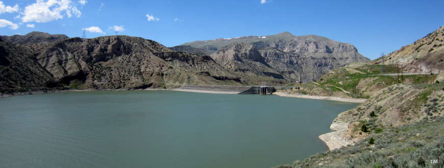
Boysen Dam
Photos courtesy of TheArmchairExplorer, CCA-by-SA 4.0 License
Related Pages
Map courtesy of National Geographic Topo!