North Stansbury Mountains Wilderness Study Area
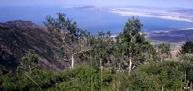
The view north over the Great Salt Lake
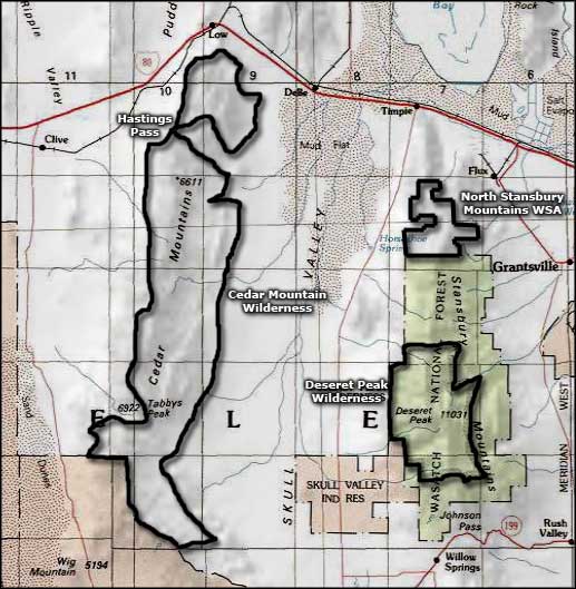
Only 40 miles west of Salt Lake City, the North Stansbury Mountains Wilderness Study Area is comprised of 10,480 acres just to the north of the Deseret Peak Wilderness of the Uinta-Wasatch Cache National Forest. These are typical Basin and Range Province mountains: north-south trending and pushed up above barren desert with valley floors on either side. Elevations vary from a high of near 8,800' close to the Forest boundary on the south to a low around 5,200' where the mountains meet the valley floors.
The lower elevations are covered with typical juniper and sagebrush scrublands while elevations above that see wild rose, service berry and mountain mahogany. Closer to the upper ridgelines you'll come across conifers, with Douglas fir and white fir on the northern slopes. Along those upper ridge lines you'll also find lots of large outcroppings of angular quartzite. And the views over the Great Salt Lake to the north are spectacular.
Visitors to the North Stansbury Mountains WSA can enjoy camping, hiking, backpacking, horseback riding and hunting (in season). There is a route up Muskrat Canyon (in the southwestern section of the property) that allows limited OHV use, all other roads and trails in the wilderness study area are just like in a regular designated wilderness: no mechanized or motorized vehicles are allowed.
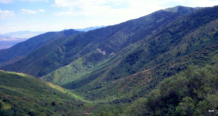
In the North Stansbury Mountains Wilderness Study Area
Photos courtesy of the Bureau of Land Management
Related Pages
Map courtesy of National Geographic Topo!