Sunspot Scenic Byway
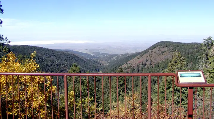
Western view from the Haynes Canyon Vista along the Sunspot Scenic Byway
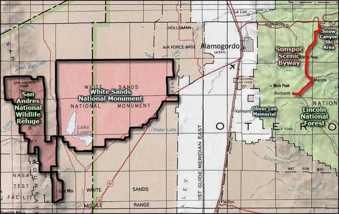
The Sunspot Scenic Byway is a 16-mile paved route that connects Cloudcroft with Sunspot. The route is through Lincoln National Forest along the western rim of the upper Sacramento Mountains. That means all along the way you'll get some great overlooks across most of south-central New Mexico: White Sands National Park and the Tularosa Basin. As the photo below testifies, you can even see as far north as the Sierra Blanca (White Mountains).
Sunspot is a village where you'll find the observatories of Apache Point and the National Solar Laboratory. The observatories have located here because the desert skies offer low dust, low humidity, very dark skies and ample clear days and nights for observations. Apache Point Observatory is operated by New Mexico State University, the National Solar Laboratory by the Association of Universities for Research in Astronomy under a cooperative agreement with the National Science Foundation. Apache Point is a traditional night-time observatory while the National Solar Laboratory does most of its research during the day. If you pay a visit to the Sunspot Visitor Center and Museum, they can tell you all about what's happening in the area.
Most folks drive down to Sunspot, hang out a bit, then drive back to Cloudcroft and descend from the heights from there on US Highway 82. But the road doesn't end at Sunspot: you can continue on to the south and end up in Timberon, a small ranching community near the southern end of Lincoln National Forest. The road through Sacramento Canyon is not the best but it will eventually allow you to leave the mountains and forest behind when you reach New Mexico Highway 506 (between Orogrande and Pinon).

The Sierra Blanca to the north
Photos courtesy of Byways.org
Related Pages
Map courtesy of National Geographic Topo!