High Road to Taos
The Jemez Mountains across the Rio Grande Valley
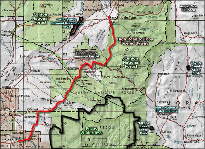
The High Road to Taos is a scenic back road that skirts the western edge of the Sangre de Cristo Mountains, weaving in and out of the Santa Fe and Carson National Forests. Along the route there's lots of great overlooks and some of the oldest settlements in America.
Historically, this route was followed by the Indians when they were looking to avoid the Spanish. As more and more Hispanic settlements happened over time, it was used more for trade and communications among the old plazas. The foothills of the Sangre de Cristo's were among the first areas settled in those days. These days, driving in here is like going back in time a couple hundred years to an area that probably wishes it had been forgotten.
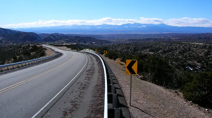
The High Road to Taos leaves the main traveled route along the Rio Grande and heads southeasterly into the mountains. (In case you aren't following my direction, I'm driving it north-to-south today: Taos to Santa Fe.) In the early days of Spanish settlement, this route crossed over to the east side of the Sangre de Cristo's and went down into the valley of Mora, once a main center of Spanish colonization and influence. When the Taos Rebellion went down in 1847, the settlers in Mora were heavy supporters of the uprising against the American invaders. The US Army retaliated against Mora by burning the town and killing all the men, women and children they found there (in Taos, they shelled the pueblo, blew up the church and hanged about twenty of the organizers from the trees growing in Taos Plaza). But along the way from Taos to Mora, the route dropped into the Valley of Vadito (in the area of Picuris Pueblo). From there, you could choose to continue southeasterly over the spine of the mountains or go southerly through Las Trampas, Ojo Sarco, Truchas and Chimayo, where you came back to the edge of the Valley of the Rio Grande. The High Road makes the turn and goes southerly. It's in Vadito that you'll see the signage pointing to Picuris Pueblo and the Sipapu Ski and Summer Resort.
The High Road to Taos turns and heads west for a bit after descending into the Valley of Vadito. This road goes almost due west and straight down to Dixon near the Rio Grande but a few miles down there's a well-marked left turn which is where the High Road goes south again. The area between this turn and the Rio Grande is in the heart of of the wine-making area in New Mexico.
The Valley here is quite settled with families of Spanish and Picuris Indian descent. In the early days of Spanish colonization, the folks of Picuris Pueblo put up a resistance and the Spaniards made an example of them: they completely destroyed the Pueblo. The Spaniards even went so far as to send troops up to El Cuartelejo (an Apache-controlled area along the Arkansas River near modern Pueblo, Colorado), trying to hunt down any Picuris Indians who'd escaped the slaughter. The Pueblo Revolt of 1680 (the first real American Revolution) happened for many good reasons, including the Spanish depredations that occurred here. But the Spanish returned in 1692 and by 1694, they had reconquered northern New Mexico.
Once you make that turn, the route is a run down the pavement to Chimayo. Las Trampas is the site of an early land grant and the church built there is one of the finest examples of an early New Mexican mission church that is still standing. Truchas was for many years a sleepy backwater, very Hispanic town in a drop-dead gorgeous setting but these days, it is slowly getting Anglicized and art galleries, studios and trinket shops are beginning to appear. However, the old roots are still quite obvious: the main street is exceptionally narrow and the houses are built right against the pavement. If you follow that main street to its eastern end, you'll find the trailhead that leads up onto the ridge connecting the Truchas Peaks with each other (both summits are above 13,000'). But if you stay on the main highway, Truchas is where the descent out of the Ponderosa pine life zone into the semi-arid desert along the Rio Grande begins. It's a long slow drop to Chimayo, then further down to where the Scenic Byway ends in Pojoaque.
Chimayo is also an old Hispanic settlement, known for the quality of the arts and crafts produced there and the presence of the Sanctuario de Chimayo (a holy place that sees many pilgrims during the Easter ceremonies). Between Chimayo and Pojoaque you'll be passing across Nambe Pueblo and Pojoaque Pueblo. Most folks seem to visit Pojoaque these days for the excellent golf course at Towa and the fun and games at the Buffalo Thunder Resort.
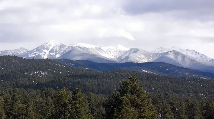
Truchas Peaks in the distance
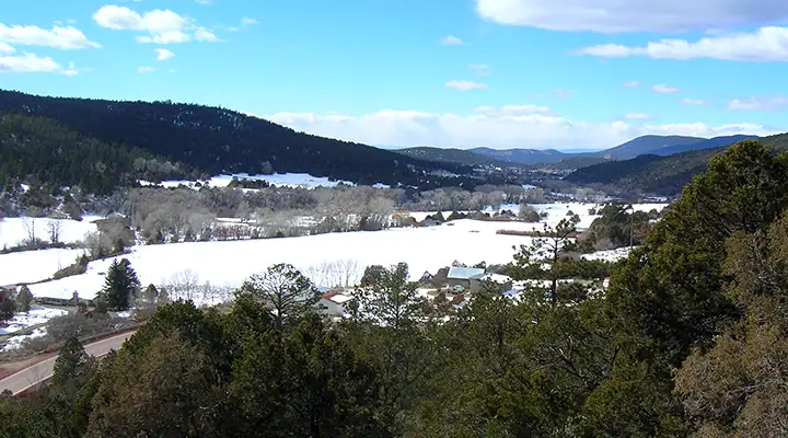
The Valley of Vadito
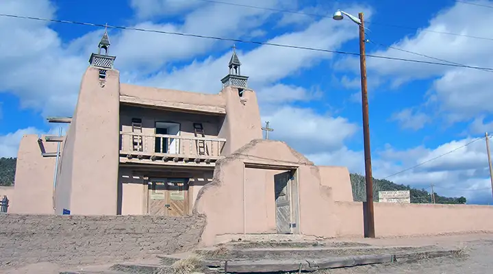
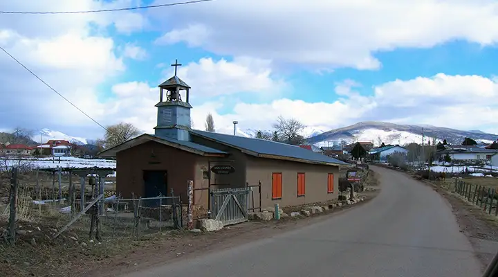
San Gregorio Mission in Las Trampas
An old church (now artist studio) in Truchas
Photos courtesy of TheArmchairExplorer, CCA-by-SA 4.0 License
Related Pages
Map courtesy of National Geographic Topo!