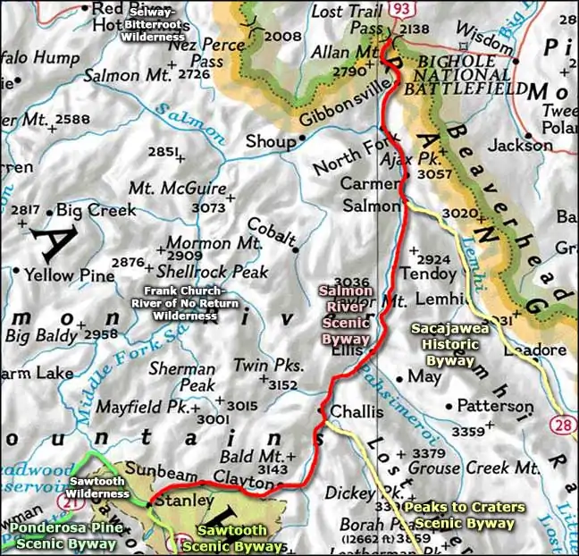
Salmon River Scenic Byway
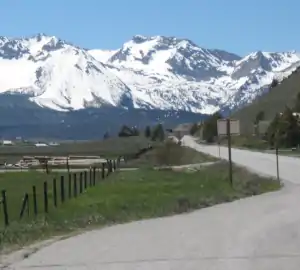
The Sawtooth Mountains beyond Stanley
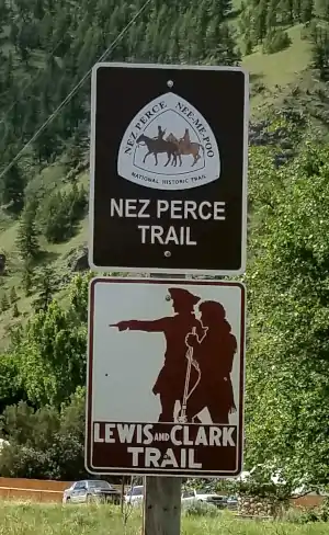
Nez Perce and Lewis and Clark Trail signs in Lost Trail Pass
The Salmon River Scenic Byway is a 162-mile drive across some of Idaho's fantastic back country: the Salmon-Challis National Forest through the Salmon River Valley. The north end of the route is at the summit of Lost Trail Pass (6,995') in the Bitterroot Mountains. The southern end of the route is at Stanley, at the foot of the Sawtooth Mountains. In between is countryside that looks much the same as it did when Lewis & Clark first stepped foot on the Idaho side of Lost Trail Pass (the Pass got its name because their guide had lost his way).
Now Lewis & Clark were really lost: they thought they could descend to the Salmon River and easily float down to the Columbia River and the Pacific Ocean from there. They spent a couple weeks trying but finally climbed back up and over the pass to go further north in Montana before trying to cross Idaho again. Today, that black ribbon of asphalt makes finding your way much easier, and the route that asphalt takes around what is now the Frank Church River of No Return Wilderness is much easier to travel.
The route follows US Highway 93 between Lost Trail Pass and Challis. At the south end of Challis, the Salmon River Scenic Byway turns right and runs over Idaho Highway 75 to Stanley. US Highway 93 from Challis south is the route of the Peaks to Craters Scenic Byway. In Salmon, Idaho Highway 28 cuts off to the southeast and runs through the valley of the Lemhi River as the Sacajawea Historic Byway. In Stanley, the Salmon River Scenic Byway ends at the same intersection where the Ponderosa Pine Scenic Byway begins its journey to the west and the Sawtooth Scenic Byway begins its journey to the south.
I drove this road from Stanley to Challis in the late spring. There was still snow in the higher areas and the streams and rivers were running high. There was hardly any traffic and there were lots of turnouts, generally alongside the river. At Challis I made a tour around town, then turned south on the Peaks to Craters Scenic Byway.
One thing I kept forgeting about this river: it flows northeast out of Stanley and makes a large loop north then west and crosses Idaho again to empty into the Snake River. And the government allows power boats on the Salmon River through the wilderness areas.

Most of the river looked like this...
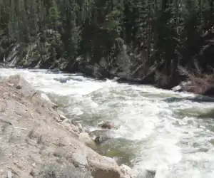
...but some of the river looked like this

A bucolic scene along the Salmon River

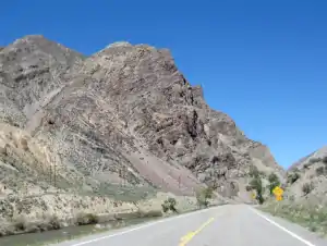
Millions of years of geology beside the river
More exposed geology
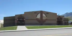
Challis City Hall, Challis Middle School and the local BLM office
Photos courtesy of TheArmchairExplorer, CCA-by-SA 4.0 License
Related Pages
Map courtesy of National Geographic Topo!