Wabayuma Peak Wilderness
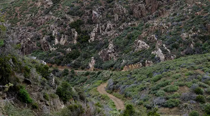
At the edge of Wabayuma Peak Wilderness
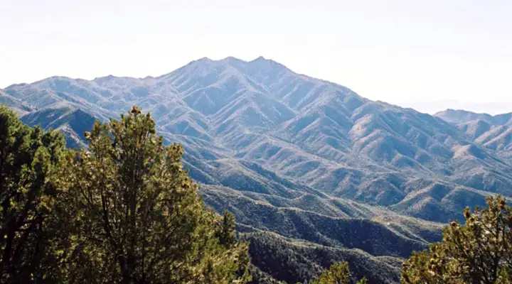
The 38,944-acre Wabyuma Peak Wilderness is dominated by Wabayuma Peak (of course). Rising to a height of 7,601 feet, the summit of Wabayuma Peak is about 5,000 feet above the deck of the surrounding desert. Wabayuma Peak is surrounded by a steep series of massive ridges to the north, west and south, a topography of spires, crags and massive rock outcroppings.
In the lower areas of the wilderness is a mix of Mojave and Sonoran Desert vegetation. The upper areas will be peppered with Arizona chaparral and pinon-juniper woodlands and the northern slopes of the higher mountains will be growing healthy ponderosa pine and Gambel oak forests.
The landscape is large and offers a variety of trails for hikers and horseback riders. However, to get anywhere near the wilderness boundary requires a high-clearance 4WD vehicle.
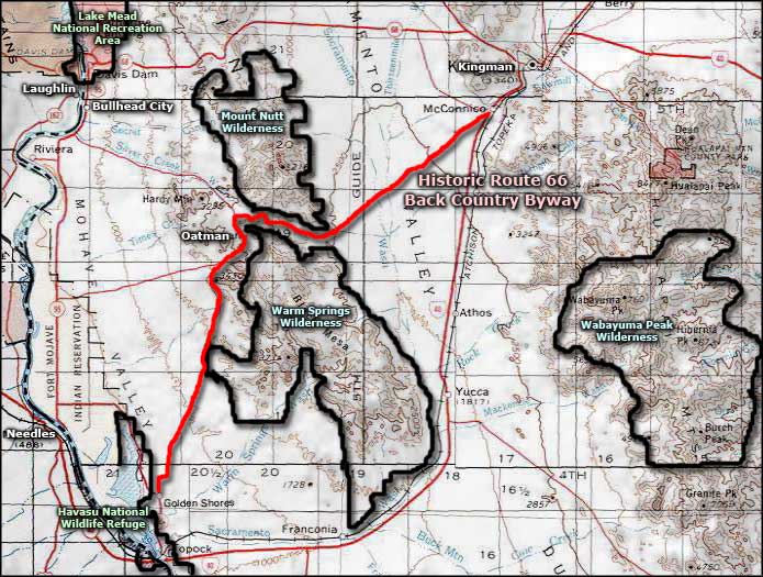
To get there: Southeast Boundary: Exit Interstate 40 at exit 25 (Yucca and Alamo Road exit). Follow the signs to Alamo Road. Once you're on Alamo Road, go about 3.2 miles to the southeast to Boriana Mine Road. Go 4.5 miles and turn left onto Suzette Road. Suzette Road offers three access points to the wilderness. If you stay straight ahead (and don't turn onto Suzette Road), in another 4.4 miles the wilderness boundary will be on the left side of the road. If your intent is simply to climb Wabayuma Peak, you might want to head south out of Kingman on Hualapai Mountain Road. Go south about 13 miles to the community of Pine Lake. Turn right on Hualapai Ridge Road and go about 18 miles to signs marking the Wabayuma Wilderness on the right. Right around the 20-mile mark you should see the main trail head for the trail that climbs Wabayuma Peak. All other possible access routes from the north and northwest sides of the wilderness area run across private property.
7.5-minute Topo Maps: Hualapai Peak, Wabayuma Peak, Yucca NE, Kingman SE
Wabayuma Peak
Upper photo courtesy of the Wilderness Land Trust
Lower photo courtesy of Chazz Layne, CCA-NC-by-SA 2.0 License
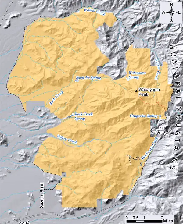
Map courtesy of the Bureau of Land Management
Related Pages
Map courtesy of National Geographic Topo!