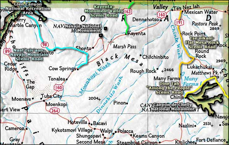
Naat'tsi'saan Navajo Mountain Scenic Road
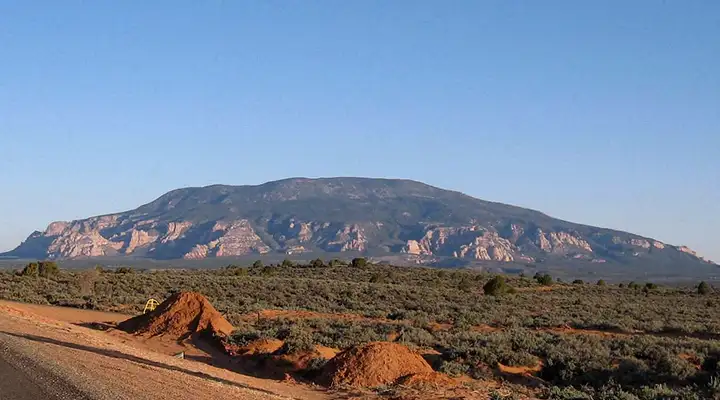
Navajo Mountain
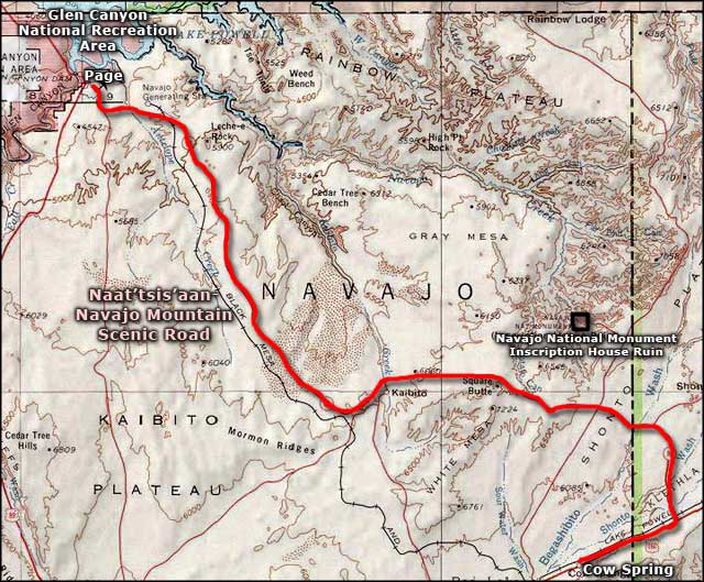
The Naat'tsis'aan Navajo Mountain Scenic Road is a 66-mile journey across the heart of Navajo country. The route begins at US Highway 160 just outside Cow Springs and follows State Route 98 to the byway terminus on US Highway 89 near Page. As one of the first settlement locations in Navajo tribal history, access to Navajo Mountain itself by non-Navajos is strictly regulated by the tribe. Navajo Mountain is also held sacred by the Hopi, Zuni and Paiute tribes with oral histories and sacred rituals going back up to 10,000 years. However, this is another exquisite drive through some glorious red rock country on the Navajo Nation. And at the north end of the route is Page and access to Lake Powell and the Colorado River.
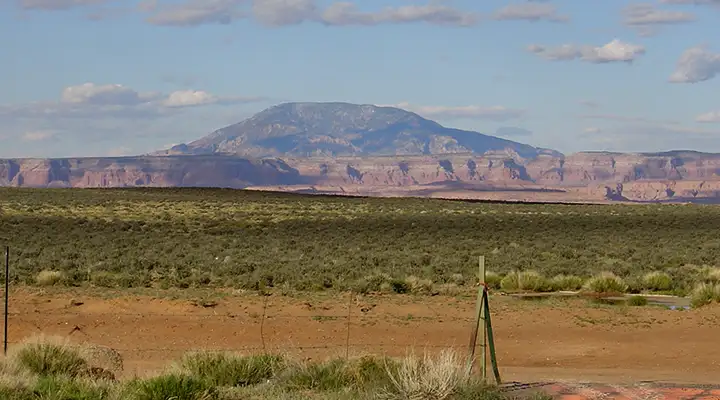
A large portion of the Naat'tsi'saan Navajo Mountain Scenic Road lies across wide open desert grasslands with red sandstone mesas, buttes and spires in the distance. At times an occasional windmill will pop up, maybe even a few stubby pine trees or stands of tall yuccas. Just north of the turnoff to Navajo Mountain is a pullout where you can stop and snap a few photos of the surrounding countryside (one of the lower photos on this page is from that pullout).
The only amenities along this route are found in the tiny settlement at Kaibito. Kaibito is about 1/2 mile off State Route 98 and has a small general store but not much else. Many of the canyons in the area are where Navajo families hid out during the months of Kit Carson's campaign to round up the tribe and march them to exile in eastern New Mexico (back in 1863-1864).
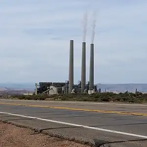
Between Leche-e Rock and Page is where you'll find the one place where modern man's creations intrude on this beautiful but forbidding landscape: the Navajo Generating Station, a large, coal-fired electric generating plant. From there you'll probably start seeing the blue waters of Lake Powell glinting in the distance, then the route dead-ends at the "T" intersection with US Highway 89 at Page. Chances are good that the only other vehicles you'll see on the road will be local folks going about their daily business: this scenic road sees very little tourist traffic.
Maybe I should rephrase that last sentence a bit: it's this road that takes you to Antelope Canyon, an incredibly beautiful slot canyon deep in the red sandstone. There is a parking area and trailhead there but you'll need to hire a local tour guide before you can actually go anywhere.
I've driven most of this road several times but only drove the whole road once.
Navajo Mountain from State Route 98
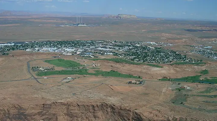
An aerial view looking east across Page with the Navajo Generating Station and Leche-e Rock in the distance
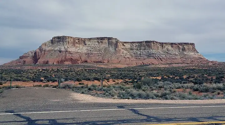
The Leche-e Rock
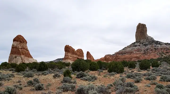
Sandstone pillars along the route
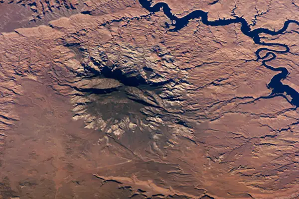
Navajo Mountain from space, Lake Powell in the upper right
Naat'tsi'saan Navajo Mountain Scenic Road
Photo of Navajo Mountain from space courtesy of NASA
Lower photo of Navajo Mountain courtesy of Wikipedia userid Solarapex, CCA-by-SA 3.0 License
Photo of Page from the air courtesy of Wikipedia userid PRA, CCA-by-SA 3.0 License
Other photos courtesy of TheArmchairExplorer, CCA-by-SA 4.0 License
Map courtesy of National Geographic Topo!
Lower photo of Navajo Mountain courtesy of Wikipedia userid Solarapex, CCA-by-SA 3.0 License
Photo of Page from the air courtesy of Wikipedia userid PRA, CCA-by-SA 3.0 License
Other photos courtesy of TheArmchairExplorer, CCA-by-SA 4.0 License
Map courtesy of National Geographic Topo!
Related Pages
Map courtesy of National Geographic Topo!