Canyon de Chelly National Monument
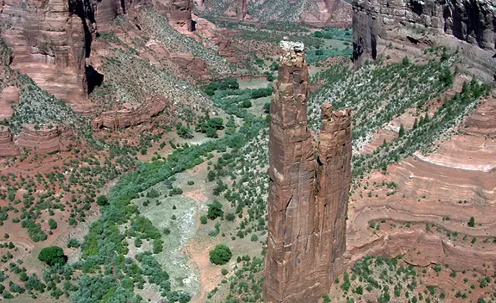
Spider Woman Rock
Canyon de Chelly National Monument is somewhat unique among National Park Service properties: some of the Navajo families who have lived in this canyon for centuries are still living here. Because of that, if you are interested in traveling through the bottom of the canyon, you need to hire a Navajo guide to accompany you on the journey. The only place where we (non-Navajo) can go to the bottom of the canyon on our own is on the White House Ruin Trail. That said, you can see virtually everything there is to see from the rim roads and their overlooks.
This canyon is really just a huge eroded crack in the Earth. Back during the Civil War, the Navajos were taking advantage of all the White Eyes military people being tied up with fighting each other. With no Army around, the Navajos were raiding local ranches and farms for food, livestock and weapons. There came a point where Kit Carson was ordered to round them all up and march them to a resettlement site at Bosque Redondo (in the flatlands of eastern New Mexico). Carson knew what he was doing and his "scorched Earth" methods shortly forced most of the tribe into hiding. Canyon de Chelly is where they hid. Almost no one outside the tribe knew the place existed. The Spanish had found the canyon a hundred years before but were never able to get into it. The Americans didn't have the records (or maps) of that Spanish expedition. So Carson's scouts were busy traveling back and forth across these high mesas until someone stumbled upon the canyon. It took some effort but eventually, Carson succeeded in removing most of the tribe from the canyon and getting them to New Mexico.
It was a horrible time for them as many of the tribespeople died en route. And eastern New Mexico looks nothing like home... so they essentially started to waste away. A couple years later, the Federal Government relented and allowed the tribe to return to their ancestral homeland, once they agreed to keep the peace.
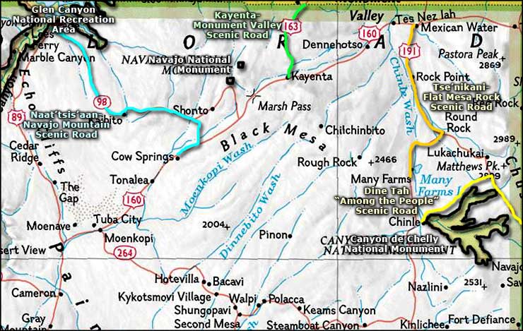
Today, the town of Chinle sits just below the mouth of the canyon. There are two rim roads: one on the south and one that goes around the north before heading off into the red rock. Most folks drive the southern route because that is where you'll see the most canyon. The north route is part of the Dine'Tah "Among the People" Scenic Road, a Native American Scenic Byway that wraps around east of Canyon de Chelly and passes into New Mexico before returning to Arizona and terminating at the tribal capital at Window Rock.
I've been to Canyon de Chelly a few times over the years, and would like to go again. This time around, I meet even come across a few people I know who live in that area.
The view from Spider Woman Rock Overlook
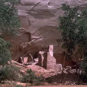
Slide House is at the bottom of that cliff

White House Ruins
Canyon de Chelly is actually composed of three canyons: Canyon de Chelly, Canyon del Muerto and Monument Canyon. The National Monument contains 83,840 acres encompassing everything between the rims of the canyons. There are picnic areas and overlooks but camping and campfires around the canyon are not allowed. If you want to stay nearby overnight, you're best off to get a room in Chinle (there's several good motels and inns there). The National Park Service also operates a campground on the outskirts of Chinle, well away from the canyon. The Canyon de Chelly Visitor Center is open every day except Christmas, from 8 am to 5 pm.
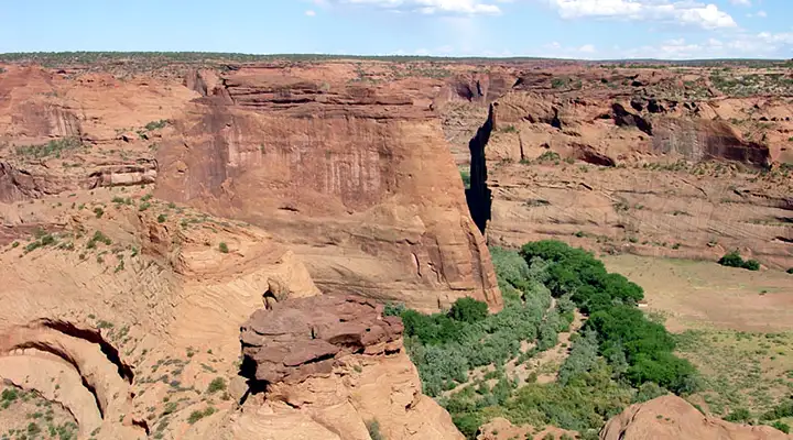
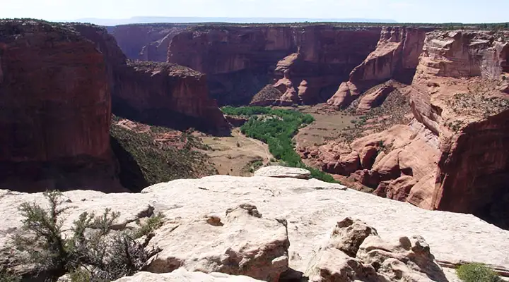
Another view of the canyon floor
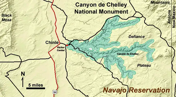
Some photos and small map are courtesy of the National Park Service
Some photos are courtesy of TheArmchairExplorer, CCA-by-SA 4.0 License
Related Pages
Map courtesy of National Geographic Topo!