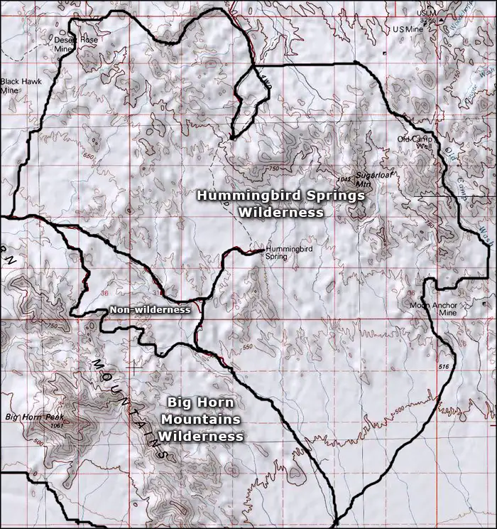
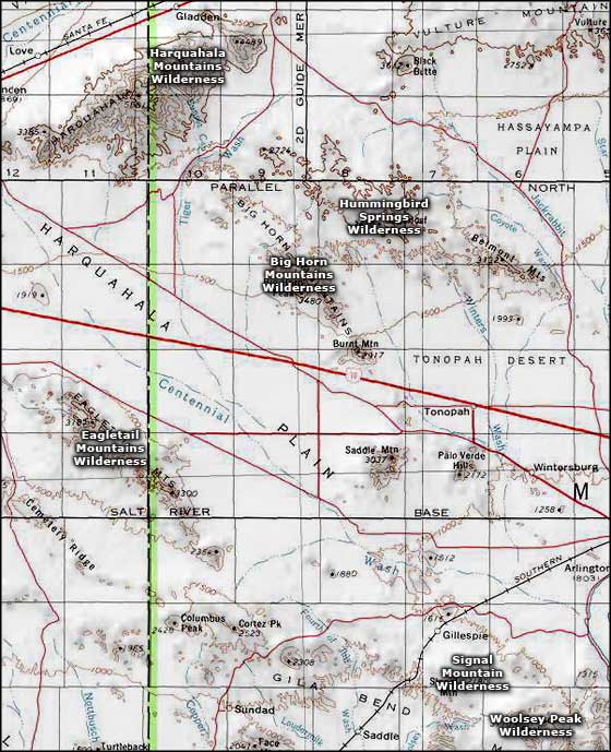
Hummingbird Springs Wilderness
In Hummingbird Springs Wilderness

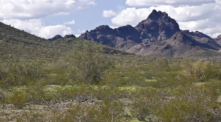
Hummingbird Springs Wilderness is a 31,200-acre property just to the northeast of Big Horn Mountains Wilderness. The countryside isn't much different from the Big Horns, except the slopes aren't as starkly vertical and the cliff bands around 3,418-foot-high Sugarloaf Mountain are much more brightly colored. Technically, these mountains are the eastern ridge of the Big Horns. If it wasn't for the need to keep that jeep trail in between open, these two wildernesses would be one.
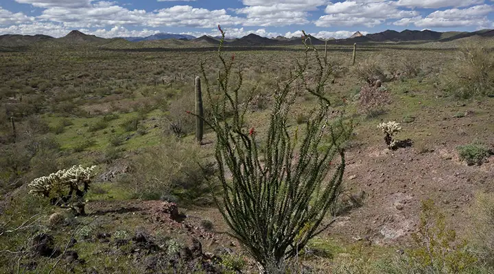
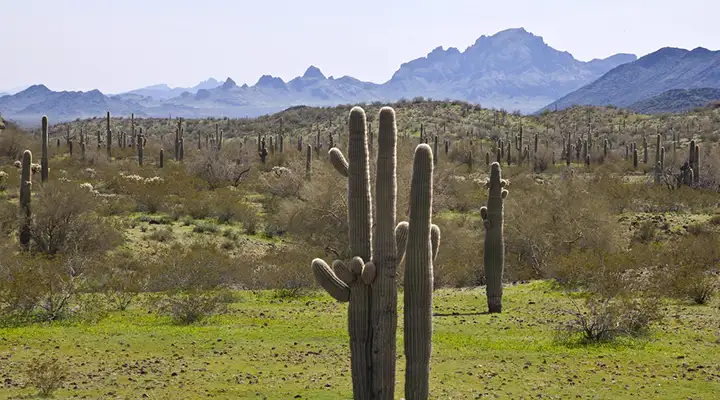
The maps show a couple good springs in the Hummingbird Springs Wilderness. Regular flowing water means good habitat for desert bighorn sheep, maybe even a few bobcats, kit foxes, coyotes, mule deer... jackrabbits, kangaroo rats, reptiles and snakes. The vegetation is typical Sonoran desert: saguaro, ocotillo, cholla, mesquite, paloverde, prickly pear. Figure pretty much everything has thorns sticking out of it.
This eastern clump of the Big Horn Mountains is rugged but not as starkly rugged as the western ridgeline. Sugarloaf Mountain is the centerpiece of the property, surrounded by lower peaks and hills that are separated by steep washes that drop down and fan out across the bajadas that make up the desert plains around here. Lots of big rock outcroppings surrounded by colorful gravels and sands.
There is an OHV road that runs north across the desert from the Tonopah area but most folks arrive at the Hummingbird Springs Wilderness boundary via jeep trails that head southeast off Eagle Eye Road (between Salome Road and Aguila). On the northwestern side of Eagle Eye Road is the Harquahala Mountain Backcountry Byway which leads quickly through the cactus to the Harquahala Mountains Wilderness.

Sugarloaf Mountain
On the desert floor
A typical rocky crag in the mountains
Photos courtesy of the Bureau of Land Management
Map courtesy of National Geographic Topo!
Related Pages
Map courtesy of National Geographic Topo!