Pend Oreille Valley Scenic Byway
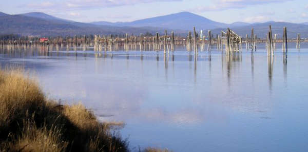
Log pilings in the Pend Oreille River near Usk
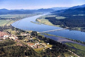
The Pend Oreille Valley Scenic Byway is a 50-mile route along US Highway 20 between Tiger and Newport in northeastern Washington. This sparsely populated road parallels the beautiful Pend Oreille River as it wraps around the southwestern side of the Selkirk Mountains. In several places along the river you'll see pilings still standing in areas where timber was put into the river for the journey downstream to the Diamond Match Company Mill at Cusick. Huge areas of western White Pine were harvested over the years, to be turned into the ubiquitous Diamond wooden matchsticks I've known all my life.
The route offers several direct fishing and boating accesses to the river itself as well as access to an off-road ATV park north of Cusick. There are also several National Forest Service access roads leading off the highway into different areas of Colville National Forest.
Pend Oreille Valley Scenic Byway is open year round and enjoys lush green springs and summers, incredibly colorful autumns and white, snowy winters. Nearby is Little Pend Oreille National Wildlife Refuge and a large, mountainous Survival Training Area used by the US Army. Pend Oreille Valley Scenic Byway is also part of the International Selkirk Loop, a route that encircles the Selkirk Mountains by traveling through parts of Idaho, British Columbia and Washington.

A field of camas in bloom along the byway
Upper photo courtesy of Deana Edmiston, via SelkirkLoop.org
Other photos courtesy of SelkirkLoop.org
Other photos courtesy of SelkirkLoop.org
Related Pages
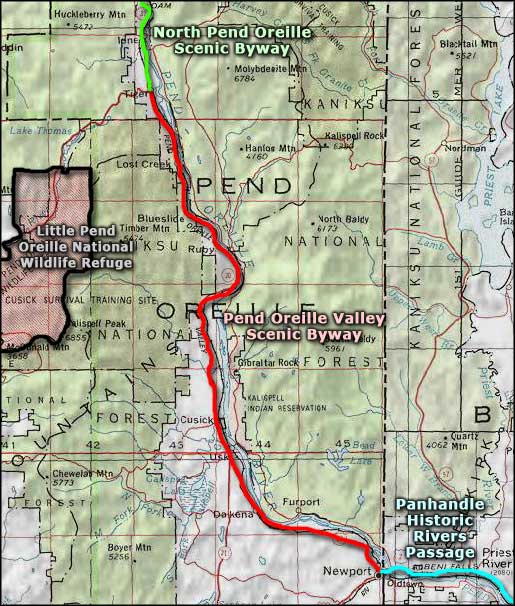
Map courtesy of National Geographic Topo!