Silver Island Mountains Backcountry Byway

The Silver Island Mountains Backcountry Byway
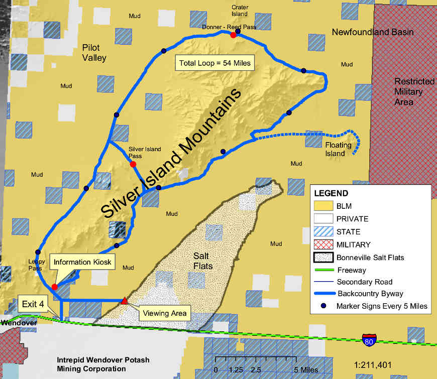
The Silver Island Mountains are against the northwestern side of the Bonneville Salt Flats. Access to this 54-mile loop is off of Exit 4 on Interstate 80, just east of Wendover. Get off the exit and turn north, go 1.5 miles on pavement and then another mile on gravel to the road junction. Then go east and follow the signs. There''s a sign about every 5 miles, all the way around the Silver Island Mountains. When you get up to the northeast corner, if you want, you can turn right and take another 14-mile loop around Floating Island. That whole northeast corner of the road is almost along the "shoreline" of the Newfoundland Evaporation Basin, kind of a wetter (and lower) adjunct of the Bonneville Salt Flats.
This is a gravel and dirt road that the Tooele County road crew maintains on an "as needed" basis. Supposedly, you could drive the route in just about any type of vehicle but personally, I'd prefer 4WD with some decent clearance, especially if you were to get interested in any of the side roads. One of the rules out here, though, is keep your vehicle on an already established roadway, but the photos on this page show you what passes for road out here. Best time to travel on this Back Country Byway is from late spring into fall, as long as it hasn't been raining lately. A little bit of rain can make this road a complete nightmare in many spots. It's highly recommended that you get out and scout muddy areas on foot, before you drive in and sink to your axles. While you're at it, look out for mountain bikers. This is an almost level route around the mountains, the only thing making it hard on bike being the sheer distance. Then again, the route can be cut in half simply by taking the road over Silver Island Pass.
This is nearly all BLM country, so hiking, backpacking, camping, photography, rock collecting, geologic study and just plain sightseeing are allowed, and sometimes encouraged. The old Hastings Cutoff of the California Trail went through this area so you might come across some historic artifacts if you look hard enough. The vegetation tends to the desert scrub side of things: ricegrass, ephedra (also known as "Mormon tea"), sagebrush and juniper. The Silver Island Mountains are rocky and rugged and have no perennial streams flowing in them. Much of the mountain range itself is made up of fossil-bearing limestone that has been folded and faulted over time. In places you will be able to discern shoreline benches that were terraced into the hillsides during the days when ancient Lake Bonneville covered this whole part of Utah and Nevada (more than 16,000 years ago).
Just to the southeast of the Silver Island Mountains is the 30,000-acre plain of the Bonneville Salt Flats. If you're out there between July and October you might see one of those famous automotive speed trials going on...
This area kinda defines the term "barren desert," and conditions are usually harsh. You might want extra food, water, gas and another spare tire. If you run into a problem, you might be out there for a while. Even in mid-summer, it can get pretty cold at night. A smart move would be to let someone know you're out there and when you expect to be back. If you just drive it straight through with no problems, figure on spending 3 hours on the road, unless you find something really interesting...
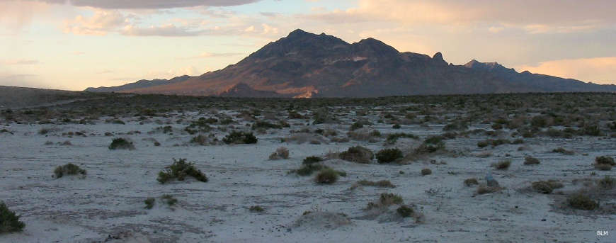
The Silver Island Mountains from across the Bonneville Salt Flats
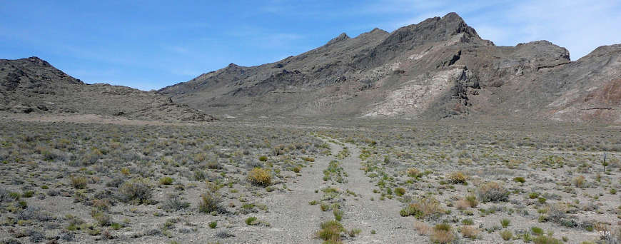
Another "roadway" in the Silver Island Mountains
Photos courtesy of the Bureau of Land Management
Related Pages
Map courtesy of the Bureau of Land Management!