Pacific Remote Islands Marine National Monument
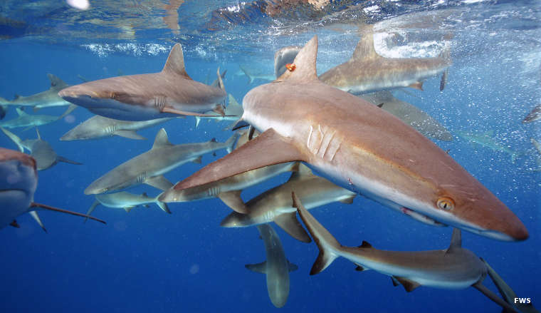
Grey reef sharks at Pacific Remote Islands Marine National Monument
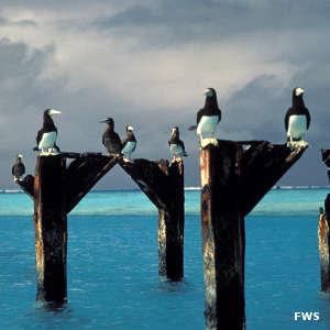
Brown boobies at Johnston Atoll
Pacific Remote Islands Marine National Monument came into being when President George W. Bush signed the bill authorizing the 490,343 square mile property on January 6, 2009. President Barack Obama expanded the monument in 2014. The property now includes some 782,000 square miles in the center of the Pacific Ocean.
As "the most widespread collection of marine- and terrestrial-life protected areas on the planet under a single country's jurisdiction," the monument protects many species of fish, shellfish, corals, marine mammals, water birds, sea birds, land birds, insects and vegetation found nowhere else on Earth. Commercial fishing and other resource extraction activities (deep sea drilling, deep sea mining) are banned in the area but free passage, recreation and research are allowed.
Included within the monument's boundaries are seven National Wildlife Refuges:
- Baker Island: The National Wildlife Refuge includes the island and everything up to 12 nautical miles offshore. The area is almost directly on the equator and suffers constant wind, hot sun and little precipitation.
- Howland Island: The National Wildlife Refuge includes the island and everything up to 12 nautical miles offshore. The area is almost directly on the equator and suffers constant wind, burning sun and little precipitation.
- Jarvis Island: The National Wildlife Refuge includes the isalnd and everything up to 12 nautical miles offshore. The area is almost directly on the equator and suffers burning sun, almost no precipitation and constant wind.
- Johnston Atoll: The land area of Johnston Atoll is under the jurisdiction of the US Air Force while the National Wildlife Refuge extends to 12 nautical miles offshore. Johnston Atoll has a dry, tropical climate with little temperature variation and constant wind.
- Kingman Reef: Almost nothing of Kingman Reef extends above the water but the National Wildlife Refuge includes everything within a 12-mile radius of the highest point. The area offers a dry tropical climate with constant northeast trade winds and little precipitation.
- Palmyra Atoll: The National Wildlife Refuge includes the atoll and everything up to 12 nautical miles offshore. Palmyra Atoll is located in the Intertropical Convergence Zone where the northeast and southeast trade winds meet. Annual precipitation varies between 160 and 200 inches.
- Wake Atoll: The land area of Wake Atoll is under the jurisdiction of the US Air Force while the National Wildlife Refuge extends offshore to 12 nautical miles. Wake Island offers a tropical climate but sees periodic storms in the winter. These days the island seems to be evacuated every few years when a major typhoon appears headed for the area.
For all the NWR's: Fishery related activities in the 12-200 mile offshore area are under the jurisdiction of the National Oceanic and Atmospheric Administration.
None of the islands are known to have ever had indigenous inhabitants. There is an oral history in the Marshall Islands area of men going to Wake Island in search of the wing bone of a large sea bird in order to save someone from being a human sacrifice in a tribal ritual but there is no evidence they ever remained on the atoll for any period of time. Most of today's inhabitants are generally military personnel on Johnston and Wake Atolls and, weather permitting, there is usually a small (4-20) group of scientists and researchers from the Nature Conservancy and the US Fish & Wildlife Service living on Palmyra Atoll.
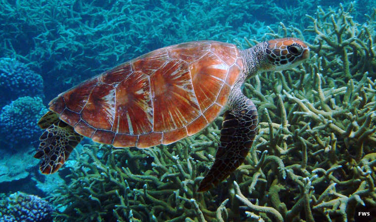
A green sea turtle near Palmyra Atoll
Photos courtesy of the US Fish & Wildlife Service
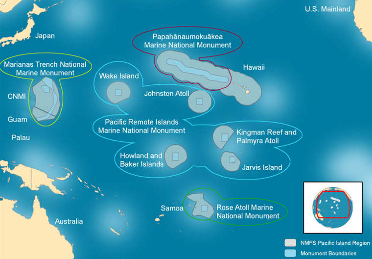
Pacific Remote Islands Marine National Monument map
Pacific Remote Islands Marine National Monument
Map courtesy of the US Fish & Wildlife Service