Sierra de Las Uvas Mountains Wilderness
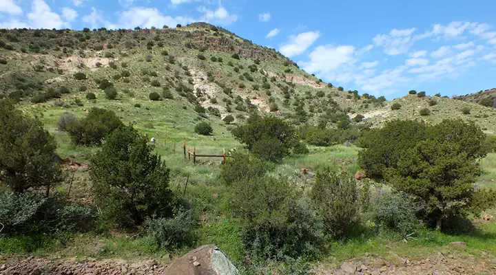
A fence corner at the edge of the Sierra de Las Uvas Mountains Wilderness
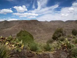
The Sierra de Las Uvas Mountains Wilderness is an 11,114-acre property wholly contained within the Organ Mountains-Desert Peaks National Monument. Most of the area is a mountainous complex of tilted volcanic rock. The mesas, buttes and canyons all slope gently to the west but drop off in cliffs to the east. In the higher elevations there are junipers on the north-facing slopes but, for the most part, the vegetation is Chihuahuan Desert scrub: grasses and thorny shrubs. The exposed caprock on the mesas and buttes offer nesting sites for many raptors.
To get there: Drive about one mile west from Hatch on NM 26 then turn south on 6th Street. Cross the railroad tracks on 6th and keep going until the paved road makes a 90° turn to the left. Right there turn right onto a dirt road and go about 3/4 of a mile to go right onto County Road E005. From there go about 3 miles south to the northeastern boundary of the wilderness area. From there CR E005 follows the eastern boundary for about 0.4 miles to a road that goes right. That road then follows the eastern boundary for another 1.5 miles. The dirt roads are generally passable by a high clearance 2WD vehicle when dry but may be impassable even by 4WD when wet. There are no marked trails in the wilderness area. Visitors will want to be carrying a good map, plenty of water, a compass, good sunscreen and perhaps a GPS device.
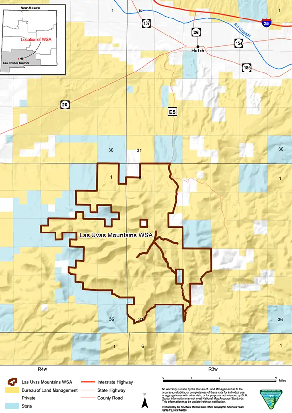
Sierra de Las Uvas Mountains Wilderness map
Photos and map courtesy of the Bureau of Land Management