Kiowa National Grassland

Kiowa National Grassland near Mills, NM

The Canadian River Canyon
Kiowa National Grassland is a 137,131-acre property in two non-contiguous parcels in northeastern New Mexico. Once upon a time the land was all homesteaded as farms and ranches. Then the climate dried up and most folks left the area. The vacant and abandoned homesteads were slowly gathered up and deposited in the Federal Land Bank as Land Utilization Projects under the care of the Soil Conservation Service. Around 1960 the patchwork quilt of public and private land ownership was transferred to the US Forest Service and officially became Kiowa National Grassland.
Today, the Grassland is almost entirely leased to cattle and sheep ranchers who get the benefits of grazing the land without having to pay more than a pittance for the use of it. That said, the large photos on this page were taken during a drive through the area during a year of drought: the few cattle I saw were busy trying to stay alive, forget getting fat for the packing house.
Elevations in the area range from around 4,500 feet to a high around 6,300 feet. The Grassland is cut by the Canadian River, the only permanent stream in the area. There are some stands of Ponderosa pine in the Canadian River Canyon and large stands of pinon and juniper in the western section of the grassland but almost 90% of the property is shortgrass prairie and sagebrush. Playa lakes (shallow, ephemeral ponds created after rainfall and snowmelt) are common in the area but are not a reliable water resource.
The Cimarron Branch of the Santa Fe Trail crossed through the eastern part of the Grassland and McNees Crossing, a reliable water source in the area, became a famous site on that trail after Robert McNees and Daniel Munro were killed there by a roving band of Native Americans in 1828. The Comanche and the Kiowa attacked Trail travelers in the area continually until the majority of Santa Fe-bound traffic shifted further north onto the Mountain Branch of the Santa Fe Trail. The Mountain Branch was a bit longer but significantly safer with more water along the route.
The Grassland is operated out of a district ranger office in Clayton but is overseen by the team that oversees Cibola National Forest.

Northeast of Clayton, NM
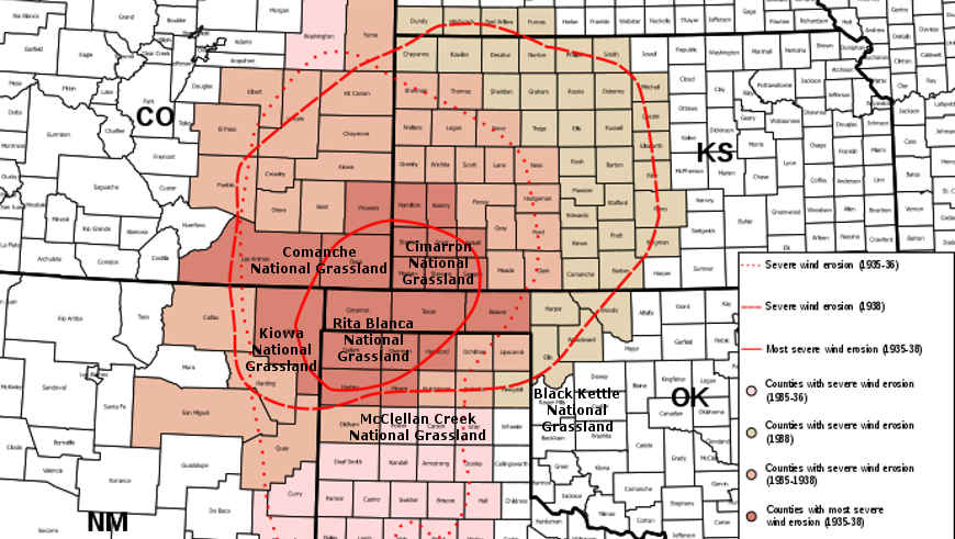
The areas hardest hit during the Dust Bowl era
Upper left photo and map courtesy of the US Forest Service
Other photos courtesy of TheArmchairExplorer, CCA-by-SA 4.0 License
Other photos courtesy of TheArmchairExplorer, CCA-by-SA 4.0 License