El Malpais Wilderness Study Area
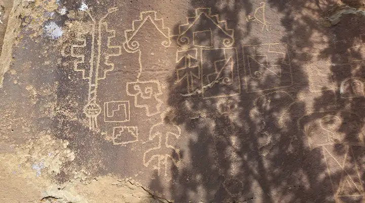
Petroglyphs in the El Malpais Wilderness Study Area

El Malpais WSA
El Malpais Wilderness Study Area is a property composed of four non-contiguous parcels of land totaling some 21,300 acres. Portions of the land are under consideration for wilderness designation in order to fill out certain areas of El Malpais National Monument that are also under consideration for wilderness designation. One tract of the WSA contains the "Little Hole in the Wall" area, a kipuka (Hawaiian term meaning island of fertile ground). That was formed when lava flowed all around and left an island of fertile soil in the middle.
Elevations in the WSA range from 7,000 to 7,600 feet. Vegetation varies between piñon and juniper woodlands and Ponderosa pine uplands. The Continental Divide National Scenic Trail passes across parts of the El Malpais Wilderness Study Area.
To get there: Go south on NM 53 from the west side of Grants about 16 miles. Park at the trailhead for the Zuni Acoma Trail on the side of Highway 53. From there hike about 1.5 miles south to the intersection with the Continental Divide Trail. Take the right fork and go further south, then west for about a mile. There'll be a fence crossing marking the boundary of the WSA.
The trail crosses some very rugged lava flows and there isn't a worn trail as such. You'll have to follow rock cairns across the lava... you need to be prepared for crossing some very rugged, nasty landscape in spots.

El Malpais Wilderness Study Area map
Photos and map courtesy of the Bureau of Land Management