Chama River Canyon Wilderness
Chama River Wilderness
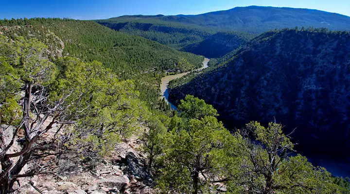
The Wild and Scenic Chama River runs through 6 miles of the 50,300-acre Chama River Canyon Wilderness. The beauty of the river canyon is such that most people completely ignore that part of the Wilderness above the canyon rim. Consequently, above the high sandstone bluffs and prominent rock formations that line the river canyon, the trail system is poor and in serious need of maintenance. However, it is possible to hike along portions of the Chama River and enjoy the views in a peaceful and quiet manner (as opposed to the rush of a whitewater raft trip through this beautiful, multi-colored canyon). The walls of the Chama Canyon are a striking variety of colors from yellows to maroons marking the distinct layers of sedimentary rock. With the elevation differences, the vegetation varies from pinon and juniper to ponderosa and fir with lots of Gambel oak, chamisa and cactus thrown in.
Sections of the river are classed as Special Trout Waters, meaning great fly fishing. Between 70 and 80 different bird varieties can be found in the Chama River Canyon. Along with the many raptors, hawks, and owls there are mule deer, elk coyote, black bear and other, smaller animals searching the canyon for food. Cattle are also allowed to graze areas of the wilderness during summer months.
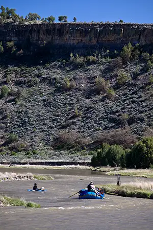
For the rafters and canoeists in the crowd, water flows are controlled by releases from the El Vado Lake Dam but normally, with a couple of short portages, you can float the river from the Colorado border to the confluence with the Rio Grande in Espanola. This is a very popular trip.
Two main trails offer popular access into Chama River Canyon Wilderness. The Hart Trail (Trail #293), off Highway 84 and then Forest Road 145, descends into Chama River Canyon and meets with the Rio Chama. This trail provides a great view of the canyon as well as great fishing opportunities. The second popular trail is a portion of the Continental Divide National Scenic Trail System. There are two access points to this famous trail. The Skull Bridge on Forest Road 151 is one entry while the other is from the top of Ojitos Canyon off Highway 96. Chama River Canyon Wilderness is located in the Coyote Ranger District. Small areas of the wilderness also extend into Carson National Forest.
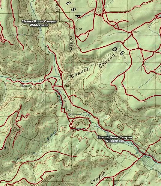
Map of the Chama River Canyon Wilderness area
Photos courtesy of the Bureau of Land Management
Map courtesy of National Geographic Topo!
Map courtesy of National Geographic Topo!