Alta Toquima Wilderness
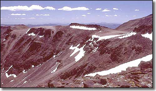
Mount Jefferson
The Toquima Mountains are steep and deeply-cut with numerous rocky canyons in their location between the Monitor Valley to the east and the Big Smoky Valley to the west. In the central, highest part of the Toquima's is where the 35,860-acre Alta Toquima Wilderness sits. The wilderness rises gently from the north to peak on a ridge 2 miles wide and 8 miles long that contains 3 different summits of Mount Jefferson, the highest point being at 11,941'. You can stand on this ridge on a clear day and get views of mountains in Utah and California. Access to the ridge is reasonably easy, starting from the Pine Creek Campground. Just below Mount Jefferson on a 15%-30% slope is the abandoned Native American village of Alta Toquima.
The lower elevations are covered with sagebrush and native grasses. Above that is the pinon pine/juniper zone and above that is the region of limber pine and aspen. Among the trees you'll find mule deer, grouse, chukar and bighorn sheep. Pine Creek is large enough to support a native population of trout.
While the western side of Alta Toquima Wilderness is almost never visited by humans, there are several trails leading to the crest of the wilderness from the north, east and south. Water is not a big concern as there are several streams that carry trout on the eastern slopes and there is even a small alpine lake in a glacial cirque at about 11,000'.
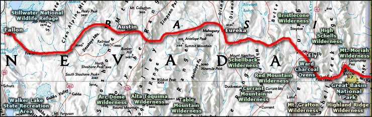
Access from the south is via US 6, 5 miles east of Tonopah to State Highway 376, then go north on SR 376 to SR 82. Past Belmont, SR 82 degenerates into an unimproved gravel road that then leads to dirt roads giving access to Alta Toquima Wilderness. From the north, on US 50 about 12 miles east of Austin is the intersection with SR 376. Take SR 376 south to SR 82 and then follow that southeast. Alta Toquima Wilderness will be to the west. Pine Creek Campground is directly on Pine Creek on the eastern side of the Alta Toquima Wilderness with developed campsites and picnic tables.
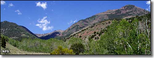
In the lower area of the Alta Toquima Wilderness
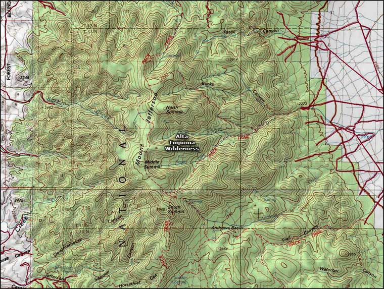
Alta Toquima Wilderness area map
Photo of the Alta Toquima Wilderness courtesy of the National Forest Service
Photo of Mount Jefferson courtesy of G. Thomas
Map courtesy of National Geographic Topo!
Photo of Mount Jefferson courtesy of G. Thomas
Map courtesy of National Geographic Topo!
Related Pages
Alta Toquima Wilderness
Arc Dome Wilderness
Bristlecone Wilderness
Currant Mountain Wilderness
Great Basin National Park
High Schells Wilderness
Arc Dome Wilderness
Bristlecone Wilderness
Currant Mountain Wilderness
Great Basin National Park
High Schells Wilderness
Map courtesy of National Geographic Topo!