Oregon National Historic Trail
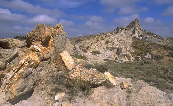
Along the "Rock Avenue" section of the Oregon Trail in Wyoming
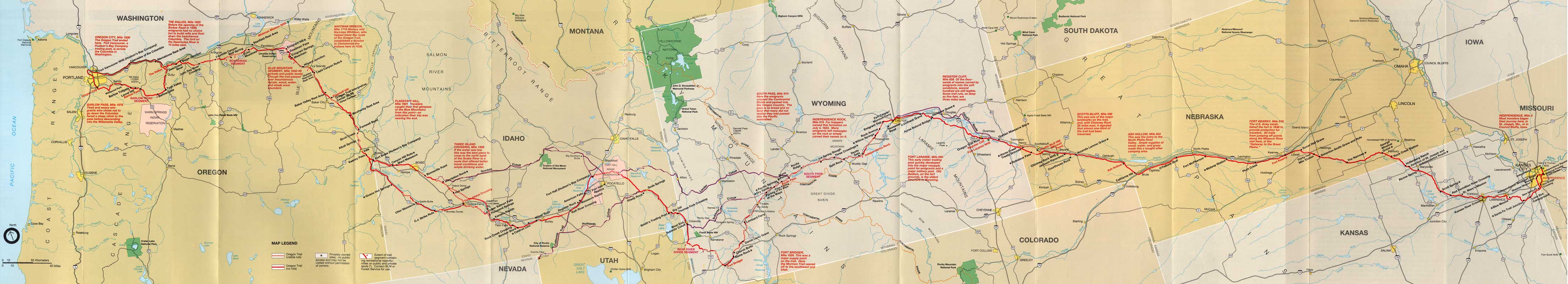
The Oregon Trail was never a single, straight-forward trail, it was more of a hodge-podge of routes between central Nebraska and the Willamette Valley. After the return of the Lewis & Clark Expedition, American trappers and mountain men began making their way overland, eventually coming to the rich valleys of Oregon. In 1810, John Jacob Astor, majority partner in the American Fur Company, sent a group overland to the mouth of the Columbia River to establish a fort and begin trading for furs among the local Native Americans.
They had instructions to stay well south of Lewis & Clark's trail so they wouldn't run into trouble with the Blackfoot Indians. They made their way to Jackson Hole and over the Tetons easily enough but the Snake River almost finished them off. They ended up abandoning almost all their equipment along the Snake but eventually made their way to the Columbia River, using that to get to the Pacific Ocean where they built Fort Astoria. In making that journey, they discovered that most of the Snake River Plain was passable for pack trains and wagons without a lot of improvements.
Once they were set up, company partner Robert Stuart and a small group of men headed back east with dispatches for the company headquarters. They retraced their path up the Columbia and then up the Snake. But they left the Snake near what is now Fort Hall and headed across the mountains and forests into southwestern Wyoming. Traveling across Wyoming, Stuart was following an old Crow hunting trail when he crossed the Continental Divide at South Pass. From that point on, the trail Stuart followed became the main route of the Oregon Trail decades later. Once he came to the North Platte River in eastern Wyoming, it was all downhill from there: and the route followed a series of wide, almost flat river bottoms all the way to the Missouri River.
The American government had gotten nominal control of the Oregon Territory through the Anglo-American Convention of 1818, which formally established a principle of "joint occupation." In the mid 1820's missionaries began making the trek westward. It wasn't until 1840 that the mass migration to Oregon really got under way, and it ran for the next 20 years.
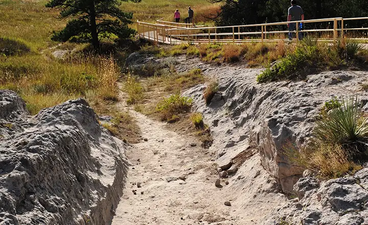
Wagon ruts along the Oregon Trail in Wyoming
The eastern "feeders" came out of Omaha, Nebraska, Independence, Missouri and St. Joseph, Missouri. Those routes all came together near Fort Kearny in Nebraska and began the run up the Platte River to the North Platte, then to Fort Casper. At Fort Casper they had to cross the North Platte, get up on the canyon rim above the river and head for the canyon of the Sweetwater. The Sweetwater was arduous in spots but it took them almost to South Pass where they crossed the Continental Divide and started the downhill run.
It was west of South Pass that the Oregon Trail began to unravel. The main route went southwest to Fort Bridger, then northwest to Fort Hall (beside the Snake River). Over the years a couple other routes were blazed and as the seasons went on, traffic would divert to those because, as much as they were harder trails to use, they also offered better forage and water. But nearly all of them rejoined the main route somewhere near Fort Hall.
From Fort Hall, most variations of the route still followed the Snake River downstream to the Columbia and then down that to the area of Fort Vancouver. Three Island Crossing on the Snake was a major divider: if they could get across the Snake, the route along the river's north bank was much easier than the route along the south bank. But either way, the two routes came together again at Fort Boise for the trip northwest across the barrens and then the Blue Mountains of Oregon. From Pendleton most folks continued overland down the banks of the Columbia to The Dalles.
For the first few years, the only choice at The Dalles was to build rafts and float down the Columbia, a trip that cost many folks their lives, their stock and/or their property. In 1846, the Barlow Road was opened up across the Cascades. Folks could go up the hill south of The Dalles, pay the toll and within a few days they'd be descending safely into Oregon City in the Willamette Valley.
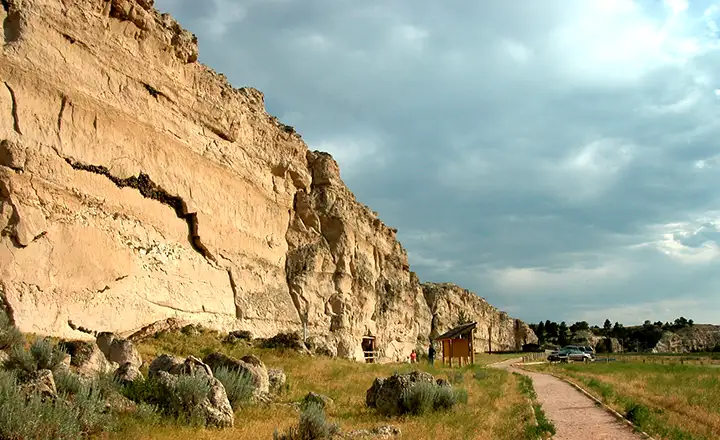
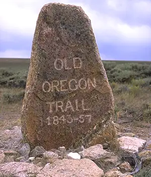
Register Cliff on the Oregon/California Trails in eastern Wyoming
At first, travel on the Oregon Trail was just a trickle: about 1,000 people between 1841 and 1843. But with the stock market manipulations and resulting economic crashes in those days, that trickle grew until by 1869, close to 400,000 people had made the journey to Oregon and Washington over the Trail.
Most folks learned to start the journey from the Missouri in the spring, when conditions were best and forage for their livestock was already growing along the route. Folks slowly got more educated in regards to trail "etiquette" and settlements along the way started to spring up. As the seasons progressed, camping areas would get over-used, pastures over-grazed and water supplies fouled by people and livestock: cholera was a regular problem in some areas every year. But the folks who traveled the Oregon Trail seem to have been somewhat more civilized than those who journeyed the California Trail: troubles with the Indians and with each other were much less. Life in the cities they left behind along the Eastern Seaboard was more dangerous.
Upper photos are courtesy of the Bureau of Land Management
Register Cliff photo and the map of the Oregon Trail are courtesy of the National Park Service
Register Cliff photo and the map of the Oregon Trail are courtesy of the National Park Service