Yellowstone National Park
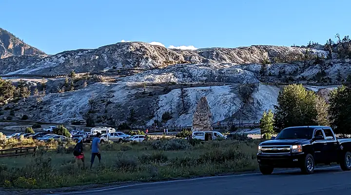
The terraces of Mammoth Hot Springs

Old Faithful Geyser
Yellowstone National Park was America's first national park. At about 2,222,080 acres, it's also one of the country's largest national parks. The countryside of Yellowstone is an incredible melting pot of fantastic geological features, all the result of the property sitting directly atop the caldera of North America's largest super-volcano. The volcano has erupted several times over the last two million years and is considered to be still active.
About 1% of Yellowstone National Park is located in Idaho, about 3% in Montana and the remaining 96% in Wyoming. As big as Yellowstone is, it is only a small part in the heart of the Greater Yellowstone Ecosystem, the last large, relatively undisturbed natural ecosystem in the northern temperate zone of planet Earth. The head of the Greater Yellowstone Coalition made a speech in 1994 setting the essential size of the Greater Yellowstone Ecosystem at about 20,000,000 acres and including Grand Teton National Park, the National Elk Refuge and Shoshone, Gallatin, Bridger-Teton, Caribou-Targhee and Custer National Forests in the whole. Among those national forests, ten separate wilderness areas have been designated by Congress since 1966 in an attempt to guarantee a higher level of resource and habitat protection than most of the national forests "enjoy." As a result of "putting a pin in the map and drawing a circle around it," there are hundreds of private properties included in the general definition of the Greater Yellowstone Ecosystem.

Hot springs with multi-colored mud surround
More than half the geothermal features on Earth are located within Yellowstone National Park's boundaries. Most of the surface of the area is covered with lava flows and rocks produced during various of the volcano's eruptions. And as wild and crazy as this countryside is, archaeological evidence from more than 1,000 sites indicates the property has been inhabited for up to 11,000 years (since the last days of the last Ice Age). Paleo-Indians from the time of the Clovis culture were using obsidian found at Yellowstone to create their distinctive arrowheads that long ago. Some of that Yellowstone obsidian has been found as far away as the Mississippi Valley, carried there by people traveling ancient trade routes.
For hundreds of years more than 100 tribes used the countryside of Yellowstone as a summer home. There were plenty of deer, moose, elk, bear, bison, wolf and coyote to go around, plenty of berries and other edible vegetation, and it was wetter and cooler than down below for hundreds of miles in most directions. Part of the reason for establishing Yellowstone National Park was to deny access to the land to those tribes. That effort gained steam after Chief Joseph led his Nez Perce across Yellowstone and lost several hundred US Army troopers trying to follow him. The Nez Perce were from the other side of Idaho and their route across the Yellowstone area showed they knew the landscape very well. But they were headed for Crow (Absaroka) territory and, in fear of Army retribution, the Crow wouldn't allow them to stay there. So the men, women and children headed north, only to be stopped by a blizzard at Bear Paw Battlefield. About 40 miles short of the Canadian border, some of them gave up the fight and surrendered. As they were surrendering, others were skipping out and shortly making it to Canada. But that 750+ mile journey showed that the Nez Perce knew the countryside well, even that far away. And they were well-acquainted with Yellowstone.

Deep blue hot springs

The Dragons Breath Geyser
These days, Yellowstone National Park sees upwards of three million visitors per year. With virtually all roads closed from mid-November into mid-May, that means the summer traffic levels are very high. The National Park Service is responsible for the maintenance of more than 2,000 buildings and 310 miles of paved roads on the property. The park offers nine visitor centers and museums and five entrances. Most of the facilities are in the Old Faithful, Canyon and Fort Yellowstone-Mammoth Hot Springs areas but there are also facilities at Towers-Roosevelt, Madison and Lake Village. In addition, there are campgrounds, picnic areas, overlooks, boardwalks and hiking trails scattered throughout. There are more than 2,000 developed campsites at a dozen campgrounds. There are primitive campsites spread along the 1,100 miles of hiking trails but to camp in the woods, you'll need a back country permit. Elevations on the property range from a low of 5,282' at Reese Creek to a high of 11,358' on the summit of Eagle Peak. That makes for cold winters and moderate summers. There are several commercial tour operators that offer snow-coach and snowmobile tours of Yellowstone in the winter.

The bank of the Madison River at Old Faithful

Yellowstone Lower Falls
The Albright Visitor Center in Mammoth Hot Springs is open daily all year round. Most of the other visitor facilities are open from late May to the end of September only. In the off-season, Albright is open from 9 am to 5 pm. In the summer season, most facilities are open from 8 am to 7 pm, although some close as early as 5 pm.
The Lewis & Clark Corps of Discovery passed well to the north of this area in 1805. The Crow, Shoshone and Nez Perce told them of the wonders of Yellowstone but no one wanted to go there. John Colter, a member of the Corps of Discovery, returned to the area and passed through the northeast section of what is now the park in the winter of 1807-1808. In 1809, he was back in "civilization" suffering from wounds he received in an encounter with the Crow and Blackfeet. While recovering he spoke of a place of "fire and brimstone" but his stories were attributed to delirium and the tales went no further. Jim Bridger returned from an expedition in 1856 and spoke of seeing similar sights, but his stories were also dismissed as "tall tales."
Finally, in 1869, a privately funded expedition made its way up the Yellowstone River to Yellowstone Lake and they returned with detailed journals, drawings and paintings of what they saw. Another expedition traveled the same area in 1870, collecting specimens, making maps and naming sites of interest. After that, a series of detailed articles appeared in the Helena Herald and in 1871, a move was underway to get Congress to declare the Great Geyser Basin a National Park.

Grand Canyon of the Yellowstone
It was in 1871 that geologist Ferdinand V. Hayden made an expedition into Yellowstone Country. With him were photographer William Henry Jackson and painter Thomas Moran. They returned with detailed journals, large format photographs and different paintings of the area, enough to convince Congress to take action to remove the Yellowstone area from the general public land auction. President Ulysses S. Grant finally signed the declaration creating Yellowstone National Park on March 1, 1872. However, in that declaration there was no funding to pay the expenses of a staff or cover the expenses of protecting the property from vandals, poachers, miners and loggers. Some funding was finally provided in 1877 but not enough to make significant difference. It wasn't until the US Army moved in in 1886 and built what became Fort Yellowstone that the ongoing poaching and destruction of natural resources started to subside. The Army had sufficient manpower and financial resources to finally get a handle on the problem and protect the property while also allowing "legal" tourism to occur. When the National Park Service took control of the property in 1918, they adopted many of the Army-developed policies and regulations.
Roads had been built by the Army but they weren't designed to accommodate the 1,000 vehicles per year entering the park by 1915. In the years after that, conflicts between automobiles and horse-driven transportation caused horses to be banned from the roads. Between 1933 and 1941, the Civilian Conservation Corps built most of the roads, campgrounds and other visitor amenities we see today. Over the years, various construction designs were implemented as facilities had to be built to handle the increased traffic but at this point in time, most of the newer facilities at Yellowstone are in the traditional design that was established in the CCC days.
About 80% of the land surface of Yellowstone National Park is forest and some 36% of that forest burned in the summer of 1988. The size of the fires was determined by the extreme heat and long-term drought of the time and the fuel build-up produced by a hundred years of fire suppression policy.
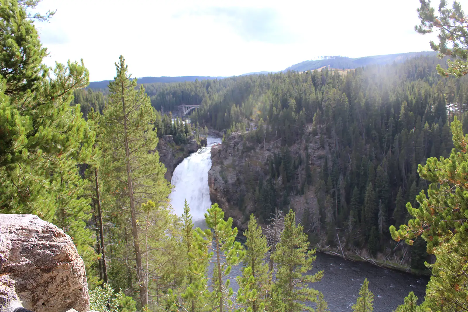
Yellowstone Upper Falls
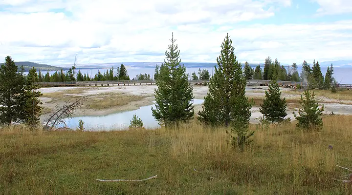
The West Thumb geyser and hot springs basin beside Yellowstone Lake
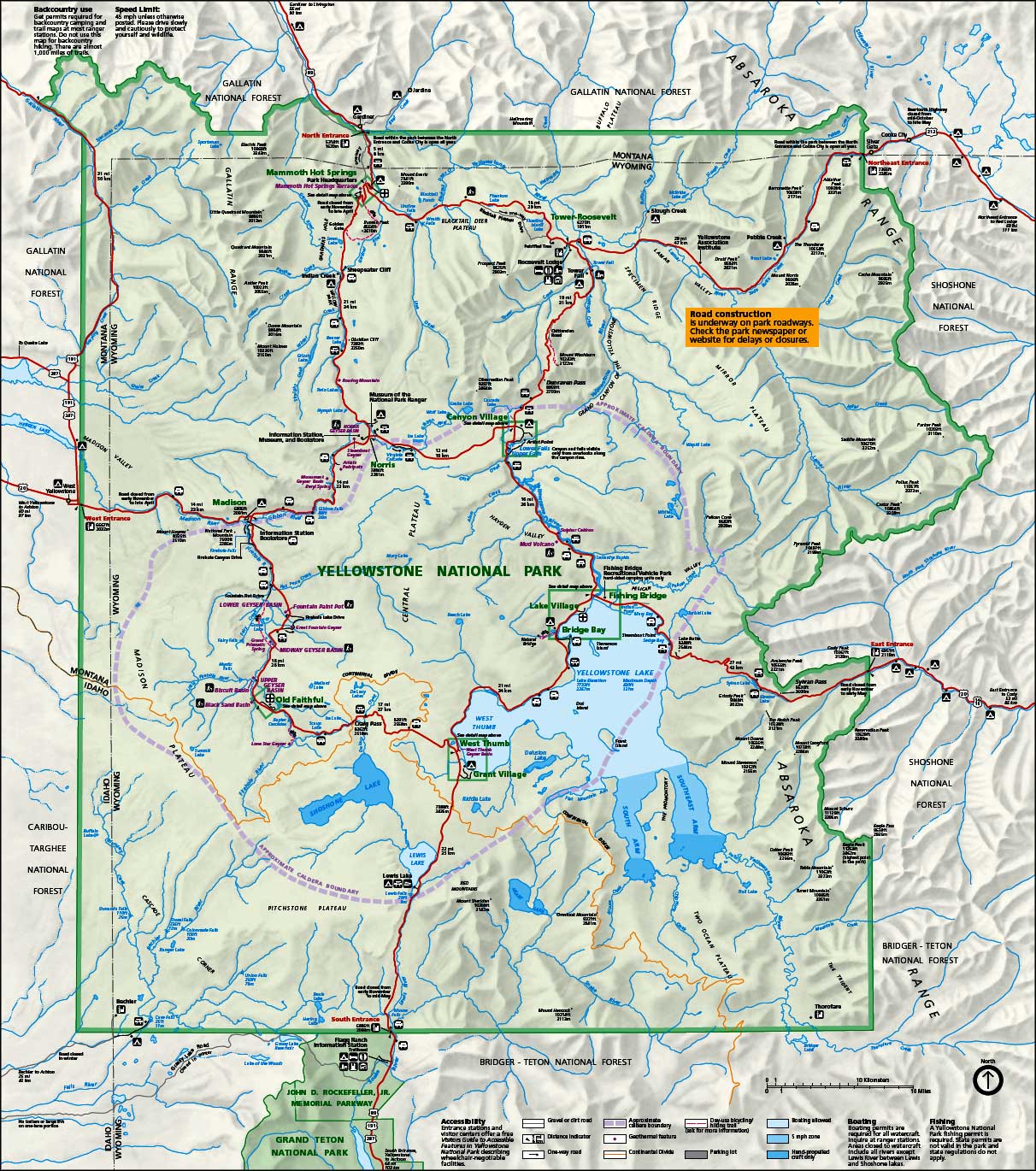
Yellowstone National Park map: Click on the map for a larger version
Photos are courtesy of TheArmchairExplorer, CCA-by-SA 4.0 License
Maps courtesy of the National Park Service
Maps courtesy of the National Park Service