Clarion Wild and Scenic River
Along the Clarion Wild & Scenic River
The Wild & Scenic River designation on the Clarion River covers about 51.7 miles (17.1 miles scenic, 34.6 miles recreational) of the river's 110 mile length. That designation begins at the Allegheny National Forest/State Game Lands Number 44 boundary (about 0.7 miles downstream from the Ridgeway Borough limit) and runs downstream to about 0.6 miles downstream of Blyson run in the backwaters of Piney Dam.
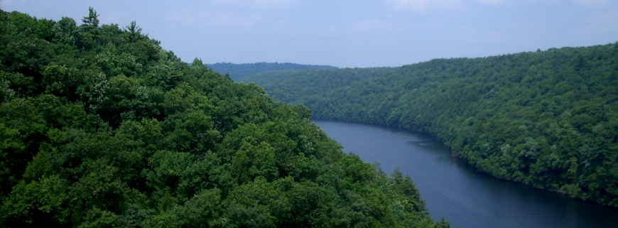
In the designation document is a reference to the relatively unique (in the Allegheny River Basin) landform of the Clarion River Valley adding to the character and beauty of the river corridor: compared to most valleys in the Appalachians, the Clarion River Valley is sinuous and relatively narrow with steep slopes rising from the water. Those steep slopes also tend to be heavily treed with an almost continuous canopy of deciduous and coniferous vegetation. That and the lack of floodplain along the river channel contribute to the sensing of closeness and remoteness.
The river is easily accessed and easily floated with a longer tubing and canoeing season than most other rivers in the area. There are also a number of facilities (picnic areas, parking areas, put-ins, pull-outs, fishing holes, hiking and biking trails, etc.) in the immediate area that support river-based recreation.
Clarion Wild & Scenic River is managed by staff at the Allegheny National Forest headquarters.
Upper photo courtesy of Grendel Khan, CCA-by-SA 3.0 License