Cow Creek Wilderness Study Area
Cow Creek Wilderness Study Area
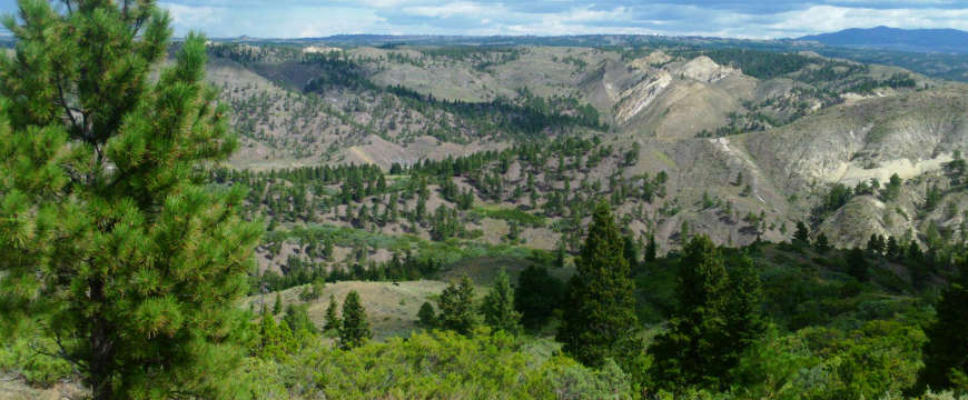
Cow Creek Wilderness Study Area is on the Missouri Plateau in the northern Great Plains, upstream of Fort Peck Reservoir on the north side of the Missouri River. Over the last 10 million years or so, the Missouri has eroded a canyon between 600 and 800 feet deep through the sandstone and shale landscape of the area. Within the Wilderness Study Area the Bull Creek, Winter Creek, and Hay Coulee drainages offer spectacular sandstone cliffs, while other parts of the property are rolling open prairie. On the west side of the Winter Creek drainage there's a four-mile-long vertical wall of stone.
Vegetation is primarily sagebrush, greasewood and short prairie grasses. There are stands of Ponderosa pine, lodgepole pine, Douglas fir and juniper throughout the area with one really dense stand in the north. Cow Creek WSA offers outstanding opportunities for horseback riding, hunting, hiking, backpacking, photography and rock climbing.
From Grass Range, Montana, take Highway 19 until it turns into Highway 191. Keep going for another 40 miles, then go north on Montana 66 for about 2.5 miles and turn west on the Bull Creek Road. Follow that west for about 6 miles to the southeast corner of Cow Creek Wilderness Study Area. Many folks also access the property by floating down the Missouri River. Other folks drive in from the north over the Cow Island Trail (which runs along the western boundary of the WSA).
Cow Creek Wilderness Study Area was originally a 34,050-acre property but only 21,590 acres of it were found suitable for full wilderness designation. The WSA overlaps the Upper Missouri River Wild & Scenic River corridor, Upper Missouri River Breaks National Monument and the Cow Creek Area of Critical Environmental Concern. The WSA is crossed by the Lewis & Clark National Historic Trail and the Nez Perce National Historic Trail.
Photo courtesy of the Wilderness Institute at the University of Montana