Coal Banks Landing Recreation Area
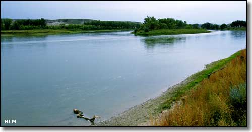
The Missouri River at Coal Banks Landing
Named for the dark layer of lignite coal that passes through all the hillsides in the area, Coal Banks Landing was a major steamboat landing on the Missouri River during the Indian Wars of 1876-1877 and during the construction of Fort Assiniboine near what is now Havre, Montana. The campground at Coal Banks Landing is on the north side of the river about 2 miles downstream from the Virgelle Ferry. This is the western end of both the Upper Missouri River Breaks National Monument and the Missouri Wild and Scenic River. This is the primary put-in point for folks floating down the Missouri River.
Coal Banks Landing offers tent and RV camping (no hook-ups), picnicking, boating and fishing. There are 9 fire rings, 13 picnic tables, 2 parking areas, 2 vault toilets, drinking water, a concrete boat ramp, a boater self-registration box and a BLM contact station.
Coming from the south on US 87, turn right onto the gravel Gardiner Road at mile marker 66.7. Go about 7 miles to the "T" intersection with the Virgelle Ferry Road. Turn left and go about 1 mile, the campground will be on the right. If coming from the north on US 87, turn left at mile marker 72.4 onto the Virgelle Ferry Road and go about 6 miles, the campground will be on the left.
The campground at Coal Banks Landing used to be open year-round but now closes for the winter. Drinking water is available at the campground from May 1 through October 31. There are no fees involved.
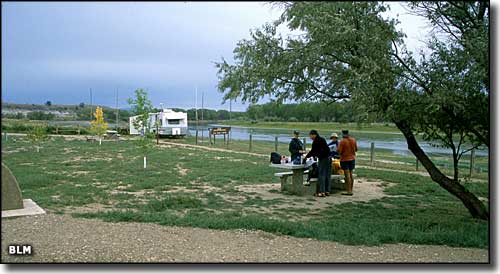
Campers at Coal Banks Landing
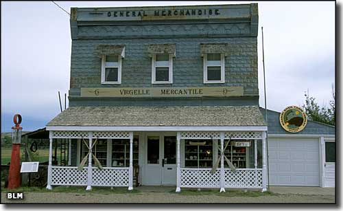
The Virgelle Mercantile
Coal Banks Landing and Virgelle Mercantile photos courtesy of the Bureau of Land Management
Related Pages
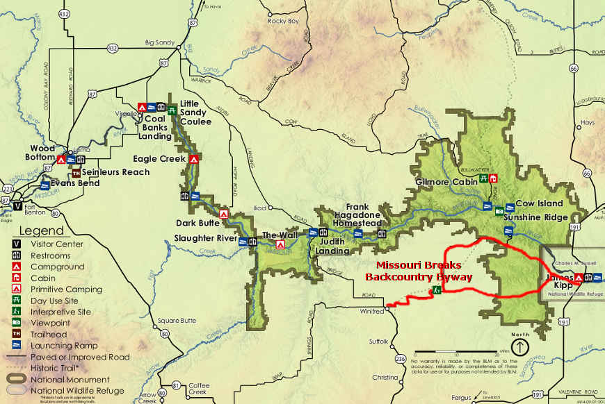
Map courtesy of the Bureau of Land Management