Kaloko-Honokohau National Historical Park
Kaloko-Honokohau National Historical Park
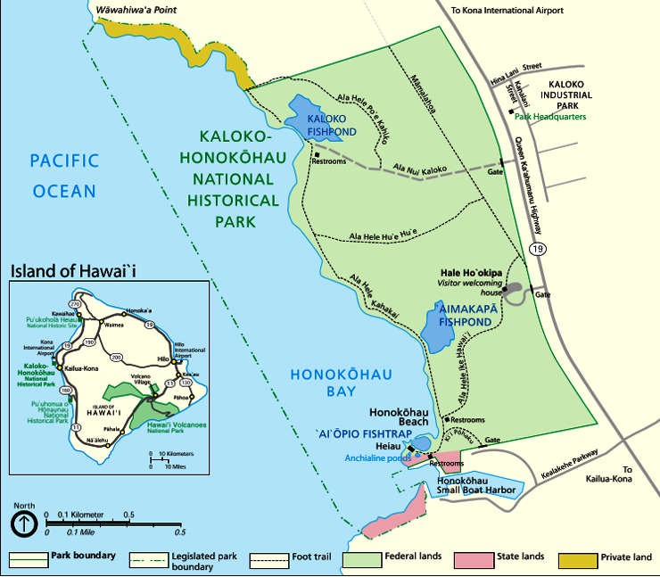
Kaloko-Honokohau National Historical Park in a 1,161-acre property on the west coast of the big island of Hawaii. The park was established in 1978 for the preservation, protection and interpretation of native Hawaiian culture and activities. The name comes from the two mountain-to-sea land divisions encompassed by the park: Kaloko and Honokohau. "Kaloko" means "pond" and "honokohau" means "bay drawing dew."
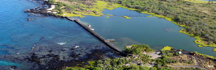
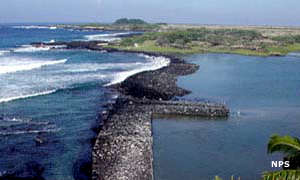
Kaloko is on the north end of the National Historical Park. It's the site of fishponds built up to 300 years ago. The fish ponds are enclosed from the ocean by a seawall about 750 feet long, 30 feet wide and over six feet high. The ancients built that sea wall by hand with no mortar and it deflects the surf better than most modern concrete constructions. Today there is an important wetland there, critical habitat for the endangered Hawaiian waterbirds and other native species.
The ancient settlement of Honokohau is near the southern end of the park, most often reached by hiking trails from the park's visitor center or by parking near the end of the small boat harbor access road on Kealakehe Parkway and hiking from there. At Honokohau you'll find house site platforms, petroglyphs, fishponds, religious sites and stone slides.
The Ala Kahakai National Historic Trail crosses Kaloko-Honokohau National Historic Park for about one mile.
The visitor center, Hawaii Pacific Parks Association store and the parking area are open daily from 8:30 am to 4 pm. The park itself is open 24/7/365, but there's nowhere to park other than the parking lot that is open from 8:30 am to 4 pm... There are no entrance fees. Camping is not allowed.
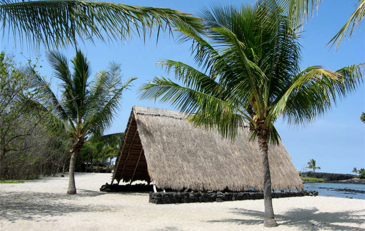
A traditional halau reconstructed at Kaloko-Honokohau National Historical Park
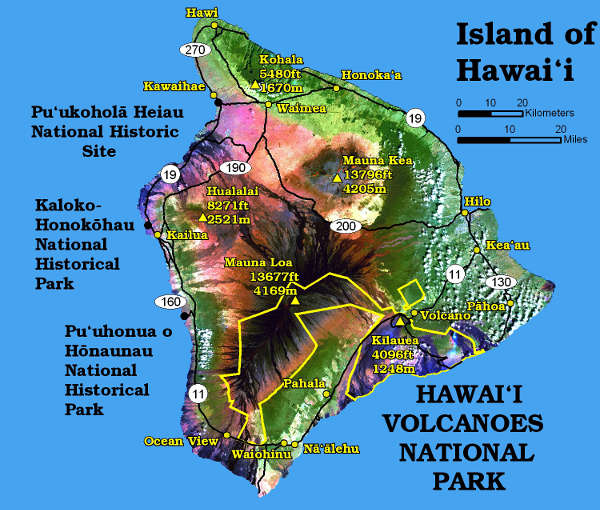
Locations of the National Park Service sites on Hawaii
Lower photo courtesy of W. Nowicki, CCA-by-SA 3.0 License
Other photos and map courtesy of the National Park Service