Ozark-St. Francis National Forest
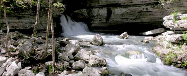
Blanchard Springs
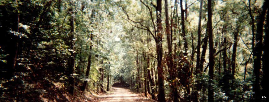
The Ozark and St. Francis National Forests have been combined administratively but the two forests are quite different from each other. Between the two forests there are six National Scenic Byways, 9 swimming beaches, more than 200 camping and picnic sites, 5 wilderness areas, 11 special interest areas, more than 400 miles of hiking, biking and horseback riding trails plus thousands of acres of lakes and streams.
Ozark-St. Francis National Forest is not nearly a contiguous property with parcels stretching from the Mississippi River on the east across central and northwest Arkansas into the Ozark Mountains on the west. In addition to all the beautiful countryside above ground, Ozark-St. Francis National Forest is also home to the spectacular cave formations of Blanchard Springs Caverns.
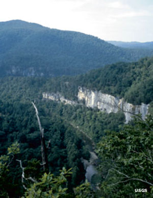
St. Francis National Forest is a 20,946-acre property in eastern Arkansas. Most of St. Francis National Forest lies along the high country of Crowley's Ridge but there is a section in the low, flat lands between the St. Francis and Mississippi Rivers. This is one of the only areas where public land touches the Mississippi River bank. It also contains the only segment of the Great River Road that isn't paved.
Ozark National Forest covers some 1.2 million acres, mostly in the Ozark Mountains of northwestern Arkansas. Mount Magazine, highest point in Arkansas, is on Ozark National Forest.
Scenic Byways
- Crowley's Ridge Parkway
- Great River Road
- Mount Magazine Byway
- Ozark Highlands Byway
- Scenic 7 Byway
- Sylamore Scenic Byway
Wilderness Areas
In St. Francis National Forest
Recreation Areas with Campgrounds
- Bear Creek Lake Recreation Area
- Blanchard Springs Caverns Recreation Area
- Brock Creek Lake Recreation Area
- Cove Lake Recreation Area
- Fairview Recreation Area
- Gunner Pool Recreation Area
- Haw Creek Falls Recreation Area
- Horsehead Lake Recreation Area
- Huckleberry Mountain Horse Trail
- Lake Wedington Recreation Area
- Long Pool Recreation Area
- Moccasin Gap Horse Trail
- Ozark Highlands Trail
- Ozone Recreation Area
- Redding Recreation Area
- Richland Creek Recreation Area
- Shores Lake Recreation Area
- Spring Lake Recreation Area
- Syllamo Mountain Bike Trail
- White Rock Mountain Recreation Area
- Wolf Pen Recreation Area
Recreation Areas with Hiking Trails
- Alum Cove Natural Bridge Geological Area
- Barkshed Recreation Area
- Bayou Bluff Recreation Area
- Bear Creek Lake Recreation Area
- Blanchard Springs Caverns Recreation Area
- Brock Creek Multi-Use Trail System
- Cove Lake Recreation Area
- East Fork Wilderness
- Fairview Recreation Area
- Gunner Pool Recreation Area
- Haw Creek Falls Recreation Area
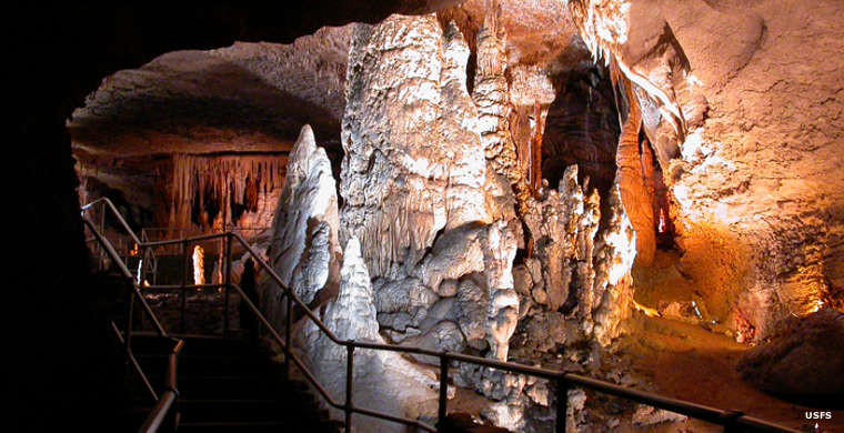
The Ghost Room in Blanchard Springs Cavern
Upper left photo courtesy of the US Geological Survey
Other photos courtesy of the US Forest Service