Overflow National Wildlife Refuge

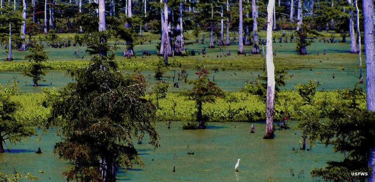
An egret sticks out against the green
Overflow National Wildlife Refuge is a 13,973-acre property on the western edge of the Mississippi River alluvial plan in southern Arkansas. The western boundary of the refuge runs along the bottom of the 110-foot Mississippi Alluvial Valley escarpment, an abrupt rise in elevation that separates the Gulf Coastal Plain from the Mississippi River Delta.
The refuge consists of about 2,400 acres of water impoundments (for the waterfowl the refuge was established to serve), 8,384 acres of bottomland hardwood forest (which the refuge was established to protect), about 2,100 acres of reclaimed croplands (reforested) and 289 acres of upland pine forest. In the winter, about 4,000 acres of the bottomland hardwood forest area is allowed to flood, creating a greentree reservoir ideal for wintering migratory waterfowl. A large proportion of that forest is willow oaks that produce small acorns loved by mallards and wood ducks. When that water drains off in the summer, that land becomes moist soil, a habitat favored by the wading and shorebirds that come in for the summer.
The 2,267-acre Oakwood Unit is non-contiguous with the rest of the refuge. To date, the Oakwood Unit is the largest transfer of land from FmHA to the US Fish & Wildlife Service. The Oakwood Unit is also closed to the public.
The Overflow National Wildlife Refuge office tends to be open Mondays through Fridays, 7 am to 3:30 pm, except closed on Federal holidays. Hunting is allowed on the refuge in accordance with all Federal, state and refuge-specific regulations. If you're on the property, you need to have a signed refuge access permit (free) on your person at all times. Motorized vehicles must stay on designated roads and parking areas. Some levees and trails are open to ATV/UTV use as long as those vehicles are engaged in some wildlife-dependent activity (fishing, hunting, bird-watching). Boat motors larger than 25 HP are not allowed.

Photo and map courtesy of the US Fish & Wildlife Service