Ouachita National Forest
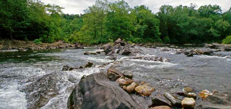
The Cossatot River, great whitewater rafting on the Ouachita National Forest
Ouachita National Forest contains some 1.8 million acres of countryside centered around the Ouachita Mountains of central and western Arkansas and southeastern Oklahoma. About 20% of the forest land is in Oklahoma. A 165,000-acre chunk of the forest was nearly declared a national park in the 1920's but a veto by President Calvin Coolidge ended that effort. The original forest declaration named the Arkansas National Forest in 1907, then the name was changed in 1926.
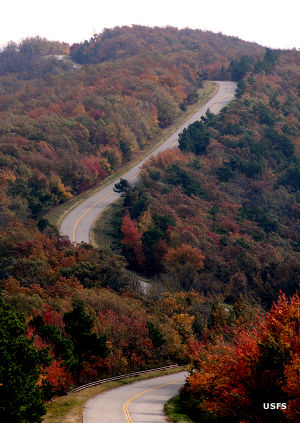
Along the Talimena Scenic Drive
This area was first explored by Europeans of the Hernando de Soto expedition in 1541. They were followed about 100 years later by French trappers and traders who traveled the rivers, trading with those of the Ouachita Tribe who'd survived the diseases brought by the Spaniards.
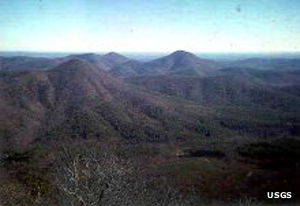
The Ouachita Mountains are truly ancient. They are the product of a collision between the South American and North American tectonic plates. That's why the ridges all run east-west instead of north-south like most of the other mountain ranges in North America do. The Ouachitas are also singularly devoid of evidence of volcanic activity, meaning the only mountain building process that took place here came as a result of that tectonic collision so long ago. At one time they were about the same height as today's Rocky Mountains but millions of years of erosion have reduced them to just the hearts of what they once were. Still, the slopes are dry, steep and heavily wooded. The Forest Service estimates that about 800,000 acres of Ouachita National Forest is covered with old-growth timber, never logged because the pain of removing the timber was more than the timber was worth.
Wilderness Areas
The Ouachita National Recreation Trail runs east-west across the forest for 192 miles, between Talimena State Park in Oklahoma and Perryville, Arkansas. The trail is well-maintained for hikers and horseback riders (mountain biking is only allowed on certain marked sections of the route) and there are overnight shelters scattered along the way.
The Talimena Scenic Drive is a National Scenic Byway that also crosses the forest offering great views and easy-to-access trails into some of the old-growth woodlands on Rich and Winding Stair Mountains.
Caddo River, Ouachita River, Little Missouri River and Mountain Fork River have made canoeing and fishing very popular on Ouachita National Forest. The forest is also crossed by the Cossatot River, thought by many to be the most difficult whitewater rafting stream east of the Rockies and west of the Smokies.
Campgrounds on Ouachita National Forest
- Albert Pike
- Bard Springs
- Big Brushy
- Billy Creek
- Cedar Lake Equestrian Camp
- Cedar Lake Recreation Area
- Charlton Recreation Area
- Crystal
- Dragover
- Fourche Mountain
- Fulton Branch
- Jack Creek
- Knoppers Ford
- Lake Sylvia
- Little Pines
- River Bluff
- Rocky Shoals
- Shady Lake
- Shirley Creek
- South Fourche
- Winding Stair
- Winding Stair Campground
- Winding Stair Mountain National Recreation Area
Select Hiking, Mountain Biking and Equestrian Trails
- Albert Pike
- Athens Big Fork
- Bard Springs
- Bear Creek
- Beech Creek
- Beech Creek National Scenic Area & Botanical Area
- Big Brushy
- Big Brushy Trail Complex
- Billy Creek Recreation Area
- Billy Creek Trail
- Black Fork Mountain
- Black Fork Mountain Wilderness
- Boardstone/Military Road
- Buffalo Gap
- Camp Clearfork
- Caney Creek
- Caney Creek Wilderness
- Cedar Lake Equestrian Camp
- Cedar Lake Recreation Area
- Cedar Lake/Old Pine
- Charlton Recreation Area
- Charlton Trail
- Crystal
- Crystal Vista
- Danville Mountain
- Dry Creek Wilderness
- Eagle Rock Loop
- Earthquake Ridge
- Flatside Wilderness
- Fourche Mountain
- Friendship
- Fulton Branch
- Hole in the Ground
- Horsethief Springs
- Horsethief Springs Trail
- Hunt's Loop
- Indian Nations National Scenic and Wildlife Area
- Iron Springs
- Jack Creek
- Kerr Arboretum Trails
- Knoppers Ford
- Lake Ouachita Vista Trail
- Lake Sylvia
- Little Blakely
- Little Missouri
- Little Missouri River Falls
- Little Pines
- Mountain Top Trail
- Orchard Trail
- Ouachita National Recreation Trail
- Possum Kingdom
- Poteau Mountain Wilderness
- River Bluff
- Rocky Shoals
- Serendipity
- Shady Lake
- Sugar Creek Hiking
- Sugar Creek Multi-Use
- Upper Kiamichi River Wilderness
- Viles Branch
- Wildcat Mountain
- Winding Stair
- Winding Stair Campground
- Winding Stair Equestrian
- Winding Stair Mountain National Recreation Area
- Wolf Pen Gap
- Womble
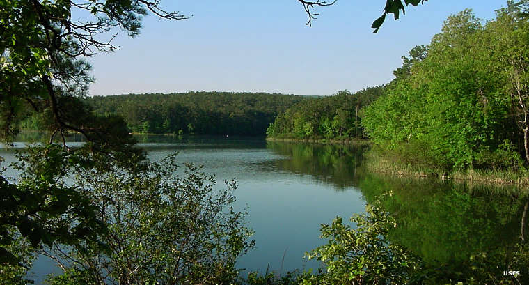
Cedar Lake
Upper left photo courtesy of the US Geological Survey
Other photos courtesy of the US Forest Service