Tlikakila Wild & Scenic River
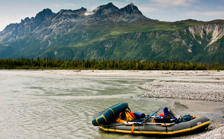
Along the Tlikakila Wild & Scenic River
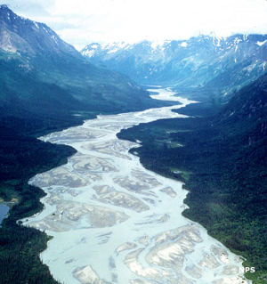
The Tlikakila's braided channel
All 51 miles of the Tlikakila River are designated Wild & Scenic River. The entire river is on Lake Clark National Park. The glacier-fed river begins below 10,000-foot peaks, high in the Chigmit Mountains, and flows southwest through a wide, glacier-carved valley along a very braided path to empty into Lake Clark.
The river is rated "suitable for intermediate boaters" and offers mostly Class I and Class II stretches. Most folks fly to Summit Lake via float plane, then make the 2-mile portage south from the lake to get to floatable water before putting in. There's also a stretch of Class III rapids below the confluence with the North Fork Tlikakila River that often requires a portage. In the lower river there's also a danger of quicksand because the sand and gravel bars are constantly shifting in the water flow. Bears can be a problem along the entire river.
Upper photo courtesy of Kevyn Jalone, NPS
Upper left photo courtesy of the National Park Service
Upper left photo courtesy of the National Park Service