Ohio & Erie Canalway National Scenic Byway

Biking on the Towpath along the Ohio & Erie Canalway National Scenic Byway
The Ohio & Erie Canalway National Scenic Byway is a 110-mile route running south from Lake Erie through northeastern Ohio, from Cleveland to New Philadelphia. It generally follows the route of the Ohio & Erie Canal built between the years 1825 and 1832 to connect Lake Erie (at Cleveland) with the Ohio River (at Portsmouth). That original full route was 308 miles long but major sections of the canal were abandoned after extensive flooding in the area in 1913.
What we see today is what has been preserved in metropolitan or regional parks and much of it has been refurbished in recent years. The scenic byway crosses the Ohio & Erie Canalway National Heritage Corridor north to south, end to end. In the northern part of the byway the route crosses Cuyahoga Valley National Park. The byway is not a single route either, it's a carefully crafted route across four counties and through 58 communities in the National Heritage Corridor. The route chronicles the evolution of transportation systems in northeastern Ohio, and the industries that grew up around them. The Scenic Byway travels beside the Ohio & Erie Canalway Towpath as much as it can and significant portions of the route also parallel the tracks of (what is now) the Cuyahoga Valley Scenic Railroad.

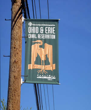
An entry to the Ohio & Erie Canalway Towpath

Pathways along the Ohio & Erie Canalway National Scenic Byway

Cuyahoga Valley Scenic Railroad in the bottom of the valley
Bottom photo courtesy of Cuyahoga Valley Scenic Railroad
Other photos are in the public domain
Other photos are in the public domain