Sandia Crest Scenic Byway
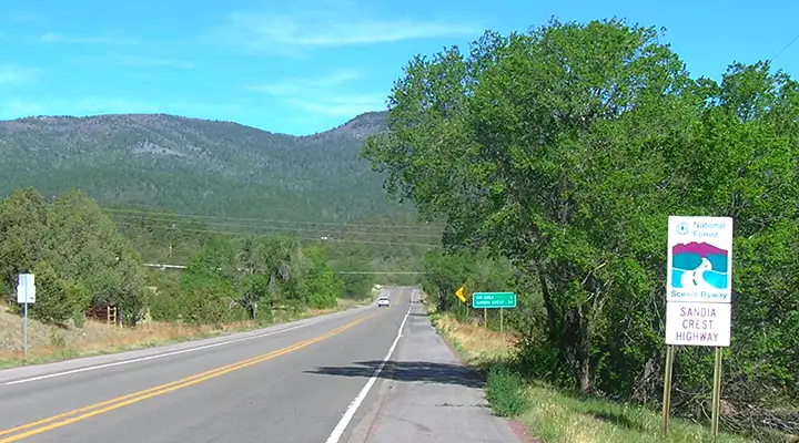
At the foot of the Sandia Crest Scenic Byway
Sandia Crest Scenic Byway is a 13.6-mile route that climbs the eastern slopes of the Sandia Mountains through a long series of tight switchbacks to end at an overlook a mile above the city lights of Albuquerque. The route is paved and open year-round. Along the route you may see mule deer, Rocky Mountain bighorn sheep, black bear and other mammals. You might also see a few golden eagles as they like to roost on the steep western face of the Sandia uplift. The whole western side of the mountains is the designated Sandia Wilderness and most of the mountains are part of Cibola National Forest.
On the way to the mountain crest you'll pass by Sandia Peak Ski Area. At the top of the mountain (but south of the overlook) is the upper terminus of the Sandia Peak Tramway: at 2.7 miles long it's the longest tramway in the world. The tramway rises from the eastern suburbs of Albuquerque to Sandia Crest, an elevation gain of more than a mile as the summit of the mountain is 10,678 feet above sea level. The ride and views in between are simply spectacular. The upper tramway stop is just above the upper end of the ski area lifts.
The lower end of the Sandia Crest Scenic Byway is in Cedar Crest. In Cedar Crest is the Museum of Archaeology and Material Culture where you'll find exhibits of Native American artifacts going back about 12,000 years. One exhibit also details the archaeological finds at Sandia Cave and discusses local turquoise mining.
Along the route of the Sandia Crest Scenic Byway are several pullouts and parking areas so folks can get easy access to the hiking trails and overlooks in this gorgeous place. The summit overlook even offers viewing telescopes.

The view south from Sandia Crest
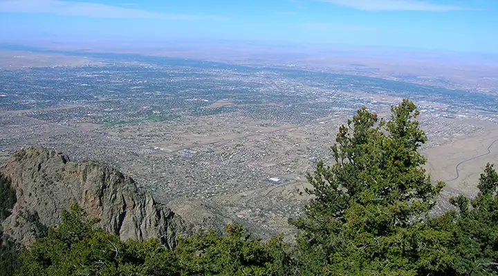
The view over Albuquerque from Sandia Crest

A trail leading north into Cibola National Forest from the Sandia Crest Scenic Byway

The view east from the Sandia Peak Ski Area parking lot

Sandia Peak Ski Area lodge

Sandia Peak ski lifts in summer

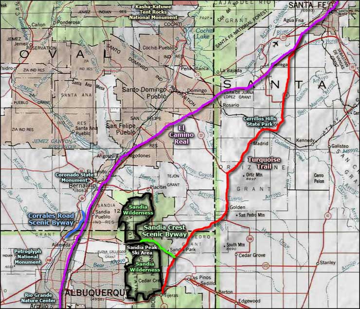
Sandia Crest Scenic Byway map
Photos courtesy of TheArmchairExplorer, CCA-by-SA 4.0 License
Map courtesy of National Geographic Topo!
Map courtesy of National Geographic Topo!
Related Pages
Map courtesy of National Geographic Topo!