Jarbidge Wilderness
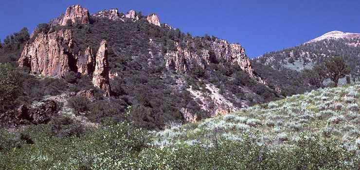
Snowslide Gulch in Jarbidge Wilderness
"Jarbidge" is a Shoshone word meaning "weird beastly creature." According to legend, the first Jarbidge was walled into a cave in Jarbidge Canyon by a group of Shoshone warriors.
For Nevada, this is an unusually wet area, receiving as much as 7 to 8 feet of snow every year. The high trails are often buried from mid-October to mid-June.
Jarbidge Wilderness is 113,167 acres of some of the most remote countryside in America. This is a rugged, mountainous, glaciated wilderness with many creeks and a few small lakes. You'll find deer and mountain lions just about everywhere but the elk seem to stick to the eastern side of the wilderness. 8 of the peaks here rise above 10,000' but none of them can be seen from pavement. The mountains rise about 4,000' above the surrounding countryside and the crystal clear air up top lets you see up to about 150 miles into the distance. There's more than 125 miles of marked trails in the Jarbidge Wilderness but the area is so remote that it sees very few visitors. There are trail heads at Slide Creek, Snowslide Gulch, Three Day Creek and Camp Draw. None of these trail heads is less than a 3 hour drive from pavement over rough gravel roads.
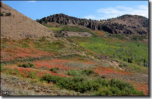
A mountain side in Jarbidge Wilderness in the fall
Photo of Snowslide Gulch in the Jarbidge Wilderness is courtesy of G. Thomas
Lower photo of the mountain side in Jarbidge Wilderness courtesy of Mike Balen, National Forest Service
Lower photo of the mountain side in Jarbidge Wilderness courtesy of Mike Balen, National Forest Service
Related Pages
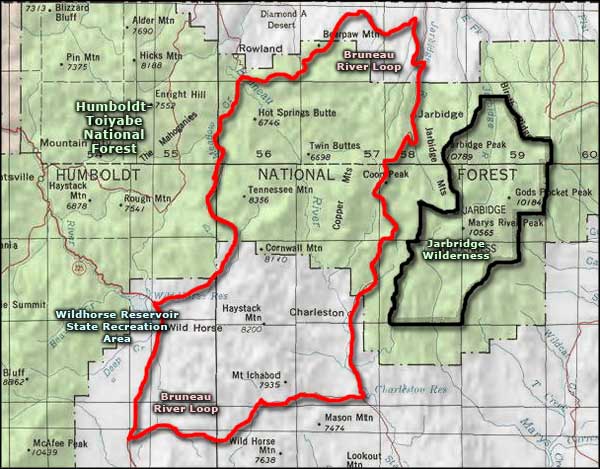
Map courtesy of National Geographic Topo!