Pacific Crest National Scenic Trail

Cascade Pass, along the Pacific Crest National Scenic Trail in Washington
The Pacific Crest National Scenic Trail is a 2,650-mile hiking trail between the Canadian and Mexican borders. The route mainly follows the upper ridges of the mountains through the Sierra Nevadas and into the Cascades as it travels north. Listed below are links to photos, information and maps of some of the places a hiker might find along the trail.
California
- Angeles National Forest
- Ansel Adams Wilderness
- Bright Star Wilderness
- Castle Crags Wilderness
- Chimney Peak Wlderness
- Cleveland National Forest
- Desolation Wilderness
- Devils Postpile National Monument
- Domeland Wilderness
- Golden Trout Wilderness
- Hauser Wilderness
- Hoover Wilderness
- Inyo National Forest
- John Muir Wilderness
- Kiavah Wilderness
- Kings Canyon National Park
- Klamath National Forest
- Lassen National Forest
- Lassen Volcanic National Park
- Marble Mountain Wilderness
- Owens Peak Wilderness
- Russian Wilderness
- Santa Rosa & San Jacinto Mountains National Monument
- Shasta-Trinity National Forest
- Sierra National Forest
- Six Rivers National Forest
- South Sierra Wilderness
- Trinity Alps Wilderness
- Yosemite National Park
Oregon
- Cascade-Siskiyou National Monument
- Crater Lake National Park
- DesChutes National Forest
- Diamond Peak Wilderness
- Fremont-Winema National Forest
- Mark O. Hatfield Wilderness
- Mount Hood National Forest
- Mount Hood Wilderness
- Mount Jefferson Wilderness
- Mount Thielsen Wilderness
- Mount Washington Wilderness
- Rogue River-Siskiyou National Forest
- Rogue Umpqua Divide Wilderness
- Sky Lakes Wilderness
- Three Sisters Wilderness
- Umpqua National Forest
- Waldo Lake Wilderness
- Willamette National Forest
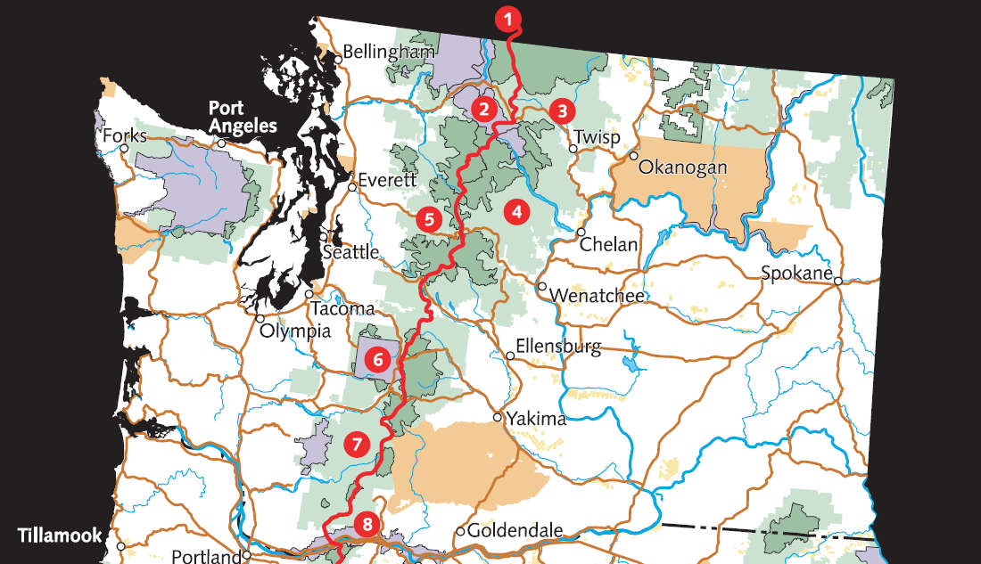
Washington
- Alpine Lakes Wilderness
- Gifford Pinchot National Forest
- Glacier Peak Wilderness
- Goat Rocks Wilderness
- Henry M. Jackson Wilderness
- Indian Heaven Wilderness
- Lake Chelan National Recreation Area
- Mount Adams Wilderness
- Mount Baker-Snoqualmie National Forest
- Mount Rainier National Park
- Norse Peak Wilderness
- North Cascades National Park
- Okanogan-Wenatchee National Forest
- Pasayten Wilderness
- William O. Douglas Wilderness

Map of the PCT

In Hoover Wilderness
Maps of the Trail
Upper photo courtesy of Daniel Hershman, CCA 2.0 License
Lower photo courtesy of Wikiopedia userid: dcrjsr, CCA-by-SA 3.0 License
Maps courtesy of the US Forest Service
Lower photo courtesy of Wikiopedia userid: dcrjsr, CCA-by-SA 3.0 License
Maps courtesy of the US Forest Service