Stafford Wilderness Study Area

Stafford Wilderness Study Area
Stafford Wilderness Study Area is a scenic and rugged area of steep slopes exposing clay and soil layers beneath narrow ridges on the north side of the Missouri River. The steep coulees tend to be vegetated by prairie grasses, sagebrush and juniper where soil and slope allow. Big game hunting and boating along the Missouri River are the major recreational activities in the area.
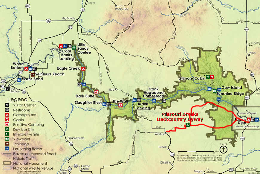
There is no public access by vehicle to the property, unless you have permission to cross the private property along the northern boundary of the WSA. Most folks who visit the area come through by boat on the Missouri.
To get there: Starting from Winifred, go east on the Stafford Ferry Road for about 2 miles to the intersection of Stafford Ferry Road and the DY Trail. Continue north on the Stafford Ferry Road for another 13 miles to the Stafford Ferry landing. This is where you put your boat into the Missouri River and head upstream for about 2 miles to get to the southeastern corner of Stafford WSA. The WSA is on the north side of the Missouri River and all travel on the property is by foot alone.
Photo courtesy of the Wilderness Institute at the University of Montana
Related Pages
Map courtesy of the Bureau of Land Management